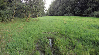
Schwingbach
| Schwingbach | ||
|
Catchment area of the Kleebach with Schwingbach |
||
| Data | ||
| Water code | DE : 2583964 | |
| location | Hessen ; Germany | |
| River system | Rhine | |
| Drain over | Kleebach → Lahn → Rhine → North Sea | |
| source | in the Hintertaunus southwest of the village of Vollnkirchen near the Napoleonsstock | |
| muzzle | in Hüttenberg in den Kleebach Coordinates: 50 ° 30 '59 " N , 8 ° 37' 40" E 50 ° 30 '59 " N , 8 ° 37' 40" E
|
|
| length | 10.9 km | |
| Catchment area | 25 km² | |
|
Source of the Schwingbach in a meadow |
||
The Schwingbach is km in length of 10.9 and a catchment area of 25 square kilometers is the largest left-side tributary of Klee Bach in Hesse .
The Schwingbach rises in the Hintertaunus south-west of the village of Vollnkirchen near the Napoleonsstock. It flows through the towns of Volpertshausen, Weidenhausen, Kleinrechtebach and Hüttenberg one after the other , where it flows into the Kleebach. In Hüttenberg it forms roughly the border between the two unofficial districts of Hochelheim and Hörnsheim.
He was the namesake of the community of the same name, which existed from 1971 to 1977, which consisted of Vollnkirchen, Weidenhausen, Kleinrechtebach and Großrechtebach and was integrated into the large community of Hüttenberg in 1977 . The Schwingbach comprehensive school in Großrechtebach, which was built in 1971 and replaced the older schools in the individual districts as a middle point school, is also named after him.
In 2007 and 2009 fish died in the lower Schwingbach for reasons that were not fully understood.
Tributaries
- Herbentalgraben ( left )
- Ulgebach ( left )
- Vollnkirchener Bach (Geschwindbach) ( right )
- Bubentalbach ( left )
- Großrechtebach ( left )
- Altengrundbach ( right )
- Lorschbach ( right )
swell
- Topographic map L5516 Wetzlar, Hessisches Landesvermessungsamt - 1987 edition
- ADFC bike tour map - Westerwald / Taunus . Hauptka & Co, ISBN 3-88495-107-6
- Friedrich K. Abicht: The district of Wetzlar . Wetzlar 1836, p. 6 ( complete online edition (Google Books) )
- Schwingbach comprehensive school website
- Michael Bender, Ernst Walter Weißenborn: Dead trout in the Schwingbach worry fishing enthusiasts ( memento from January 6, 2010 on WebCite ). In: Gießener Anzeiger, June 12, 2009, archived on January 6, 2009
- Retention cadastre for the Schwingbach river basin code number: 2583964 (PDF; 986 kB)

