Semmel (Magdeburg)
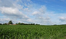
The Semmel is an agricultural area of the Feldmark west of the Westerhüsen district, which today belongs to the city of Magdeburg .
Although historically part of the district of Westerhüsen, the area is now assigned to the Salbke district . The roll is located north of the road connecting Westerhüsen with Beyendorf-Sohlen , west of the path branching off from it to the Sohlener mountains . To the west, the parcel is bounded by the individual building of a former brickworks and the former clay pit behind it. The Großer Riesenberg hill rises to the northwest .
The meaning of the unusual field name is not entirely clear. It is believed that the name may be derived from the shape of the parcel. However, a derivation from the old term same or sammeling in the sense of totality or assembly is also conceivable . The area could then have been used as a common meadow that was shared by the villagers.
Individual evidence
- ↑ Marta Doehler, Iris Reuther , Settlement Development in Westerhüsen Magdeburg Southeast , State Capital Magdeburg 1995, page 31
- ^ Werner Burghardt, The field names of Magdeburg and the district of Wanzleben , Böhlau Verlag Köln Graz 1967, page 227
Coordinates: 52 ° 3 '4.6 " N , 11 ° 38' 52.9" E

