Skáleyjar
| Skáleyjar | ||
|---|---|---|
| Farmhouse on the main island | ||
| Waters | Breiðafjörður , Iceland | |
| Geographical location | 65 ° 25 ′ N , 22 ° 43 ′ W | |
|
|
||
| Number of islands | 140 | |
| Main island | Skáley | |
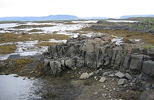
| View towards the Westfjords at low tide | ||
The Skáleyjar are a larger group of islands in a fjord in the west of Iceland .
location
The Skáleyjar archipelago is located in the north of the Breiðafjörður fjord .
The islands actually belong already to the West Fjords , are they still only about 4-5 miles south of the coast of Bárðarströnd . The closest to them is the Skálmarnes peninsula in the Múlasveit district . It is just as far to the Skálanes peninsula in the Gufudalssveit district . After Reykhólar It is about 10 km as the crow.
It is a large archipelago of around 140 islands, most of which are quite small. The archipelago belongs to the larger Vestureyjar group .
Life on the Skáleyjar
Nothing is known about the first settlements on the islands.
Today they are only used in summer.
You can walk back and forth between some of the islands at low tide, especially during the spring tide, but this is not possible with most of the islands. Some are too far apart. From the mainland, Skáldsey Island can be reached on foot at low tide. Under such circumstances, one can also walk between the three islands belonging to the Inneyjar.
In earlier times, the ownership of these islands was highly sought after, as the farmers received a considerable additional income from hunting seals and seals and from using eider ducks.
The latter is still maintained there. Most of the islands are also used as summer pastures.
Description of some of the islands in the group
Main island of Skáley
Its length is 1.5 km and its width up to 400 m, being of an irregular shape.
The upstream neighboring islands of Stöðuley og Litla-Lyngey absorb any storm surges. There are also many archipelago in the area. Many of these archipelago and small neighboring islands are within walking distance at low tide.
Fagurey
This island is one of the largest Vestureyjar islands (800 × 250 m). Her name means beautiful island
Like most of the larger islands, it was continuously inhabited in earlier times, which can be seen in the ruins of huts and traces of gardens, fountains, etc. At the beginning of the 21st century only the island of Flatey in the fjord Breiðafjörður is inhabited all year round.
The Skáleyjar archipelago was abandoned so long ago that the reasons are only known by rumors. Assumptions point to epidemics and superstitions (ghost stories).
Hot Springs
At one of the islands there is a hot spring in the tidal range, a low temperature area that delivers water at 50–60 ° C.
tourism
Nowadays you can take boat tours on the fjord, for example from Stykkishólmur or Reykhólar, where u. a. these islands can also be controlled.
See also
literature
- Ferðafélag Íslands. Árbók 1989. Breiðafjarðreyjar. (Icelandic)
Web links
Individual evidence
- ↑ Íslandshandbókin. 1. bindi. 1989, p. 216
- ↑ http://www.nat.is/travelguide/br_eyjar_skaleyjar.htm Accessed: November 20, 2010
- ↑ Íslandshandbókin. ibid.
- ^ HU Schmid: Dictionary Icelandic - German. Hamburg (Buske) 2001, p. 54 and 56
- ↑ http://www.nat.is/travelguide/br_eyjar_skaleyjar.htm Accessed: November 20, 2010
- ↑ Íslandshandbókin. ibid.


