St. Martin's Island
| St. Martin | ||
|---|---|---|
| St. Martin's Island | ||
| Waters | Bay of Bengal | |
| Geographical location | 20 ° 37 '38 " N , 92 ° 19' 21" E | |
|
|
||
| length | 10 km | |
| width | 1.5 km | |
| surface | 8 km² | |
| Highest elevation | 4 m | |
| Residents | 6500 813 inhabitants / km² |
|
| main place | Jinjira Dakhinpāra | |
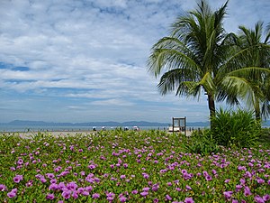
St. Martin's Island , Bengali language : সেন্ট মার্টিন্স দ্বীপ, also Coconut Island , is the southernmost island and the only coral island in the People's Republic of Bangladesh . The island is located deep in the south of the country in the Bay of Bengal , just a few kilometers west of the coast of Myanmar . It covers an area of approx. 8 km² (or significantly less according to the map), which is slowly but continuously decreasing due to the rising sea level and the erosion on the coral reef . The length in north-south direction is about 10 km and the maximum width 1.5 km. At the same time, the number of inhabitants, who mainly live in the north of the island, has risen to an estimated 7,000 inhabitants, not least due to the general population development in Bangladesh.
In the past, fishing or agriculture (especially the cultivation or use of coconut palms and, to a much lesser extent, the cultivation of rice and other types of grain or other fruits) were the basis and main source of income for the inhabitants, today (predominantly local) tourism dominates economic life. The fact that St. Martin's Island has not yet been taken over by international tourism is mainly due to its remote location.
The island does not have its own airport and can only be reached by ferry from the ports of Cox's Bazar and Teknaf , both of which are in the southernmost administrative district of the country ( Cox's Bazar (district) ).
Web links
Individual evidence
- ↑ Topic programm.ARD.de , accessed on July 11, 2012.

