Stora founds
| Stora founds | ||
|---|---|---|
| Waters | Baltic Sea | |
| Geographical location | 57 ° 21 '58 " N , 17 ° 5' 56" E | |
|
|
||
| length | 200 m | |
| width | 450 m | |
| surface | 6 ha | |

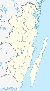
Stora Grundet is an island north of the Swedish Baltic Sea island of Öland .
The island has a west-east extension of about 450 meters and a north-south extension of about 200 meters. The Baltic Sea is north of Stora Grundet. The south shore of the island borders on the Öland bay of Grankullaviken . Together with two smaller islands a little further east, Stora separates the bay from the Baltic Sea.
Stora Grundet is known as the Långe Erik lighthouse, which was built in 1845 and marks the northern tip of Öland, is located here . Since 1965, Stora Grundet has been connected to Öland from the west by an approximately 130 meter long bridge.
In addition to the lighthouse, there are also several other houses on the island. Originally the lighthouse keepers lived here with their families. There is also a small port on the south side of the island. As the lighthouse is one of Öland's tourist attractions, the island is often visited by tourists in summer. In the season there is some gastronomy and a souvenir shop.

