Öland
| Öland | |
|---|---|

|

|
| Basic data | |
| Part of the country (landsdel) : | Götaland |
| Province (län) : | Kalmar Lan |
| Surface: | 1,347 km² |
| Residents: | 25,846 (December 31, 2016) |
| Population density: | 18.46 inhabitants per km² |
| Highest elevation: | Rösslösa 57 m ö.h. |
| Largest lake: | Hornsviken |

Oland is a Swedish Baltic Sea island in today's Province County Kalmar . With a length of 137 km and a maximum width of 16 km, it has an area of around 1347 km². This makes Öland the second largest island in Sweden (after Gotland ) and also the country's smallest historical province . It is divided into the municipality of Borgholm in the north and Mörbylånga in the south.
The island has been connected to the mainland town of Kalmar by the six-kilometer-long Öland Bridge since 1972 .
geography
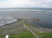
Öland is a plateau with a highest elevation of 57 m above sea level ( Galgbacken ) . The plateau slopes to the east, while it forms terraces to the west coast . Surface rocks are sandstone , slate and limestone . Since the earth layer is thin due to erosion, large parts of the island - especially in the south - consist of a karst and heather landscape ( Stora Alvaret ) with corresponding fauna . To the north, the Raukar of Byrum indicate that the island rose from the sea.
The flora on Öland is determined by the karst subsoil (see Burren ) and the climate . Small trees and bushes determine the appearance of the arid zone. The windmills are typical of Öland . 400 of the former 2000 windmills are still preserved. The south of the island has been declared a World Heritage Site as an agricultural landscape in southern Öland . Today Öland is a popular holiday island.
Between the mainland and the island in the middle of Kalmarsund lies the granite island Blå Jungfrun ( German Blue Jungfrau ), which is protected as a national park . There are large and small wetlands on Blå Jungfrun. The Ancyluswall stretches along the coast facing the Baltic Sea , with several swamps on its western flank.
Larger places on Öland are Borgholm , Färjestaden , Köpingsvik and Mörbylånga , which are all located on Kalmarsund. Highway 136 runs along the west coast and connects the north and south tips of the island.
Prehistory and History

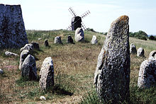
Öland, the island of stone monuments , was founded in 7000 BC. Inhabited by hunters (before it was long below sea level). In the Neolithic Age it was found around 4000 BC. Populated by farmers. Oland has from that time an isolated occurrence of four passage tombs , in the parish are Resmo. Over 13,000 archaeological sites and countless reading finds testify to Öland's history back to the Middle Ages . During the Bronze Age between 1500 and 500 BC The trade gained in importance. Hides and skins were exchanged for metal objects. During this time, large barrows were dug, including the Blå rör , the largest of the approximately 100 tumuli on the island. Also Menhire , partly on grave fields ( Gettlinge , Mysinge or Seby and Tingstad and Odens Flisor ) are encountered. Ship settlements (Gettlinge) and Treuddar (Vi alvar, Resmo , Segerstad ), however, are rare.
The Warnen (Variner) were a Germanic tribe that originally lived on Öland, but left the island during the Migration Period . The large castles such as Gråborg , Ismantorp and Eketorp date from this period (400–550 AD) . In total, the remains of 16 castles were found on Öland. Among the runes of the project Karlevistein which Bjärbystein and the stones of Lerkaka out. A first larger settlement was established around 750 AD near Köpingsvik in the north of the island.
Around 800 AD, Öland belonged to the territory of the Svea kings , but had its own legal status. In the Middle Ages, Öland gained importance due to its location on Kalmarsund , which was an important sea route. The emergence of Markt Köping as a trading center and the construction of a fort near Borgholm, which was later expanded into a large castle, bear witness to this.
Öland was drawn into the Swedish-Danish wars between 1300 and 1700: in the 1360s, the 1450s, at the beginning of the 16th century, during the Kalmar War 1611–1613 and after the defeat of the Swedish fleet on the southern tip of Öland in 1676 in Scania During the war , the island was ravaged by Danish troops. In 1612 the occupation by Danish troops lasted ten months. 700 farms are said to have been destroyed during this time. Rynings kors is a stone cross that is assigned to this time.
From 1569 to 1801 the entire island was a royal hunting area. For the local peasant population this meant severe cuts. Chopping wood or hunting were prohibited. To protect the royal game, keeping dogs was temporarily prohibited. Weapons were also not allowed. However, the royal game caused great damage to the farmers' fields. 1850 was in the region around Böda north of the island - the area remained even after 1801 still owned by the state - the Bödaaufstand place the fetched using military was suppressed.
The island, which had belonged to the province of Kalmar since 1617, briefly became a separate province in 1817, but in 1824 it was reconnected to Kalmar.
For a long time, Öland was a distinct agricultural landscape. Between 1810 and 1870 the population increased by 60% to about 38,000 people. The sometimes very barren soils of Öland had to feed more and more people. Attempts have been made to make previously unused soils (such as Malmar ) usable. Many Öland moors, such as Skedemosse , have been drained in order to obtain new agricultural land. Some of these measures had a very negative impact on the island's water balance. Also, as in Österskog, forests were cleared or unfavorable Alvar soils were processed, as in Dröstorp . The still increasing need of the people led to a labor migration mainly to Germany and Denmark. After an agricultural crisis, there was another wave of emigration from 1880, in which about half of the population left Öland. The preferred destination of the emigrants this time was America. Even today the island has a declining population.
economy
The population of Öland has declined significantly and is now only around half of its peak in the 19th century. While the population in the more remote areas in the north and south of the island continues to shrink, stagnation and in some cases an increase can be observed in the area around the Öland Bridge.
Even today agriculture is the most important industry. Around 25% of the island's area is used for agriculture, with the number of farms falling from 2000 to 1500 since 1960. The fishing industry is also operated from several small fishing ports.
Industry only plays a subordinate role. The limestone industry on Öland , which was important in the past, has lost its importance and is now mainly concentrated in the area around Sandvik in the north of the island. In the south of the island, Degerhamn is the industrial center. An alum factory had existed here since the 18th century . Today there is a cement factory. Other companies are used to process agricultural products. There are canning and sugar factories.
Tourism has gained significantly in importance , with the season being limited to a short summer season of less than three months in which hundreds of thousands of tourists, especially Swedes, visit the island. Many tourist offers close by mid-August. There is hardly any tourism in winter.
The daily Ölandsbladet has been published on Öland since 1867 . In addition to several national banks, the Ölands Bank is also active on Öland .
traffic
The railway lines that used to exist on the island were shut down.
Buildings
Windmills
Öland is characterized by the unusually large number of windmills. In the 19th century, owning a mill had developed into a peasant status symbol. The resulting mills, predominantly of the post mill type , were used exclusively for the farm in question. The number of windmills rose to 2000. Statistically, there were only about 10 to 20 inhabitants per windmill. In the course of the 20th century, the mills lost their importance and fell into disrepair. A large part was demolished. However, around 400 have survived and are preserved today. The largest of the widespread post mill is the so-called mill king who Björnhovda kvarnar east of Färjestaden. Other well-known mills are the Lerkaka , Störlinge , Sandviks Kvarn , Strandtorp mill and the Jordhamn scrubbing mill .
Palaces and castles
The Swedish royal family has their summer residence at Solliden Castle near the largest city in Öland, Borgholm . Crown Princess Victoria celebrates her birthday there every July. Not far from here are the ruins of Borgholm Castle .
The remains of the prehistoric castles of Bårby , Gråborg and Ismantorp are also noteworthy . The eketorp south of the island has been reconstructed and is one of the most recognizable structures in Öland.
Churches
Today there are 35 church buildings on Öland, some of which date back to the Romanesque period and initially served as fortified churches . The churches of Gärdslösa , Resmo , Långlöt , Högby , Egby and Föra are particularly noteworthy . The Källa ödekyrka is no longer in use as a church . There are also interesting church buildings in Borgholm and Köpingsvik . A structural feature of the churches on Öland was the shape of the saddle churches , with a tower at each end of the nave. However, in the 19th century these churches were all rebuilt. Remains of the second tower can still be found near the church of Resmo.
Museums
There are various smaller museums on Öland, but most of them are only open in the summer season. Besides Eketorp Castle , the most famous is the Öland Museum in Himmelsberga . The traditional rural culture of the island is presented in the open-air museum of Himmelsberga. One of the row villages typical of Öland has been preserved in Himmelsberga. Other museums include the Borgholm City Museum , the Skedemosse Museum , in which the history of Skedemosse's gold finds is presented, and the Linbasta of Lerkaka , in which the tradition of Öland linen production is presented.
The Böda Skogsjärnväg museum train runs in the northeast of the island .
Lighthouses
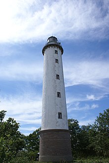
The lighthouses Långe Erik and Långe Jan , which are built on the northern and southern tip and are open to the public in summer, are Öland's landmarks . Other lighthouses in Öland are Kapelluddens fyr and Högby fyr on the east coast and the Skeppsstäv and Ispeudde beacons on the west coast.
Recreational facilities
The largest and nationally known leisure facility is the animal and amusement park Ölands Djur & Nöjespark, founded in 1974, north of Färjestaden near the Öland Bridge. The park combines a classic amusement park, a fun pool and a zoo.
nature
There are many different natural spaces on Öland. The steppe-like agricultural landscape in southern Öland Alvar south of the island is part of the UNESCO - World Heritage Site . This Alvar is the habitat for a diverse flora and fauna adapted to the difficult living conditions. Certain plants such as the Öland sun rose are unique to this area. The Alvar lakes and Vätar in the Alvar are attractions for a rich bird life. There are other bird sanctuaries on certain parts of the coast of Öland, for example at the southern tip in the Ottenby nature reserve , where an ornithology research station is also located, and on the west coast in Beijershamn .
An extensive forest area extends north of the Alvar area with the Mittlandsskogen . The northern tip of the island is also forested. With the Ökopark Böda there is a special protected area. Due to the soil, which is unusual for Sweden (fossil mountain species), there are many unusual flowers in Öland's flora . 34 species of orchid deserve special mention , especially the orchid genus.
Special features exist with the rock formations of Byrum and Neptune fields on the coast of the island.
Wetlands
Öland has a large number of wetlands . An inventory in 1993 counted 410 wetlands, each with an area of at least two hectares. Originally the number of wetlands was significantly larger. Since the 17th century, however, various efforts have been made to drain the moors in order to gain new agricultural land. Around half of the wetlands in Öland were lost in this way, with sometimes considerable consequences for the island's ecology and water balance. However, the hoped-for benefits for agriculture often failed to materialize or only lasted for a short time. The contents of the exposed peat were quickly broken down by contact with oxygen . In addition, wind erosion occurred. By straightening the watercourses, the water flowed away faster and the groundwater level sank. Many wells dried up. The disappeared moors were missing as natural water reservoirs. In the second half of the 20th century, work began on renaturing wetlands.
In the wetlands of Öland there are plants such as flour primrose , swamp heart leaf , shrub fingerwort , rush edge , swamp stendelwort , fleshy orchid , single tuber , glossy stendel , bog blue grass , pipe grass , stiff sedge , rusty red hornbill and flywort . In the fauna, birds such as the yellow wagtail , ruff , dunlin , Montagu's harrier , snipe , black godwit , redshank , marsh harrier , teal , eared grebe and black tern can be observed. Scabiosa pied butterflies , crested newts and agile frogs are also native to the moors.
Landscape symbols
The landscape symbols are the Öland sun rose , the sprout and the flounder . Another symbol of Öland is the extinct livestock breed of the Öland horse , which attempts are being made to breed.
literature
- Unlike Johansson: Öland - grove and heather. Kalmar 1999, ISBN 91-973285-6-1 .
- George Emory Fay: Major archaeological sites on Öland Island, Sweden. 1985.
Web links
- Official tourist information (German, English, Swedish)
- B7 Baltic Islands Network (English)
Individual evidence
- ↑ Statistiska centralbyrån: Folkmängd i landskapen on December 31, 2016
- ↑ http://arkeologiikalmar.blogspot.com/2009/02/olands-forsta-manniska-upptackt.html
- ↑ Märta Strömberg : The megalithic tombs of Hagestad . P. 198
- ↑ Staffan Rodebrand: Moore auf Öland. ISBN 91-974576-9-8 , p. 3.
- ↑ Staffan Rodebrand: Moore auf Öland , pp. 7 f., 15 f.
- ↑ Staffan Rodebrand: Moore auf Öland , p. 19 ff.
- ↑ Staffan Rodebrand: Moore auf Öland , p. 23 ff.
Coordinates: 56 ° 44 ' N , 16 ° 40' E


