Blå Jungfrun
| Blå Jungfrun National Park | ||
|---|---|---|
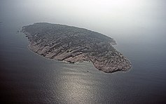
| General view of the island from the north | ||
|
|
||
| Location: | Kalmar Lan , Sweden | |
| Next city: | Squid | |
| Surface: | 1.98 km² | |
| Founding: | 1926, expanded in 1988 | |
The uninhabited Swedish island of Blå Jungfrun ("Blue Maiden") is located in northern Kalmarsund , between the Baltic coast of Sweden and the northern tip of the island of Öland . The island has an area of 0.66 km². Its highest point is 86 meters above sea level. While the northern part is rugged and bare, the southern area is flatter and overgrown with deciduous forest. The island is made up of large, blocked areas and ice-polished granite cliffs .
The granite
Blå-Jungfrun granite is Sweden’s southern Rapakiwi . It is characterized by large reddish brown alkali feldspars in a pyterlitic structure. The geographically and geologically closest rock that has a comparable structure is the Götemaren granite. Apart from that, such clear pyterlite structures can be found in the east of the Åland Islands and on the Finnish mainland. The impressive granite caves on Blå Jungfrun are glacial pots called jättegrytor ("giant pots").
fauna and Flora
There was never a sedentary population on the island. There are only rabbits and bats in mammals . The black guillemot is the typical bird for the island. A species-rich lichen flora makes the island's vegetation interesting.
Popular belief

The island had a meaning similar to the Blocksberg ( Brocken ) in Germany in southern Swedish popular belief , which is why it was given the nickname Blåkulla ( blå meaning "black", "dark"). In contrast to German superstition , the Witches' Sabbath should not take place on Walpurgis Night , but on Maundy Thursday . The seafarers therefore avoided the place for a long time.
At the southern tip of the island there is a labyrinth in the form of a stone setting ( Trojeborgen, Trojaburg ). The system has fifteen rings. It was already described by Carl von Linné . Their meaning is not known.
National park
The island is located in the Blå Jungfrun National Park of the same name , which has a total area of 1.98 km² by 1.32 km² and consists of water. The area was acquired with the help of donations from the industrial magnate Torsten Krueger and designated as a national park in 1926. In 1988 the national park was expanded. The area is also designated as a Natura 2000 area .
traffic
The island can be reached in summer by excursion boats from Oskarshamn on the mainland or from Byxelkrok on Öland.
Web links
Individual evidence
- ↑ Bevarandeplan för Natura 2000-området Blå Jungfrun (Swedish; PDF; 187 kB), Länsstyrelsen Kalmar län, 2005.


