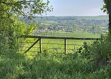
Stourpaine
Stourpaine is a place in north Dorset , England . The village has its origins in the Saxon times and the name simply means "Property of the Payn am Stour family".
The place is on the River Stour and the A350 in the southeast corner of Blackmore Vale, under the limestone plateau Cranborne Chase, three miles northwest of Blandford .
Construction of a church began in 1190 on the site of today's Holy Trinity Church and was completed around 1300.
In a field near the church there are remains that indicate the former castle and a mill. On a hilltop , Roman weapons , artifacts and ceramics have been found along with several Roman coins .
The village had a population of 608 people in 2001 .
Web links
Commons : Stourpaine - collection of images, videos and audio files
- History of Stourpaine
- Walks in Stourpaine, Dorset, South West England
- The Dorset Page: Stourpaine
- Stourpaine: Photos, Maps, Books, Memories
- Stourpaine: Parish Plan
Coordinates: 50 ° 53 ′ N , 2 ° 12 ′ W

