Talnikowy waterfall
| Talnikowy waterfall | ||
|---|---|---|
| Coordinates | 68 ° 26 '52.3 " N , 93 ° 17' 57.5" E | |
|
|
||
| place | Putorana Mountains , Siberia , Russia | |
The Talnikowy Waterfall ( Russian Тальниковый водопад ) is a 482 m high waterfall in the Putorana Mountains , the north-western part of the Central Siberian Mountains in the north of Siberia , Russia ( Asia ) and with this height of fall from several cascades is one of the highest waterfalls on earth .
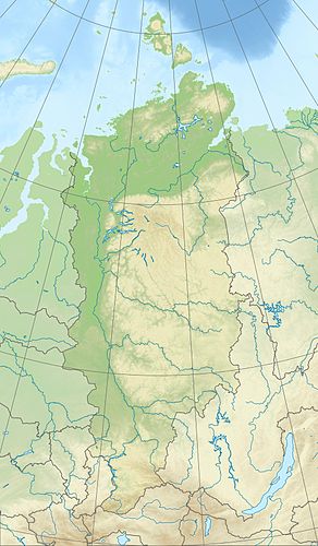
The waterfall is located in the western part of the Putorana Mountains on the left or east of Lake Djupkun , located on the Kureika River . Its stream, which is about 1 km long projected onto the plain in the waterfall area, falls steeply from a plateau mountain.
In the past, the height of the waterfall, which is rarely mentioned in the literature, was estimated at 600 m. Instrumental measurements were first taken in 1990 during an expedition into the mountains by Petro Kravchuk , author of the natural science book Geographisches Kaleidoskop (1988). The expedition with eight members was led by Boris Babizki (born 1936; former USSR athlete). A fall height of 482 m was determined. The measurement result appeared in Kravchuk's book Nature Records .
Web links
- Тальниковый водопад: миф или реальность? Description, photos and topographic map. Archived from the original on March 8, 2014 ; Retrieved November 10, 2019 (Russian).
Individual evidence
- ^ Petro Kravchuk: Geographical Kaleidoscope . Радянська школа, ISBN 5-330-00384-9 (Russian, original title: Географический калейдоскоп .).
