Kureika (river)
|
Kureika Курейка |
||
| Data | ||
| Water code | RU : 17010800112116100099860 | |
| location | Krasnoyarsk Region ( Russia ) | |
| River system | Yenisei | |
| Drain over | Yenisei → Arctic Ocean | |
| source |
Putorana Mountains , Central Siberian Mountains 68 ° 30 ′ 12 ″ N , 96 ° 0 ′ 39 ″ E |
|
| muzzle | at Kureika in the Yenisei Coordinates: 66 ° 29 ′ 18 " N , 87 ° 14 ′ 8" E 66 ° 29 ′ 18 " N , 87 ° 14 ′ 8" E |
|
| Mouth height | approx. 3 m
|
|
| length | approx. 888 km | |
| Catchment area | approx. 44,700 km² | |
| Discharge at the Oschernaya A Eo gauge : 28,100 km² Location: 311 km above the mouth |
MQ 1976/1991 Mq 1976/1991 |
360 m³ / s 12.8 l / (s km²) |
| Discharge at the Svetlogorsk A Eo gauge : 39,900 km². Location: 98 km above the mouth |
MQ 1936/1992 Mq 1936/1992 |
625 m³ / s 15.7 l / (s km²) |
| Outflow A Eo : 44,700 km² at the mouth |
MQ Mq |
664 m³ / s 14.9 l / (s km²) |
| Left tributaries | Jadun | |
| Right tributaries | Belduntschana , Jagtali | |
| Flowing lakes | Lake Ana , Lake Djupkun | |
| Reservoirs flowed through | Kureika reservoir | |
| Communities | Svetlogorsk | |
|
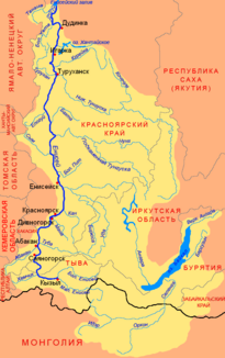
Location of the Kureika (Курейка) in the catchment area of the Yenisei |
||
The Kureika ( Russian Курейка , wiss. Transliteration Kurejka ) is an approximately 888 km long tributary of the Yenisei in the Krasnoyarsk region , in the north of Siberia and Russia ( Asia ).
course
The Kureika rises about 205 km north of the Arctic Circle on the Putorana Plateau, the central part of the Putorana Mountains , which represent the north-western part of the Central Siberian Mountains . In its upper and middle reaches it flows through the southern and southwestern mountain parts - exclusively through unpopulated area. At first she runs south to the influence of by the Jadunsee flowing Jadun and then in a north northwesterly direction while a little later by the elongated Anamasee runs. A little further north, its water falls over the approximately 13 m high Kureika waterfall ( ⊙ ).
A little further north, at the tributary of the Jagtali , the Kureika bends to the west and flows through the likewise elongated Djupkunsee , which bends to the southwest in the river valley. In the lake, the river is fed by many mountain streams with waterfalls, including that of the Talnikowy waterfall . A little further to the south-west it flows through the bay and island-rich Kureika reservoir , the dam of which is near Svetlogorsk . In this region the Putorana Mountains merge into the eastern foothills of the West Siberian lowlands .
About 100 km below the reservoir, after flowing south-west across the Arctic Circle , the Kureika flows into the Yenisei at a height of just 3 m , which flows 863 kilometers further downstream into the Kara Sea ( Arctic Ocean ); Opposite its mouth to the west is the village of Kureika .
Hydrography and Navigability
The catchment area of the Kureika covers 44,700 km², its mean discharge (MQ) is 664 m³ / s. The river has many rapids and also waterfalls, such as the aforementioned Great Kureika Waterfall . It is navigable below the Kureika reservoir up to its mouth and in the reservoir area .
Ice drift and flood
The Kureika is covered by ice from about mid-October to the end of May every year . When the region's permafrost thaws and the ice and snow melt, large stretches of land on the river banks are hit by heavy floods .
Individual evidence
- ↑ a b Topographic map (1: 200.000, Bl. Q-45-XV, XVI), mouth of the Kureika (coming from the top right) and a. with the village of Kureika on the other side of the estuary (with heights above sea level ) on mapq45.narod.ru
- ↑ a b c d e Kureika in the State Water Register of the Russian Federation (Russian)
- ↑ a b c d Article Kureika in the Great Soviet Encyclopedia (BSE) , 3rd edition 1969–1978 (Russian)
- ↑ Kureika at the Oschernaya gauge - hydrographic data from R-ArcticNET
- ↑ Kureika at the Svetlogorsk gauge - hydrographic data from R-ArcticNET

