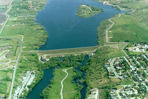
Jamestown Dam
| Jamestown Dam | |||||||
|---|---|---|---|---|---|---|---|
|
|||||||
|
|
|||||||
| Coordinates | 46 ° 55 '51 " N , 98 ° 42' 32" W | ||||||
| Data on the structure | |||||||
| Construction time: | 1952 to 1953 | ||||||
| Height above valley floor: | 26 m | ||||||
| Height above foundation level : | 33.5 m | ||||||
| Building volume: | 736,266 m³ | ||||||
| Crown length: | 432 m | ||||||
| Base width: | 222 m | ||||||
| Data on the reservoir | |||||||
| Water surface | 8.48 km² | ||||||
| Total storage space : | 37 million m³ | ||||||
The dam Jamestown ( english Jamestown Dam ) is located in Stutsman County in the US state of North Dakota . It dams the James River to the Jamestown reservoir ( English Jamestown Reservoir ). The town of Jamestown is immediately downstream of the dam.
The dam was built by the United States Bureau of Reclamation . Construction of the dam began in April 1952; it was completed in September 1953. The dam is used for flood protection.
Barrier structure
The barrier is an earthfill dam approximately 26 m (85 ft ) above the river bed and 33.5 m (110 ft ) above the foundation floor . The length of the dam crest is 432 m (1418 ft). The maximum width of the dam is 222 m (730 ft). The volume of the dam is 736,266 m³ (963,000 cubic yards ).
Reservoir
With the normal storage target , the reservoir extends over an area of around 8.48 km² (2095 acres ). At this dam target it holds 37 million m³ (30,000 acre-feet ) of water. During flooding, the reservoir can hold a maximum of 283.7 million m³ (230,000 acre-feet); its area is then around 53.62 km² (13,250 acres).
Individual evidence
- ↑ a b c Jamestown Dam and Reservoir Unit. (PDF) United States Bureau of Reclamation , pp. 5–8 , accessed on September 4, 2018 .

