
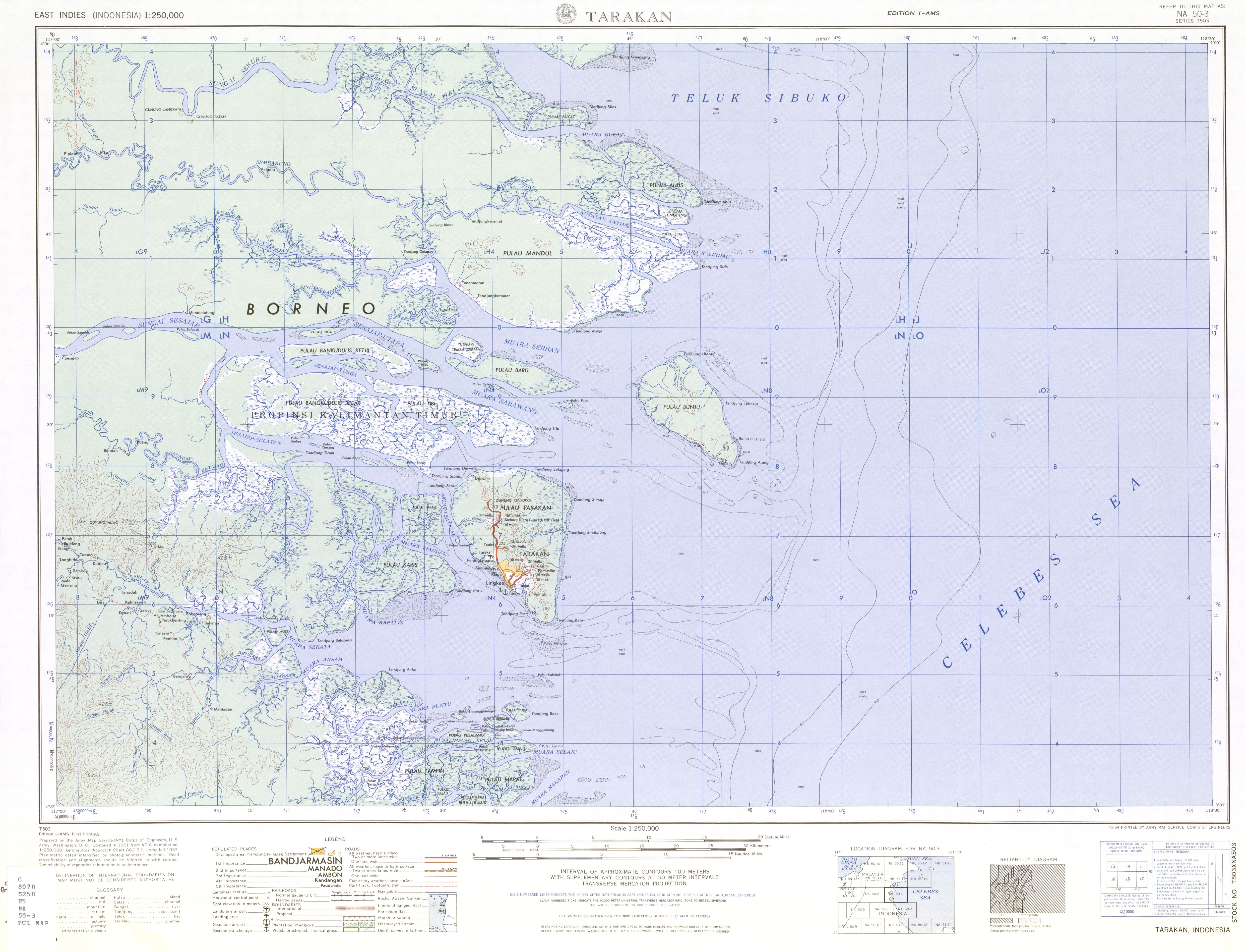
Tarakan (island)
| Tarakan (island) | ||
|---|---|---|
| Waters | Celebes Sea | |
| Geographical location | 3 ° 21 ' N , 117 ° 34' E | |
|
||
| length | 25.1 km | |
| width | 16.8 km | |
| surface | 303 km² | |
| Highest elevation | Gunung Tjangkol 113 m |
|
| Residents | 193,069 (2010) 637 inhabitants / km² |
|
| main place | Tarakan | |
 |
||

Tarakan is a small island in the Indonesian province of East Kalimantan . It corresponds to the extent of the city of Tarakan . Tarakan is located in the western part of the Celebes Sea off the northeast coast of Borneo . The island covers about 303 km² and consists mainly of marshland .
The rich oil fields made the island an important production location for the oil industry during the Dutch colonial era . The Japanese also recognized the importance of Tarakan and took the island in the Battle of Tarakan in January 1942 . It was not until May 1, 1945 that the 26th Australian Brigade Group began to recapture the island.
Two landing craft of the Australian Navy were named HMAS Tarakan . One is L-3017 from 1944. The boat was renamed HMAS Tarakan on December 16, 1948 . The second boat is the HMAS Tarakan (L 129) from 1971.

Climate diagram of Tarakan
-Indonesien.png)