Telchac Puerto
| Telchac Puerto | ||
|---|---|---|
|
Coordinates: 21 ° 21 ′ N , 89 ° 16 ′ W Telchac Puerto on the Yucatan map
|
||
| Basic data | ||
| Country | Mexico | |
| State | Yucatan | |
| Municipio | Telchac Puerto | |
| Residents | 1722 (2010) | |
| Detailed data | ||
| height | 1 m | |
| Post Code | 97407 | |
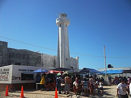
| Telchac Puerto lighthouse | ||
Telchac Puerto is a small port town in the north of Mexico's Yucatán peninsula with around 1,700 inhabitants. Telchac Puerto is located in the state of Yucatán and is the administrative seat of the Municipio Telchac Puerto .
location
Telchac Puerto is only a few kilometers east of the Laguna Rosada, about 68 km (driving distance) northeast of Mérida or about 44 km east of the port city of Progreso ; the place Telchac Pueblo is about 15 km south.
climate
The subtropical to tropical climate is - as in the entire Caribbean - muggy hot. The annual average temperature during the day is approx. 31 °; at night the thermometer rarely falls below 20 °. The annual rainfall is around 600 mm, with most of the rain falling in the summer months of June to September.
economy
The place lived for a long time from fishing and salt production. Since the 1980s tourism has played an increasingly important role, mainly for Mexicans; Beaches, hotels, restaurants provide the necessary infrastructure. Nearby is Playa de Coco , one of the few beaches in Mexico where the coconut palms have survived the lethal yellowing that has been rampant worldwide since the 1980s .
Surroundings
About 6 km to the south-west are the ruins of the small Mayan town of Xcambó , which is well worth seeing , in which a colonial-era chapel ( capilla abierta ) was built.

