Tobacco Caye
| Tobacco Caye | ||
|---|---|---|
| Tobacco Caye | ||
| Waters | Caribbean Sea | |
| Geographical location | 16 ° 54 ′ N , 88 ° 4 ′ W | |
|
|
||
| Residents | uninhabited | |
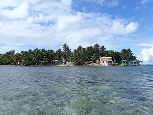
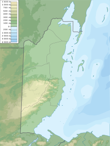
Tobacco Caye is a small reef island off the coast of Belize , about 16 km east of Dangriga .
geography
The island is part of the Belize Barrier Reef and is located in the South Water Caye Marine Reserve in the Stann Creek District . The island itself is approximately 3 acres (1.2 hectares). It is egg-shaped and extends over approx. 24 m (NS) or 125 m from west to east. About 20 people live on the island and work as servants for the four small hostels.
It is said that the island got its name from tobacco growing . The oldest European map showing Tobacco Caye comes from the British geographer J. Speer from 1771.
The island was devastated by Hurricane Mitch in 1998, but has since been rebuilt.
Individual evidence
- ↑ About.com posting [1]
- ^ Moon guide article .
- ^ DR Stoddart: Cays of the Belize Barrier Reef and Lagoons . Smithsonian Institution, Washington, DC 1982.
- ^ J. Speer: The West-India Pilot 1771, p. 15.
Web links
Commons : Tobacco Caye - Collection of Images, Videos and Audio Files
Wikivoyage: Dangriga - travel guide
Wikivoyage: Tobacco Caye - Travel Guide (English)


