Tokunoshima
| Tokunoshima | ||
|---|---|---|
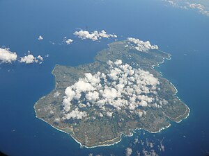
| Aerial view of Tokunoshima Island (2011) | ||
| Waters | East China Sea | |
| Geographical location | 27 ° 49 ′ N , 128 ° 56 ′ E | |
|
|
||
| length | 25 km | |
| width | 18 km | |
| surface | 247.77 km² | |
| Highest elevation | Inokawadake 645 m |
|
| Residents | 22.002 (October 1, 2019) 89 inhabitants / km² |
|
Tokunoshima ( Japanese 徳 之 島 ) is an island in the Pacific Ocean belonging to the Amami group . It is part of the Japanese prefecture of Kagoshima . The island has an area of approx. 248 km² with an extension of 25 km in north-south and 18 km in east-west direction.
There are three parishes on the island: Tokunoshima in the east, Amagi in the northwest and Isen in the south. Its total population is 22,002.
history
Tokunoshima was originally part of the Ryūkyū Kingdom until the island was incorporated into the Tokugawa Shogunate ( Japan ) in 1624 . Since then, the island has been particularly known for its Tōgyū bullfighting form , in which, in contrast to the European bullfighting forms, the animals compete against each other.
Web links
Commons : Tokunoshima - collection of pictures, videos and audio files
- Tokunoshima Visitors Guide (English)

