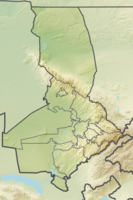
Tortkuduk
| Tortkuduk | |||
|---|---|---|---|
| General information about the mine | |||
| Mining technology | In situ method | ||
| Funding / year | 2,550 t | ||
| Information about the mining company | |||
| Operating company |
Areva (51%) Kazatomprom (49%) |
||
| Start of operation | 2008 | ||
| Funded raw materials | |||
| Degradation of | Uranium ore | ||
| Geographical location | |||
| Coordinates | 44 ° 30 '16 " N , 69 ° 12' 3.1" E | ||
|
|||
| Location | Suzak | ||
| area | Turkistan region | ||
| Country | Kazakhstan | ||
| District | Chu-sarysu | ||
The Tortkuduk uranium mine is a mine for the extraction of uranium ore in northern Turkistan near the town of Suzak. Tortkuduk is operated by Katco, a joint venture between the French company Areva and the Kazakh company Kazatomprom . Uranium mining began in 2008. With 2,550 tons of uranium in 2013, Tortkuduk is the largest uranium mine in Kazakhstan.
geography
The mine is located in the north of the Turkistan region near the town of Taikonur. It is located about 150 kilometers north of Turkistan and 290 kilometers east of Kyzylorda .
Occurrence
There are several sandstone uranium deposits of various sizes in the Turkistan region . The Tortkuduk uranium mine consists of four areas because of its large size: Muyunkum-South, Tortkuduk-South, Tortkuduk-North and Tortkuduk-Central. The uranium reserves of the entire mine are around 24,000 tons of uranium ore.
history
The mine began development in 2004 with the signing of an agreement between Areva and Kazatomprom to jointly mine uranium at the site. Funding began in 2008.
See also
Web links
- Katco (English)
Individual evidence
- ↑ a b world-nuclear.org: World Uranium Mining Production (English)
- ↑ Uranium Project - Pre Feasibility of Tortkuduk Central (Kazakhstan - KATCO) (English)
