Drink
| Drink | ||
|---|---|---|
| Trinket (2012) | ||
| Waters | Indian Ocean | |
| Archipelago | Nicobar Islands | |
| Geographical location | 8 ° 5 '32 " N , 93 ° 34' 50" E | |
|
|
||
| length | 9.6 km | |
| width | 2.1 km | |
| surface | 17.79 km² | |
| Residents | 436 (2001) 25 inhabitants / km² |
|
| main place | Drink | |
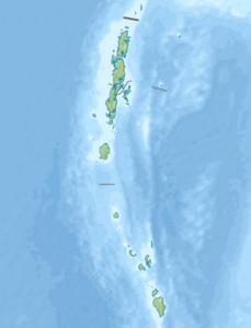
Trinket (also called Trinkat , Nicobar : Laful ) is an Indian island and belongs to the Nicobar Islands in the Indian Ocean .
It is located east of the neighboring islands of Camorta and Nancowry .
According to the 2001 Indian census, there were 436 people on the island in four villages: the largest was Trinket , followed by Safebalu , Tapiang and Hockcook . At that time the island had an area of 86.3 km².
In 1778 the island was declared an Austrian crown colony by the Trieste East India Trade Company . In 1784 this claim was given up again.
In the great tidal waves of the tsunami as a result of the severe seaquake in the Indian Ocean in 2004 , Trinket was badly devastated, the area was reduced considerably and the island broke into two parts. 91 people were killed. The survivors were then evacuated to neighboring islands.
Remarks
- ↑ Page of the police with the island names (English) ( Memento of the original from March 27, 2010 in the Internet Archive ) Info: The archive link was inserted automatically and has not yet been checked. Please check the original and archive link according to the instructions and then remove this notice.
- ^ Page of the police with village names (English) ( Memento of the original dated February 4, 2012 in the Internet Archive ) Info: The archive link was inserted automatically and not yet checked. Please check the original and archive link according to the instructions and then remove this notice.
- ^ Franz Theodor Maurer, Die Nikobaren: Colonial history and description together with motivated suggestions for the colonization of these islands by Prussia , Berlin: Heymann, 1867, p. 119

