Umbele Islands
| Umbele Islands | ||
|---|---|---|
| Waters | Gulf of Tolo | |
| Geographical location | 3 ° 4 ′ S , 122 ° 30 ′ E | |
|
|
||
| Number of islands | > 13 | |
| Residents | 2862 (2010) | |
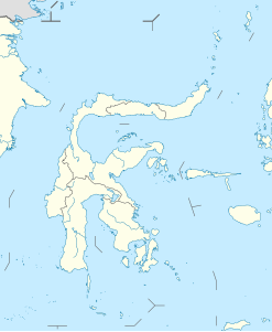
The Umbele Islands ( Indonesian Kepulauan Umbele ) are an Indonesian group of islands on the coast of Sulawesi . It forms the center of the Salabangka Islands .
geography
The Umbele Islands are located on the coast of the southern tip of the province of Central Sulawesi (Sulawesi Tengah), in the Gulf of Tolo . The islands belong to the administrative district ( Indonesian Kabupaten ) Morowali .
In its center lies Umbele Gunung , the largest island, and to the west of it with Umbele , the second largest. The small island of Umbele Mandidi lies off the coast of Umbele and the islands of Pakuburan and Buaya to the northwest of the group . To the north of Umbele Gunung is the island of Rajagunung with the offshore islet Anak Rajagunung and in the northeast the islands of Panimbawang and Buagala . The east of the group is formed by the trio Pakuburan Panimbawang , Kuso and Saubane with several small islands. A little to the north of it is the islet of Tokoh Bonte .
Half of the Kapola settlement is on the north-western tip of Umbele, the other half, connected by a bridge, on Umbele Mandidi. The Polewali settlement is on the west coast of Umbeles . Umbele is located on the north coast of Umbele Gunung , and Boelimau is another settlement on the southeastern tip . In the essence of Buagala lies the Baigala settlement .
The most populous Desa is Pulau Dua (1045 inhabitants) to which the north Umele, Umbele Mandidi, Pakuburan and Buaya belong. The west of the village Kapola, like the northwest of the island, belongs to the Desa Umbele (344 inhabitants). The Desa Polewali (415 inhabitants) consists of the settlement of the same name, the south of the island Umbele and the south-west of Umbele Gunung. The place Boelimau is located in Desa of the same name (383 inhabitants), which includes the east of Umbele Gunungs and the offshore islands in the southeast. The Desa Panimbawang (675 inhabitants) includes the island of the same name, Buagala, Rajagunung with Anak Rajagunung and the north of Umbele Gunung. The Umbele Islands have a total of 2,862 inhabitants.
Individual evidence
- ↑ a b Map of Kendari , accessed November 19, 2016.
- ↑ Mapcarta: Kepulauan Salabangka
- ↑ a b Penduduk Indonesia menurut desa 2010 ( Memento from March 27, 2014 in the Internet Archive ) (Indonesian; PDF; 6.0 MB), accessed on January 26, 2013.
