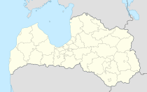
Vecvārkava
| Vārkava | ||
|---|---|---|
 Help on coat of arms |
|
|
| Basic data | ||
| State : |
|
|
| Landscape: | ||
| Administrative district : | Vārkavas novads | |
| Coordinates : | 56 ° 12 ' N , 26 ° 30' E | |
| Residents : | 658 | |
| Area : | ||
| Population density : | ||
| Height : | ||
| Website: | www.varkava.lv | |
| Post Code: | ||
| ISO code: | ||
Vecvārkava (also Upmala ) is a village in the Latgale region in eastern Latvia , on the banks of the Dubna .
history
The place arose in Soviet times as the center of a kolkhoz around the former Warkow estate . Today there is a school, a doctor's office and an information point for tourists. A nature trail, the former manor house and the Catholic church are all worth seeing.
Personalities
- The embryologist Aleksandrs Kovaļevskis (1840–1901) was born in Vārkava .
Vārkavas novads
The place is the center and namesake of the administrative district of the same name (Vārkavas novads), which was formed from three municipalities in 2009 (see administrative structure of Latvia ). The administration building is located in Vecvārkava. In 2010, 2369 inhabitants were registered. The largest towns are Vecvārkava, Vanagi, Rimicāni, Arendole and Piliškas.
literature
- Astrīda Iltnere (ed.): Latvijas Pagasti, Enciklopēdija. Preses Nams, Riga 2002, ISBN 9984-00-436-8 .
Individual evidence
- ↑ Vārkavas novada 2008. gada publiskais pārskats ( page no longer available , search in web archives ) Info: The link was automatically marked as broken. Please check the link according to the instructions and then remove this notice. (Latvian).
