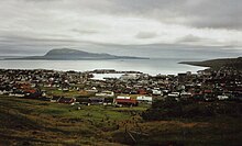
Viðarlundin í Kerjum

Viðarlundin í Kerjum is a forest in the north-west of Tórshavn , the capital of the Faroe Islands . Sometimes he is also called Viðarlundin uppi í Kerjum . It consists mainly of spruce and pine and is located a little below the Hotel Føroyar . The Faroese word viðarlund literally means "wood" and describes a park or forest in the Faroe Islands, of which only 0.06% is forested.
As early as 1932, the town of Tórshavn was given the Uppi í Kerjum site above the town with a size of 3 hectares for “planting with trees”. The project was not tackled until the 1950s, when the emerging forest was known as "Skótaplantasjan". The Forestry Authority (Skógfriðingarnevndin) started planting and maintenance on March 18, 1974. In spring 2012 it was decided to create a hiking trail from the Marknegilsvegur road to the hotel, which leads through the middle of the forest. The path was completed in autumn 2012, thereby creating the forest, which is at a height of 135 m. ü. d. M. is now accessible to everyone for the first time. It consists mainly of spruce (Picea), less of pine (Pinaceae).
The forest Viðarlundin í Kerjum is still owned by the City Tórshavn and covers an area of today m² 32,100. The forest, which is laid out on sloping terrain and in which new trees have been planted over the last few years, is one of the largest parks and forests in the city. From here you have a good view over the whole capital to the island of Nólsoy off Tórshavn . Like all forests outside Tórshavn, Viðarlundin í Kerjum is fenced in to protect the trees from sheep foraging for food.
Individual evidence
- ↑ Højgaard, Andrias: Træplanting í í Føroyum eina Old 47. Tórshavn 1989th
- ↑ Højgaard, Andrias: Træplanting í í Føroyum eina Old , 40. Tórshavn 1989th
- ↑ Skoven i Kerjum
- ↑ Elttør, Eyðun: Uppskot til løgtingslóg um viðarvøkstur og frílendisrøkt , Tab. (Talva) 2, Løgting, March 4, 2003.
Coordinates: 62 ° 0 ′ 44 " N , 6 ° 47 ′ 50" W.
