Wahlbergøya
| Wahlbergøya | ||
|---|---|---|
| Waters | Hinlopenstrasse | |
| Archipelago | Vaigattøyane , Svalbard | |
| Geographical location | 79 ° 22 ′ N , 19 ° 48 ′ E | |
|
|
||
| length | 13 km | |
| surface | 46 km² | |
| Highest elevation | 194 moh. | |
| Residents | uninhabited | |
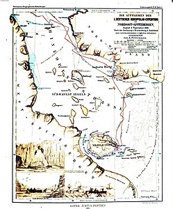
| Wahlberg I. on the map of the First German North Polar Expedition (1868) | ||
Wahlbergøya is the largest island of Vaigattøyane , one in the Hinlopen Strait located and Spitsbergen belonging archipelago.
The approximately triangular island is about 13 km long from its northwest cape Ryggneset to its southeast cape Jäderinneset. With an area of 46 km², it is up to 194 m high. The Southwest Cape is called Ardneset. The largest islands in Vaigattøyane after Wahlbergøya are Von Otterøya in the southeast and Nyströmøya in the northwest.
Wahlbergøya is a polar desert with very sparse vegetation. About 4% of its area is glaciated . There are several small lakes.
The island is named after the botanist Peter Fredrik Wahlberg (1800–1877), who was secretary of the Swedish Academy of Sciences from 1848 to 1866 .
Wahlbergøya has been part of the Northeast Svalbard Nature Reserve since 1973 .
Individual evidence
- ↑ a b The Norwegian Pilot . Volume 7: Sailing Directions Svalbard and Jan Mayen (PDF; 55.0 MB), The Norwegian Hydrographic Service and Norwegian Polar Institute, 3rd edition, Stavanger 2012 (PDF version 3.5, May 2016), ISBN 978-82-90- 65330-4 , pp. 46 and 315 (English).
- ↑ islands of Hinlopen Strait on www.spitzbergen.de, accessed on August 10, 2016th
- ↑ Wahlbergøya . In: The Place Names of Svalbard (first edition 1942). Norsk Polarinstitutt , Oslo 2001, ISBN 82-90307-82-9 (English, Norwegian).

