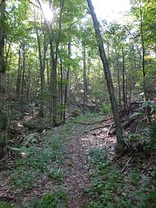
Wooster Mountain State Park
|
Wooster Mountain State Park
|
||
| location | Danbury (Connecticut) , Fairfield County (Connecticut) , USA | |
| surface | 1.8 km 2 | |
| Geographical location | 41 ° 21 ′ N , 73 ° 28 ′ W | |
|
|
||
| Setup date | 1926 | |
| administration | Dept. of Energy & Environmental Protection, State of Connecticut | |
Wooster Mountain State Park is a state park in the Danbury area in the US state of Connecticut . Recreational opportunities include hiking and hunting. Part of the Ives Trail also runs in the park area . Hiking trails connect the park with Bennet's Pond Park to the southwest and Pine Mountain (304 m) to the west.
geography
The Saugatuck River rises near Spruce Mountain (272 m) in the northwest and traverses the park on the way to Sugar Hollow Pond , Wooster Mountain (275 m) in the southwest and Moses Mountain (296 m) in the northeast are the highest Surveys. To the east, the park is partially bounded by US 7 Sugar Hollow Road.
See also
literature
- Joseph Leary: A Shared Landscape - A Guide and History of Connecticut's State Parks & Forests . 2004. ISBN 978-0974662909
Web links
- Wooster Mountain State Park Connecticut Department of Energy and Environmental Protection
Individual evidence
- ↑ Brochure and map of the Ives Trail. (pdf) Retrieved December 1, 2019 (English).

