Yamato Aogaki Quasi National Park
|
Yamato Aogaki Quasi National Park
|
||
| location | Nara Prefecture , Japan | |
| WDPA ID | 3263 | |
| Geographical location | 34 ° 36 ' N , 136 ° 0' E | |
|
|
||
| Setup date | Dec 28, 1970 | |
| administration | Nara prefecture | |
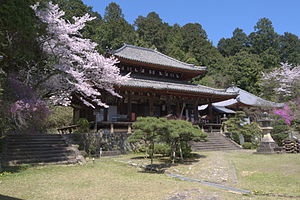
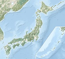
The Yamato Aogaki Quasi National Park ( Japanese 大 和 青 垣 国 定 公園 Yamato Aogaki Kokutei Kōen ) is one of over 50 quasi national parks in Japan. It is 57.42 km² and is located in the eastern part of the Yamato or Nara basin in the north of the Nara prefecture . The Nara Prefecture is responsible for the administration of the park, which was established on December 28, 1970. With the IUCN Category V, the park area is classified as a Protected Landscape / Protected Marine Area . In the park there are various temples such as the Isonokami-jingū , the Hase-dera and the Byakugō-ji .
See also
Web links
Commons : Yamato-Aogaki Quasi-National Park - Collection of pictures, videos and audio files
Individual evidence
- ↑ 大 和 青 垣 国 定 公園 . In: 百科 事 典 マ イ ペ デ ィ ア et alii at kotobank.jp. Retrieved December 20, 2019 (Japanese).
- ↑ 大 和 青 垣 国 定 公園 . Nara Prefecture, 2013, accessed December 20, 2019 (Japanese).

