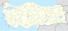
Yayladağı Gümrük Kapısı
Coordinates: 35 ° 54 ′ 19.4 ″ N , 36 ° 0 ′ 40 ″ E
Yayladağı Gümrük Kapısı (also Yayladağı Sınır Kapısı ) is a Turkish border crossing on the border between Turkey and Syria . It is the westernmost of the crossings on this border and is located west of Yayladağı , Hatay Province , on the Turkish D825 road. In Syrian territory, Kesab is to the north and the village of an-Nabʿain is to the west of the border crossing.
The Yayladağı Customs District was established in 1938. The border crossing was set up with a cabinet decision in 1958. The buildings also date from this period. After the Reyhanlı attack in 2013, the border crossing was closed.
