Zengou
Zengou (also: Zongo ) is a district of Zinder in Niger .
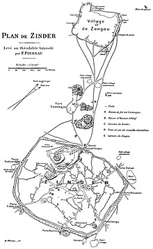
Zengou is next to Birni , the seat of the Sultan , one of the two oldest districts of Zinder. Zengou was originally a Hausa settlement and a camp for Tuareg caravans. Here, as in Birni, there was an important slave market geared towards export. Between 1911 and 1926, when Zinder was the capital of the French military territory of Niger, an administrative city with buildings in the French colonial style emerged between Zengou and Birni. During this time, large parts of the traditional Hausa architecture in Zengou were destroyed. The French moved the tanneries , which were initially settled in Birni in the 1850s under Sultan Ténimoun dan Sélimane , to the outskirts of Zengou. The district is still an important commercial and economic center today.
literature
- Gabi Waibel: Settling down and social change among the Tuareg Zinders (Niger) (= Hamburg contributions to Africa customer . No. 58 ). Institute for Africa Customers, Hamburg 1998, ISBN 3-928049-56-9 .
Individual evidence
- ↑ a b Jolijn Geels: Niger . Bradt, Chalfont St Peter 2006, ISBN 1-84162-152-8 , p. 215 and 221 .
- ^ Roberta Ann Dunbar: Slavery and the Evolution of Nineteenth-Century Damagaram (Zinder, Niger) . In: Suzanne Miers, Igor Kopytoff (Ed.): Slavery in Africa. Historical and Anthropological Perspectives . The University of Wisconsin Press, Madison / London 1977, ISBN 0-299-07330-0 , pp. 161 .
- ^ Eric J. Arnould: Marketing and Social Reproduction in Zinder, Niger Republic . In: Robert McC. Netting, Richard R. Wilk, Eric J. Arnould (Eds.): Households. Comparative and Historical Studies of the Domestic Group . University of California Press, Berkeley / Los Angeles / London 1984, ISBN 0-520-04996-9 , pp. 137 .
- ^ Alison Behnke: Niger in Pictures . Twenty-First Century Books, Minneapolis 2008, ISBN 0-8225-7147-1 , pp. 72 .
Coordinates: 13 ° 49 ' N , 8 ° 59' E
