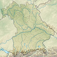
Ammertal in the area of the Ammerleite and Talbach slopes
Coordinates: 47 ° 45 ′ 25 ″ N , 10 ° 57 ′ 19 ″ E
The Ammertal nature reserve in the area of the Ammerleite and Talbach slopes is located in the Weilheim-Schongau district in Upper Bavaria in the area of the Rottenbuch and Böbing communities . It is part of the FFH area Ammer vom Alpenrand b. to the NSG 'Vogelfreistätte Ammersee-Südufer' (8331-302).
The approximately 251 hectare area with the NSG-00078.01 was placed under nature protection in 1959 . It extends north of the core town of Rottenbuch and west of the core town of Böbing along the Ammer and Talbach . The B 23 runs west of the area .
See also
Web links
Commons : Ammertal in the area of the Ammerleite and Talbach slopes - collection of images, videos and audio files


