
Ockenfels
| coat of arms | Germany map | |
|---|---|---|

|
Coordinates: 50 ° 35 ' N , 7 ° 16' E |
|
| Basic data | ||
| State : | Rhineland-Palatinate | |
| County : | Neuwied | |
| Association municipality : | Linz on the Rhine | |
| Height : | 136 m above sea level NHN | |
| Area : | 1.66 km 2 | |
| Residents: | 1073 (Dec. 31, 2019) | |
| Population density : | 646 inhabitants per km 2 | |
| Postal code : | 53545 | |
| Area code : | 02644 | |
| License plate : | NO | |
| Community key : | 07 1 38 055 | |
| Association administration address: | Am Schoppbüchel 5 53545 Linz am Rhein |
|
| Website : | ||
| Local Mayor : | Kurt Pape ( CDU ) | |
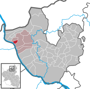
| Location of the local community Ockenfels in the district of Neuwied | ||
  |
||


Ockenfels is a municipality in the Neuwied district in the north of Rhineland-Palatinate . It belongs to the Linz am Rhein association.
geography
Ockenfels adjoins the city of Linz on the Rhine to the north and lies south of Kasbach-Ohlenberg above the right bank of the Rhine on a terrain that rises sharply from southwest to northeast. The village covers altitudes between 80 m above sea level. NHN and 180 m above sea level NHN . The municipal area reaches up to around 200 m from the Rhine, the majority of the natural space can be assigned to the main town of the Linzer Terrasse , the area to the east of the Rheinwesterwälder volcanic ridge . Ockenfels Castle is located near the municipality in the district of Linz am Rhein . The Blumenau residential area belongs to Ockenfels .
Today Ockenfels is primarily a residential community , but for some years now there have also been efforts to locate commercial businesses.
history
The place was first mentioned in a document in 1257. The main features of the current district boundaries of Ockenfels were created in 1809 when the parish of Linz was divided into eight districts based on a Nassau ordinance. The municipality of Ockenfels was initially under the administration of the Nassau Office of Linz . After the Rhineland was ceded to the Kingdom of Prussia in 1815, the community was assigned to the newly formed Linz District (incorporated into the Neuwied District in 1822 ) and administered by the Linz mayor (from 1927 “Amt Linz”).
Since the land registry was reorganized in 1828, only minor border corrections have been made. A description of the Ockenfels parish presented in 1829 shows that 300 residents lived in 62 houses in the village at the time, with a chapel and a schoolhouse at their disposal.
- Population development
The development of the population of Ockenfels, the values from 1871 to 1987 are based on censuses:
|
|
politics
Municipal council
The local council in Ockenfels consists of 16 council members, who were elected in a personalized proportional representation in the local elections on May 26, 2019 , and the honorary local mayor as chairman.
Allocation of seats in the municipal council:
| choice | SPD | CDU | FDP | total |
|---|---|---|---|---|
| 2019 | 5 | 9 | 2 | 16 seats |
| 2014 | 6th | 9 | 1 | 16 seats |
| 2009 | 6th | 9 | 1 | 16 seats |
| 2004 | 4th | 12 | - | 16 seats |
mayor
Kurt Pape (CDU) is the local mayor of Ockenfels. In the direct election on May 26, 2019, he was confirmed in his office for a further five years with a share of the vote of 56.64%.
coat of arms
|
|
Blazon : "In red a golden glaive wheel under a silver shield head with a black cross reaching to the edge of the shield." |
Culture and sights
traffic
In the immediate vicinity of the community runs the federal highway 42 , which leads from Koblenz to Bonn . The next motorway junction is Bad Honnef / Linz on the A3 . The main access is from Linz am Rhein via the K11.
The next train station is Linz (Rhine) on the right-hand Rhine route . The only means of public transport in the local community is the Ockenfels - Linz caller collective taxi.
Web links
Individual evidence
- ↑ State Statistical Office of Rhineland-Palatinate - population status 2019, districts, communities, association communities ( help on this ).
- ↑ State Statistical Office Rhineland-Palatinate (ed.): Official directory of the municipalities and parts of the municipality. Status: January 2018 [ Version 2020 is available. ] . S. 32 (PDF; 2.2 MB).
- ↑ State Statistical Office Rhineland-Palatinate - regional data
- ↑ ELECTION RESULTS. Retrieved May 29, 2019 .
- ^ The Regional Returning Officer Rhineland-Palatinate: direct elections 2019. see Linz am Rhein, Verbandsgemeinde, fourth line of results. Retrieved February 20, 2020 .
- ↑ AST Ockenfels. Accessed December 1, 2018 .

Cities: Bad Hönningen | Dierdorf | Linz on the Rhine | Neuwied | Uncle . Municipalities: Anhausen | Asbach | Bonefeld | Breitscheid (Westerwald) | Bruchhausen | Buchholz (Westerwald) | Dattenberg | Datzeroth | Dernbach | Döttesfeld | Dry wood | Ehlscheid | Drake | Oath of May | Hammerstein (on the Rhine) | Hanroth | Hardert | Harschbach | Hausen (Wied) | Hümmerich | Isenburg (Westerwald) | Kasbach-Ohlenberg | Kleinmaischeid | Kurtscheid | Leubsdorf (on the Rhine) | Leutesdorf | Linkenbach | Marienhausen | Meinborn | Melsbach | Neustadt (Wied) | Niederbreitbach | Niederhofen | Niederwambach | Oberdreis | Oberhonnefeld-Gierend | Upper wheels | Ockenfels | Puderbach | Ratzert | Raubach | Rengsdorf | Rheinbreitbach | Rheinbrohl | Rodenbach near Puderbach | Rossbach (Wied) | Rüscheid | Saint Catherine | Stebach | Steimel | Street house | Thalhausen | Urbach (Westerwald) | Vettelschoss | Waldbreitbach | Windhagen | Woldert .