
Woldert
| coat of arms | Germany map | |
|---|---|---|

|
Coordinates: 50 ° 36 ' N , 7 ° 39' E |
|
| Basic data | ||
| State : | Rhineland-Palatinate | |
| County : | Neuwied | |
| Association municipality : | Puderbach | |
| Height : | 255 m above sea level NHN | |
| Area : | 5.03 km 2 | |
| Residents: | 584 (Dec. 31, 2019) | |
| Population density : | 116 inhabitants per km 2 | |
| Postal code : | 57614 | |
| Area code : | 02684 | |
| License plate : | NO | |
| Community key : | 07 1 38 078 | |
| Community structure: | 2 districts | |
| Association administration address: | Hauptstrasse 13 56305 Puderbach |
|
| Website : | ||
| Local Mayor : | Volker Otto | |
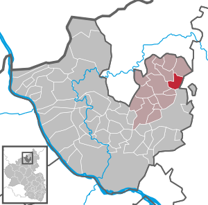
| Location of the local community of Woldert in the Neuwied district | ||
  |
||

Woldert is a municipality in the Neuwied district in the north of Rhineland-Palatinate . She belongs to the Verbandsgemeinde Puderbach .
geography
The place is a little off the main traffic arteries east of Puderbach on the edge of the Rhine-Westerwald nature park . Woldert lies on both sides of the Dreisbach , which drains to the southwest to the Holzbach .
The districts of Woldert and Hilgert as well as the residential area Haus Osterberg belong to the municipality of Woldert .
history
Both villages belonging to the municipality belong to the so-called clearing areas . Woldert was called Nyderwoltroyde in 1324 , so there must have been a "Niederwoldert" and an "Oberwoldert" at that time. In 1478 Woldert was called Wolterote , later Wolderoth . Hilgert was called "Hilgerrode" in 1376.
Because they belonged to the County of Wied , the Walpoden von Reichenstein owned land in Woldert (1478). In 1582 Woldert had eight and Hilgert four houses.
Woldert belonged to the County of Wied-Runkel until 1806, in 1815 the community came to the newly formed Prussian province of Lower Rhine (from 1822 Rhine province ). From 1816 Woldert belonged to the mayor's office in Niederwambach in the Neuwied district . In 1927 this was renamed to Amt Niederwambach and in 1937 merged with Amt Puderbach. Since then, Woldert has been part of Puderbach administratively .
The mill in Hilgert already existed in the 17th century and was a Countess-Wiedische ban mill . The villages Hilgert, Woldert, Weroth and Dendert belonged to the mill ban. According to a lease document from 1690, the leaseholder had to pay 110 Reichstaler lease annually. The mill ban was lifted in 1845 and Prince zu Wied sold the mill for 1,505 thalers.
Today's community was created on March 16, 1974 through the merger of the previously independent communities Woldert (435 inhabitants) and Hilgert (68).
- Cultural monuments
See the list of cultural monuments in Woldert
- Population development
The development of the population of Woldert in relation to today's municipal area; the values from 1871 to 1987 are based on censuses:
|
|
politics
Municipal council
The local council in Woldert consists of twelve council members who were elected in the local elections on May 26, 2019 in a personalized proportional representation, and the honorary local mayor as chairman. The twelve seats in the municipal council are divided between two groups of voters.
mayor
Volker Otto became the local mayor of Woldert on June 10, 2014. In the direct election on May 26, 2019, he was confirmed in his office for another five years with a share of 80.31% of the votes. His predecessor was Michael Heinrichs.
coat of arms
|
|
Blazon : “On the right, in silver, four red diagonal bars, covered by a standing peacock looking to the left; on the left two silver ears of wheat in red and below, in a looped point, in silver a red mill wheel with eight spokes and eight blades. " |
| Reasons for the coat of arms: The coat of arms colors red and silver as well as the peacock indicate that Woldert used to belong to the County of Wied , they are the colors of the Counts of Wied-Isenburg-Braunsberg. The ears of wheat indicate that agriculture dominated the municipality of Woldert. The mill wheel indicates that there were grain mills in both villages belonging to the municipality. |
traffic
The next motorway junction is Dierdorf on the A3 . The nearest ICE - Station is in Montabaur on the high-speed line Cologne-Rhine / Main .
Web links
Individual evidence
- ↑ State Statistical Office of Rhineland-Palatinate - population status 2019, districts, communities, association communities ( help on this ).
- ↑ State Statistical Office Rhineland-Palatinate (ed.): Official directory of the municipalities and parts of the municipality. Status: January 2019 [ Version 2020 is available. ] . S. 52 (PDF; 3 MB).
- ↑ Official municipality directory 2006 ( Memento from December 22, 2017 in the Internet Archive ) (= State Statistical Office Rhineland-Palatinate [Hrsg.]: Statistical volumes . Volume 393 ). Bad Ems March 2006, p. 201 (PDF; 2.6 MB). Info: An up-to-date directory ( 2016 ) is available, but in the section "Territorial changes - Territorial administrative reform" it does not give any population figures.
- ↑ State Statistical Office Rhineland-Palatinate: My village, my city. Retrieved July 12, 2019 .
- ^ The Regional Returning Officer Rhineland-Palatinate: Local elections 2019, city and municipal council elections
- ↑ Local council Woldert meets (10.06.2014). NR-Kurier, June 10, 2014, accessed on March 20, 2020 .
- ↑ Woldert in the fight against the Indian balsam. NR-Kurier, July 7, 2014, accessed on March 20, 2020 .
- ^ The State Returning Officer Rhineland-Palatinate: direct elections 2019. see Puderbach, Verbandsgemeinde, last line of results. Retrieved March 20, 2020 .

Cities: Bad Hönningen | Dierdorf | Linz on the Rhine | Neuwied | Uncle . Municipalities: Anhausen | Asbach | Bonefeld | Breitscheid (Westerwald) | Bruchhausen | Buchholz (Westerwald) | Dattenberg | Datzeroth | Dernbach | Döttesfeld | Dry wood | Ehlscheid | Drake | Oath of May | Hammerstein (on the Rhine) | Hanroth | Hardert | Harschbach | Hausen (Wied) | Hümmerich | Isenburg (Westerwald) | Kasbach-Ohlenberg | Kleinmaischeid | Kurtscheid | Leubsdorf (on the Rhine) | Leutesdorf | Linkenbach | Marienhausen | Meinborn | Melsbach | Neustadt (Wied) | Niederbreitbach | Niederhofen | Niederwambach | Oberdreis | Oberhonnefeld-Gierend | Upper wheels | Ockenfels | Puderbach | Ratzert | Raubach | Rengsdorf | Rheinbreitbach | Rheinbrohl | Rodenbach near Puderbach | Rossbach (Wied) | Rüscheid | Saint Catherine | Stebach | Steimel | Street house | Thalhausen | Urbach (Westerwald) | Vettelschoss | Waldbreitbach | Windhagen | Woldert .