
Ruppertsberg
| coat of arms | Germany map | |
|---|---|---|

|
Coordinates: 49 ° 24 ' N , 8 ° 12' E |
|
| Basic data | ||
| State : | Rhineland-Palatinate | |
| County : | Bad Dürkheim | |
| Association municipality : | Deidesheim | |
| Height : | 117 m above sea level NHN | |
| Area : | 8.07 km 2 | |
| Residents: | 1447 (Dec. 31, 2019) | |
| Population density : | 179 inhabitants per km 2 | |
| Postal code : | 67152 | |
| Area code : | 06326 | |
| License plate : | DÜW | |
| Community key : | 07 3 32 043 | |
| LOCODE : | DE RPB | |
| Association administration address: | At the train station 5 67146 Deidesheim |
|
| Website : | ||
| Local Mayor : | Heiner Weisbrodt | |
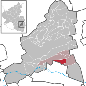
| Location of the local community Ruppertsberg in the Bad Dürkheim district | ||
  |
||

Ruppertsberg is a municipality in the Bad Dürkheim district in Rhineland-Palatinate , Germany . It belongs to the Deidesheim community , within which it is the second smallest local community in terms of population.
geography
The municipality is located in the Weinstrasse region and is part of the Rhine-Neckar metropolitan region . The west of the district protrudes into the Haardt , as the eastern part of the Palatinate Forest is called. The 337 meter high Rehberg and the 333 meter high Hartenberg extend in this area . Neighboring communities are - clockwise - Deidesheim , Meckenheim and Neustadt an der Weinstrasse . In the northeast, the Marlach largely forms the boundary with Deidesheim.
history
Ruppertsberg was first mentioned in a document in 1040. It probably developed out of the Hoheburg from 800 onwards . During the time of the tribal duchies, the place belonged to the Duchy of Franconia . Around 1100 the last Count of Kraichgau gave the place to the Speyer Monastery , which gave it as a fief to the Knights of Ruppertsberg. In the 14th century imperial troops destroyed the castle, whereupon the knights built a moated castle, the so-called castle, in the northeast of the village. From 1541 the eastern part of the community, the Niedergericht, was temporarily owned by von Dalberg . After the destruction of the Thirty Years' War , only two families lived in Ruppertsberg. Until the end of the 18th century, Ruppertsberg belonged to the Speyer monastery and was there under the Deidesheim office .
In the course of the First Coalition War , a battle took place on site. In the period that followed, French revolutionary troops occupied the region and annexed it after the Peace of Campo Formio (1797) . As a result, Ruppertsberg became part of the French Republic in 1798 and, from 1804, of the Napoleonic Empire . During this time, the place was assigned to the canton of Neustadt in the Département du Mont-Tonnerre and had its own Mairie . In 1815 the community had 780 inhabitants.
Due to the agreements reached at the Congress of Vienna (1815) and an exchange contract with Austria , the region became part of the Kingdom of Bavaria in 1816 . From 1818 the community of Ruppertsberg belonged to the Landkommissariat Neustadt in the Bavarian Rhine District ; The Neustadt district office emerged from the former in 1862 .
From 1939 the place was part of the district of Neustadt . After the Second World War , the place became part of the then newly formed state of Rhineland-Palatinate within the French occupation zone . In the course of the first administrative reform in Rhineland-Palatinate , Ruppertsberg moved to the newly created Bad Dürkheim district in 1969 . Three years later, the community became part of the also newly formed Deidesheim Association .
religion
Until 2015, on the Catholic side, the place formed the parish of St. Martin , before this became part of the newly created parish of St. Michael with its seat in Deidesheim on January 1, 2016 . At the end of 2017, 53.5 percent of the population were Catholic and 25.3 percent were non-denominational. 19.3 percent were Protestant and 1.9 percent belonged to another religion.
politics
Municipal council
The local council in Ruppertsberg consists of 16 council members, who were elected in a personalized proportional representation in the local elections on May 26, 2019 , and the honorary local mayor as chairman.
The distribution of seats in the municipal council:
| choice | SPD | CDU | FWG | total |
|---|---|---|---|---|
| 2019 | 1 | 7th | 8th | 16 seats |
| 2014 | 2 | 9 | 5 | 16 seats |
| 2009 | 2 | 9 | 5 | 16 seats |
| 2004 | 1 | 8th | 7th | 16 seats |
- FWG = Free Voter Group Ruppertsberg e. V.
mayor
The local mayor of Ruppertsberg is Heiner Weisbrodt. In the local election on May 26, 2019, he was elected with 58.64 percent of the vote. His predecessor Ursula Knoll (CDU) had not previously run for office again.
coat of arms
|
|
Blazon : "In gold, a black tower built in the corners with four battlements over a black wall with a battlement each on the right and left and with an open pointed gate, in which a green-stemmed blue grape in gold."
It was approved by the Mainz Interior Ministry in 1955 . |
Partnerships
Ruppertsberg maintains partnerships with Courpière in France and Höchstädt an der Donau .
Culture and sights


Buildings
The castle , the cemetery and the local Raiffeisenstrasse are designated as monument zones. The first is a moated castle that was expanded into a castle in the 18th century under Damian Hugo von Schönborn and was located on the northeast side of the town. Two of the original four wings have been preserved from her. The castle character has largely been lost due to later renovations.
There are also numerous individual monuments, including the following objects:
The Catholic parish church of St. Martin is a three-aisled late Gothic building from the early 16th century. The stone pulpit, created around 1510 with its depictions of saints and prophets, is particularly worth seeing.
The former tea house is the landmark of Ruppertsberg. It was built in 1844 a few hundred meters west of the village in the vineyards based on the model in the English Garden in Munich . The former tea house is a large square pavilion with a glazed upper floor. On November 4, 2014, it was badly damaged in a fire. On May 16, 2017, 17 experts founded the “Teehaus Ruppertsberg” association for the reconstruction with the task of preserving the tea pavilion in accordance with the listed building standards and filling it with life again.
The Catholic pilgrimage chapel of the Holy Fourteen Holy Helpers , which is also often referred to as the Klaus chapel , is located on the border with the Königsbach district . The leading there, lying on Königsbacher page pilgrimage with Stations of the Cross leads from the local parish church through the woods to the chapel.
See also: List of cultural monuments in Ruppertsberg
nature
The Marlachwiesen nature reserve is partially within the Ruppertsberg district.
Regular events
The Ruppertsberger Weinkerwe takes place every year on the last weekend in August. On Sunday of this weekend, it coincides with the German Wine Route Adventure Day .
Concerts are held throughout the year under the “Kulturtage Ruppertsberg” series of events.
Economy and Infrastructure
economy
Ruppertsberg is a wine-growing community with a long winemaking tradition ; Accordingly, the community is significantly influenced by viticulture and belongs to the Palatinate wine-growing region . The vineyards are Linsenbusch , Hoheburg , Gaisböhl , Nußbien , Spieß and Reiterpfad . In addition to the Ruppertsberg wineries, these are from the Christmann winery in Neustadt an der Weinstrasse , from the Dr. from Bassermann-Jordan in Deidesheim, from the Deidesheim winegrowers' association and from the Dr. Bürklin-Wolf in Wachenheim an der Weinstrasse .
traffic
The nearby Deidesheim train station on the Palatinate Northern Railway , which opened in 1865 and 1873, enables rail connections to Bad Dürkheim and Neustadt an der Weinstrasse . In the course of the planning, it was discussed whether the railway line should run west or east of the settlement area. Although it runs right through the west of the district, the community never had its own stop due to the small spatial distance to the Deidesheim train station. There are also bus routes to the surrounding towns; line 580 leads to Ludwigshafen am Rhein . Ruppertsberg is part of the tariff area of the Rhein-Neckar transport association .
District road 10 runs through Ruppertsberg . Bundesstrasse 271 runs east of the village . In the southeast there is a connection to the federal motorway 65 via the Deidesheim driveway.
Personalities
Sons and daughters of the church
- Eduard Nortz (1868–1939), politician (BBB)
- Edmund Bien (1927–2007), Bundesliga referee
- Franz-Georg Rössler (1949–2017), teacher, composer and Esperantist
People who worked on site
- Georg Dietrich von Sobbe (1747–1823), Prussian major general, took part in the battle near Ruppertsberg in 1792
- Johann Kaspar Adolay (1771–1853), politician, died on site
- August Hiller von Gaertringen (1772-1856), Prussian infantry general, took part in the battle near Ruppertsberg in 1792
- Christine Veth (* 1986), soccer player, played for TV Ruppertsberg in her youth
literature
- Literature about Ruppertsberg in the Rhineland-Palatinate state bibliography
Web links
- Weather station Ruppertsberg
- Ursula Knoll, former local mayor: Internet presence of the local community Ruppertsberg.
- Ursula Knoll, former mayor: private page about Ruppertsberg.
- Hans Jürgen Holle: Ruppertsberg Culture Days. Cultural Association Ruppertsberg i. G.
Individual evidence
- ↑ State Statistical Office of Rhineland-Palatinate - population status 2019, districts, communities, association communities ( help on this ).
- ↑ Municipal statistics EWOISneu, as of December 31, 2017.
- ^ The Regional Returning Officer Rhineland-Palatinate: Local elections 2019, city and municipal council elections
- ^ The Regional Returning Officer Rhineland-Palatinate: Local elections 2019, election of the honorary local and city mayors
- ^ Karl Heinz Debus: The great book of arms of the Palatinate . Neustadt an der Weinstrasse 1988, ISBN 3-9801574-2-3
- ^ Georg Peter Karn, Rolf Mertzenich: Bad Dürkheim district. City of Bad Dürkheim, municipality of Haßloch, municipalities of Deidesheim, Lambrecht, Wachenheim (= cultural monuments in Rhineland-Palatinate. Monument topography of the Federal Republic of Germany . Volume 13.1 ). Wernersche Verlagsgesellschaft, Worms 1995, ISBN 3-88462-119-X , p. 240 .
- ^ Fire in the historic tea house in Ruppertsberg. Morgenweb.de (Mannheimer Morgen), November 4, 2014, accessed on February 22, 2015 .
- ↑ Friends of the “Teehaus Ruppertsberg”. Retrieved August 14, 2017 .
- ↑ New life for the pleasure house. Bad Dürkheim district administration (DÜW Journal), page 23, August 1, 2017, accessed on May 24, 2020 .
- ↑ "Ruppertsberg Culture Days"

Altleiningen | Bad Dürkheim | Battenberg (Palatinate) | Bissersheim | Bobenheim am Berg | Bockenheim an der Weinstrasse | Carlsberg | Dackenheim | Deidesheim | Dirmstein | Ebertsheim | Ellerstadt | Elmstein | Erpolzheim | Esthal | Forest on the Wine Route | Frankeneck | Freinsheim | Friedelsheim | Gerolsheim | Gönnheim | Grosskarlbach | Grünstadt | Hassloch | Herxheim am Berg | Hettenleidelheim | Kallstadt | Children's home | Kirchheim an der Weinstrasse | Kleinkarlbach | Lambrecht (Palatinate) | Laumersheim | Lindenberg | Meckenheim | Mertesheim | Neidenfels | Neuleiningen | Niederkirchen near Deidesheim | Obersülzen | Obrigheim (Palatinate) | Quirnheim | Ruppertsberg | Tiefenthal | Wachenheim an der Weinstrasse | Wattenheim | Weidenthal | Weisenheim am Berg | Weisenheim am Sand