Lesson
|
Lesson
City of Erkelenz
Coordinates: 51 ° 4 ′ 49 ″ N , 6 ° 23 ′ 45 ″ E
|
|
|---|---|
| Height : | approx. 75 m |
| Residents : | 45 (Jun 30, 2020) |
| Postal code : | 41812 |
| Area code : | 02164 |
|
Location of Unterwestrich in the Rhenish lignite district
|
|
Unterwestrich is a small, rural district of Erkelenz in the Heinsberg district in North Rhine-Westphalia . The Zourshof also belongs to Unterwestrich . Unterwestrich is located in the mining area of the Garzweiler II opencast mine , which is why the place is to be dredged in the near future and therefore relocated. Under the motto "Human rights before mining rights", residents of the Erkelenz villages Keyenberg, Kuckum, Berverath and Ober- and Unterwestrich have announced legal resistance to their expropriation by RWE.
geography
Unterwestrich lies on the edge of the Erkelenzer Börde . In addition, the headwaters of the Niers are located near Unterwestrich .
location
Kuckum is located north of Unterwestrich , Keyenberg to the east, Oberwestrich to the south-east, Berverath to the south-west and Kaulhausen to the west . With the exception of Kaulhausen, all of these villages are located in the mining area of the Garzweiler II opencast mine .
Waters
The Niers runs parallel to the street village in the north.
history
In 1377 a free aristocratic court, the Hoyve tot Westrich, was first named. The Benedictine Abbey of Gladbach owned interest goods in Westrich from 1285 to 1794. The Kreuzherrenkloster von Wickrath had a hereditary lease, which was leased to the hereditary tenants. The Zourshof was the seat of the Knights of Zours in the Middle Ages .
Unterwestrich belonged to the neighboring town of Keyenberg in the Middle Ages and in the early modern period . During the French period from 1794 to 1814 Westrich belonged to the Mairie Kuckum and from 1816 to 1935 to the Mayor of Keyenberg. In 1935 this mayor's office was dissolved and incorporated into the Holzweiler office. On January 1, 1972, Unterwestrich came to the city of Erkelenz.
Place name
In 1285 the place Westrich was first mentioned in a document. The name can be derived from the two Old High German words westar (= west) and richi (= empire, region) and refers to the neighboring town of Kuckum.
religion
The majority of the population is Catholic. Unterwestrich has always been a branch of the Parish Keyenberg. There is no chapel. After the dissolution and amalgamation of the parish of Keyenberg to the parish of St. Maria and Elisabeth Erkelenz, Unterwestrich is now also part of this large parish.
traffic
Street
The A 61 runs east of Unterwestrich and the next junction is at Mönchengladbach-Wanlo . The L 354 runs through the village.
rail
The nearest train station is in Mönchengladbach-Herrath , about 4 kilometers northwest of Unterwestrich.
bus
Unterwestrich is served by the EK 1 bus line (Erkelenz – Keyenberg). The connections to Mönchengladbach , Cologne and Aachen are therefore good.
Attractions
- Zourshof (private property)
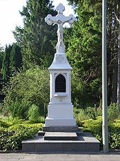
- Crossroads of cast iron with a Madonna. The cross comes from the Glimbach cemetery and was erected at the Zourshof around 1920.
- Neo-Gothic crossroads
Individual evidence
- ↑ Update of the population on June 30, 2020 (PDF). In: Website of the city of Erkelenz. Retrieved July 15, 2020 .
- ↑ https://rp-online.de/nrw/staedte/erkelenz/garzweiler-anwohner-kuendigen-juristische- resistance-gegen-rwe-tagebau-an_aid- 46192017
- ^ Federal Statistical Office (ed.): Historical municipality directory for the Federal Republic of Germany. Name, border and key number changes in municipalities, counties and administrative districts from May 27, 1970 to December 31, 1982 . W. Kohlhammer, Stuttgart / Mainz 1983, ISBN 3-17-003263-1 , p. 307 .
literature
- Karl L. Mackes, Erkelenzer Börde and Niersquellgebiet , series of publications of the city of Erkelenz No. 6, Mönchengladbach 1985


