
Weihenzell
| coat of arms | Germany map | |
|---|---|---|

|
Coordinates: 49 ° 21 ' N , 10 ° 38' E |
|
| Basic data | ||
| State : | Bavaria | |
| Administrative region : | Middle Franconia | |
| County : | Ansbach | |
| Management Community : | Weihenzell | |
| Height : | 387 m above sea level NHN | |
| Area : | 45.23 km 2 | |
| Residents: | 2898 (Dec. 31, 2019) | |
| Population density : | 64 inhabitants per km 2 | |
| Postal code : | 91629 | |
| Primaries : | 09802, 0981, 09824, 09828 | |
| License plate : | AN , DKB, FEU, ROT | |
| Community key : | 09 5 71 217 | |
| Community structure: | 22 parts of the community | |
| Address of the municipal administration: |
Ansbacher Str. 15 91629 Weihenzell |
|
| Website : | ||
| Mayor : | Gerhard Kraft ( CSU ) | |
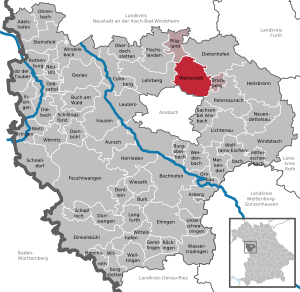
| Location of the community Weihenzell in the district of Ansbach | ||
  |
||

Weihenzell (colloquially: Wai ə tsél ) is a municipality in the Central Franconian district of Ansbach and the seat of the Weihenzell administrative community .
geography
Geographical location
The community is located seven kilometers northeast of Ansbach in the Frankenhöhe Nature Park .
Community structure
The municipality has 22 officially named municipal parts (the type of settlement is given in brackets ):
|
|
|
In the municipal area who was Aimershof that probably for during the Thirty Years War deserted village has become.
Neighboring communities
Neighboring communities are (clockwise from the north): Rügland , Dietenhofen , Bruckberg , Petersaurach , Ansbach and Lehrberg .
climate

Diagram of precipitation mean values Weihenzell for the period from 1961 to 1990


In Weihenzell, the average annual rainfall is 687 mm.
history

.jpg)
The place was first mentioned by name as "Celle" in a feudal deed of Bishop Manegold zu Würzburg from March 29, 1299. A cell is a farm yard of a monastery. In the case of Weihenzell, it was St. Gumbertus Monastery that founded the place. Due to the distance to the monastery, this will not have happened in the early period (8th / 9th centuries), but it must have taken place before 1012, as the monastery was converted into a canon in that year. It was not mentioned until 1307/08 with the addition of Wigencelle . The place name probably contains the personal name Wigo . According to E. Fechter, a derivation of mhd. Wîh (= "holy") is also possible.
According to the 16-point report of the Ansbach Regional Office from 1684, Weihenzell formed a community with cell rugs and garlic mill . In Weihenzell 21 teams are recorded: The four farms, twelve estates, three estates and two houses were subordinate to the Hofkastenamt Ansbach , whereby seven estates had to be handed over to the Stiftsamt Ansbach . The community owned a school house, a shepherd's house, a shepherd's house, a fishing water and 254 acres of wood. There was also a parish church and a rectory. The high court and the village and community authority exercised the Brandenburg-Ansbachische Hofkastenamt Ansbach.
At the end of the 18th century there were 26 properties in Weihenzell. The court box office in Ansbach continued to exercise the high court and the village and community rule. All properties had the Principality of Ansbach (Hofkastenamt Ansbach: 25, Stiftsamt Ansbach: 1) as the landlord . In addition to the households, there were the following ecclesiastical and communal buildings: church, rectory, schoolhouse, shepherd's house, sheep house and crushing house . The district forester's house was a stately building. At that time there were 24 subject families.
In 1792 Prussia acquired the Principality of Ansbach, which means that Weihenzell was also under Prussian administration. From 1797 to 1808 the place was under the judiciary and chamber office of Ansbach .
As part of the principality, Weihenzell fell to Bavaria through an exchange in the Treaty of Paris (February 1806) . As part of the municipal edict, the Weihenzell tax district was formed in 1808 , to which Adelmannsdorf , Beutellohe , Höfen , Neumühle , Papiermühle , Steinmühle , Thierbach and Zellrüglingen belonged. The rural community Weihenzell was founded in 1811 and was congruent with the tax district. It was subordinate to the Ansbach Regional Court in administration and jurisdiction and to the Ansbach Rent Office ( renamed Ansbach Tax Office in 1920 ). With the second community edict (1818) Gebersdorf was surrounded by Katterbach and Grüb and Wippendorf from Hennenbach to Weihenzell. In the following period the rural community Weihenzell split up:
- April 8, 1830: formation of the rural community Grüb with Gebersdorf and Wippendorf;
- July 27, 1830: Adelmannsdorf and Höfen are reorganized into the newly formed community of Haasgang .
Since then, only Beutellohe, Neumühle, Papiermühle, Steinmühle, Thierbach and Zellrüglingen belonged to the rural community of Weihenzell. From 1862 on, Weihenzell was administered by the Ansbach District Office (renamed the Ansbach District in 1938 ). The jurisdiction remained with the district court of Ansbach until 1870, 1870-1879 city and district court Ansbach , since 1880 district court Ansbach . In 1885 the municipality had an area of 11.413 km².
An important decision was made in 1859: the Ansbach – Gunzenhausen railway line will not be extended to Weihenzell; so the industrial development passed the village. During the Second World War, 60 people died as a result of the war; after 1945 mainly displaced persons from the Sudetengau were accepted. The population increased and more Catholics were registered.
Incorporations
| local community | Residents (1970) | Incorporation | Remarks |
|---|---|---|---|
| Forest | 246 | July 1, 1971 | |
| Grüb | 161 | 1st January 1974 | |
| Haasgang | 345 | July 1, 1972 | Incorporation of 212 of the 345 residents, reclassification of the other residents to Dietenhofen |
| Vestenberg | 547 | May 1, 1978 | Incorporation of 69 of the 547 residents, reclassification of the other residents to Petersaurach |
| Wernsbach near Ansbach | 315 | 1st January 1974 |
Population development
In the period from 1988 to 2018, the population increased from 2,135 to 2,948 by 813 inhabitants or by 38.1%.
Weihenzell community
| year | 1818 | 1840 | 1852 | 1861 | 1867 | 1871 | 1875 | 1880 | 1885 | 1890 | 1895 | 1900 | 1905 | 1910 | 1919 | 1925 | 1933 | 1939 | 1946 | 1950 | 1961 | 1970 | 1987 | 1995 | 2010 | 2017 | |
|---|---|---|---|---|---|---|---|---|---|---|---|---|---|---|---|---|---|---|---|---|---|---|---|---|---|---|---|
| Residents | 668 | 462 | 454 | 465 | 441 | 488 | 490 | 502 | 491 | 477 | 488 | 496 | 501 | 487 | 484 | 502 | 485 | 445 | 564 | 619 | 605 | 650 | 2095 | 2560 | 2847 | 2904 | |
| Houses | 120 | 80 | 87 | 93 | 98 | 98 | 89 | 114 | 552 | ||||||||||||||||||
| source |
Weihenzell municipality
| year | 1818 | 1840 | 1861 | 1871 | 1885 | 1900 | 1925 | 1950 | 1961 | 1970 | 1987 | 2017 |
|---|---|---|---|---|---|---|---|---|---|---|---|---|
| Residents | 237 | 240 | 278 * | 254 | 266 | 260 | 253 | 310 | 326 | 335 | 814 | 1341 |
| Houses | 31 | 42 | 47 | 50 | 50 | 46 | 62 | 223 | ||||
| source |
politics
Municipal council
The Weihenzell local council has 15 members including the mayor Gerhard Kraft, CSU / Free Voters Community.
| election day | CSU | FW Weihenzell | FWG surrounding area | total |
| March 16, 2014 | 4th | 7th | 3 | 14th |
| March 2, 2008 | - | 9 | 5 | 14th |
| March 3, 2002 | 7th | 4th | 3 | 14th |
(As of: local elections on March 16, 2014 )
badges and flags
Weihenzell has had its own coat of arms since 1985.
|
|
Blazon : "In silver on a green three-mountain , which is covered with a silver wave tip, a green clover plant with five leaves , the stem covered with a blue shield, inside a golden heraldic lily ."
Blue-white-green municipal flag |
| Founding of the coat of arms: The Weihenzell community has consisted of the formerly independent communities of Forst, Grub, Haasgang, Wernsbach and Weihenzell since 1971. The clover with five leaves represents these five places and at the same time symbolizes the agricultural structure of the municipality. The lily points to the Gumbertuskloster in Ansbach, which is considered to be the founder of Weihenzell. The wave peak represents a healing spring in the municipality, which attracted many people in the 17th century. |
Community partnerships
-
 Saint-Laurent-sur-Gorre in the Nouvelle-Aquitaine region , since 1986
Others
Weihenzell is part of the communal northern alliance NorA , which was founded in 2004 and which also includes the political communities Flachslanden, Lehrberg, Oberdachstetten and Rügland.
Culture and sights
Architectural monuments
Natural monuments
- Oak near Petersdorf with a chest height of 8.30 m (2015).
Regular events
Fair every year is celebrated on Jakobi Sunday (4th Sunday in July).
traffic
The district road AN 10 leads to Wernsbach or Frankendorf . The district road AN 9 / district road ANs 2 leads past Grüb to Ansbach or to Zellrüglingen . Communal roads lead to Wippendorf and Petersdorf . The Franconian Marienweg runs through Weihenzell .
Telephone prefixes
The main area code used is 09802. The 0981 is valid in Schönbronn and Wernsbach near Ansbach, the 09824 in Beutellohe, Petersdorf and Thierbach and the 09828 in Haasgang, Moratneustetten and Neubronn.
literature
- Johann Kaspar Bundschuh : Weihenzell . In: Geographical Statistical-Topographical Lexicon of Franconia . tape 6 : V-Z . Verlag der Stettinische Buchhandlung, Ulm 1804, DNB 790364328 , OCLC 833753116 , Sp. 124 ( digitized version ).
- Elisabeth Fechter: The place names of the district of Ansbach . Inaugural dissertation. Erlangen 1955, DNB 480570132 , p. 195-197 .
- Günther P. Fehring : City and district of Ansbach (= Bavarian art monuments . Volume 2 ). Deutscher Kunstverlag, Munich 1958, DNB 451224701 , p. 150-151 .
- Manfred Jehle: Ansbach: the margravial chief offices Ansbach, Colmberg-Leutershausen, Windsbach, the Nuremberg nursing office Lichtenau and the Deutschordensamt (Wolframs-) Eschenbach (= historical atlas of Bavaria, part Franconia . I, 35). tape 2 . Commission for Bavarian State History, Munich 2009, ISBN 978-3-7696-6856-8 , p. 925, 1014 .
- Karl Heinrich von Lang , Heinrich Christoph Büttner , Julius W. Schulz: Landgericht Ansbach (= historical and statistical description of the Rezatkreis . Issue 1). Johann Lorenz Schmidmer, Nuremberg 1809, p. 33 ( digitized version ).
- Wolf-Armin von Reitzenstein : Lexicon of Franconian place names. Origin and meaning . Upper Franconia, Middle Franconia, Lower Franconia. CH Beck, Munich 2009, ISBN 978-3-406-59131-0 , p. 236 .
- Günther Roesner: Weihenzell. History and present of a Middle Franconian village . 2nd, revised edition. Ansbach 1999, p. 146-147 (first edition: 1985).
- Konrad Rosenhauer et al. (Ed.): The district of Ansbach. Past and present . Publishing house for authorities and business Hoeppner, Aßling-Pörsdorf 1964, DNB 450093387 , p. 205-206 .
- Gottfried Stieber: Weyhenzell . In: Historical and topographical news from the Principality of Brandenburg-Onolzbach . Johann Jacob Enderes, Schwabach 1761, p. 950-952 ( digitized version ).
Web links
- Map of the community Weihenzell on the BayernAtlas
- Weihenzell in the Topographia Franconiae of the University of Würzburg , accessed on September 16, 2019.
- Weihenzell: Official statistics of the LfStat
Individual evidence
- ↑ "Data 2" sheet, Statistical Report A1200C 202041 Population of the municipalities, districts and administrative districts 1st quarter 2020 (population based on the 2011 census) ( help ).
- ↑ E. Fechter, p. 195.
- ↑ Weihenzell community in the local database of the Bavarian State Library Online . Bavarian State Library, accessed on September 16, 2019.
- ↑ W.-A. v. Reitzenstein, p. 236. There is also a document for the year 1208, which, however, cannot be reliably assigned to this place.
- ↑ Georg Rusam: Basics and beginnings of church organization at the middle Rezat . In: Journal for Bavarian Church History . tape 17 . Verlag die Egge, Nuremberg 1949, p. 91 ( digitized version ).
- ^ Ernst Förstemann : Old German name book . 1st edition. First volume: personal names . Published by Ferdinand Förstemann, Nordhausen 1856, Sp. 1292 ( digitized version ).
- ↑ E. Fechter, p. 195.
- ↑ Staatsarchiv Nürnberg , Ansbacher Salbuch 129, 3775. Quoted from M. Jehle, Vol. 2, p. 694.
- ↑ M. Jehle, Vol. 2, p. 901.
- ^ Johann Bernhard Fischer : Weihenzell . In: Statistical and topographical description of the Burggraftum Nürnberg, below the mountain, or the Principality of Brandenburg-Anspach. Second part. Containing the economic, statistical and moral condition of these countries according to the fifteen upper offices . Benedict Friedrich Haueisen, Ansbach 1790, p. 28 ( digitized version ).
- ↑ JK Bundschuh, vol. 6, col. 124: “Evangelical-Lutheran parish village 2 hours from Ansbach with 24 subjects belonging to it. Here is a sizable paper mill. The Kappelberg, which is on this mark, contains a lot of gypsums. "
- ↑ State Archives Nuremberg , Government of Middle Franconia, Chamber of the Interior, 1952, 3850: Formation of the municipal and rural communities in the district court of Ansbach 1808–1817. Quoted from M. Jehle, Vol. 2, p. 961.
- ↑ M. Jehle, Vol. 2, pp. 947 f .; K. Rosenhauer, p. 11.
- ↑ M. Jehle, Vol. 2, p. 948; K. Rosenhauer, p. 11.
- ↑ M. Jehle, Vol. 2, p. 1014.
- ↑ a b c K. Bayer. Statistical Bureau (Ed.): Localities directory of the Kingdom of Bavaria. According to government districts, administrative districts, ... then with an alphabetical register of locations, including the property and the responsible administrative district for each location. LIV. Issue of the contributions to the statistics of the Kingdom of Bavaria. Munich 1888, Section III, Sp. 1092 ( digitized version ).
- ↑ a b Wilhelm Volkert (Ed.): Handbook of the Bavarian offices, communities and courts 1799–1980 . CH Beck, Munich 1983, ISBN 3-406-09669-7 , p. 421 .
- ↑ a b c Federal Statistical Office (ed.): Historical municipality directory for the Federal Republic of Germany. Name, border and key number changes in municipalities, counties and administrative districts from May 27, 1970 to December 31, 1982 . W. Kohlhammer, Stuttgart / Mainz 1983, ISBN 3-17-003263-1 , p. 706 f .
- ↑ a b Only inhabited houses are given. In 1818 these were designated as fireplaces , in 1840 as houses and from 1871 to 1987 as residential buildings.
- ↑ a b Alphabetical index of all the localities contained in the Rezatkreise according to its constitution by the newest organization: with indication of a. the tax districts, b. Judicial Districts, c. Rent offices in which they are located, then several other statistical notes . Ansbach 1818, p. 103 ( digitized version ). For the community Weihenzell plus the residents and buildings of Adelmannsdorf (p. 3), Beutellohe (p. 9), Gebersdorf (p. 29), Grüb (p. 33), Höfen (p. 41), Neumühle (p. 63 ), Papiermühle (p. 71), Steinmühle (p. 89), Thierbach (p. 91), Wippendorf (p. 104) and Zellrüglingen (p. 106).
- ^ A b Eduard Vetter (Ed.): Statistical handbook and address book of Middle Franconia in the Kingdom of Bavaria . Self-published, Ansbach 1846, p. 46-47 ( digitized version ).
- ↑ a b c d e f g h i j Bavarian State Statistical Office (Hrsg.): Historical municipality register: The population of the municipalities of Bavaria in the period from 1840 to 1952 (= contributions to Statistics Bavaria . Issue 192). Munich 1954, DNB 451478568 , p. 165 , urn : nbn: de: bvb: 12-bsb00066439-3 ( digitized version ).
- ↑ a b Joseph Heyberger, Chr. Schmitt, v. Wachter: Topographical-statistical manual of the Kingdom of Bavaria with an alphabetical local dictionary . In: K. Bayer. Statistical Bureau (Ed.): Bavaria. Regional and folklore of the Kingdom of Bavaria . tape 5 . Literary and artistic establishment of the JG Cotta'schen Buchhandlung, Munich 1867, Sp. 986 , urn : nbn: de: bvb: 12-bsb10374496-4 ( digitized version ).
- ↑ Kgl. Statistisches Bureau (Ed.): Directory of the municipalities of the Kingdom of Bavaria according to the status of the population in December 1867 . XXI. Issue of the contributions to the statistics of the Kingdom of Bavaria. Ackermann, Munich 1869, p. 152 ( digitized version ).
- ↑ a b Kgl. Statistical Bureau (ed.): Complete list of localities of the Kingdom of Bavaria. According to districts, administrative districts, court districts and municipalities, including parish, school and post office affiliation ... with an alphabetical general register containing the population according to the results of the census of December 1, 1875 . Adolf Ackermann, Munich 1877, 2nd section (population figures from 1871, cattle figures from 1873), Sp. 1152 , urn : nbn: de: bvb: 12-bsb00052489-4 ( digitized version ).
- ↑ K. Bayer. Statistical Bureau (ed.): Community directory for the Kingdom of Bavaria. Manufactured due to the new organization of government districts, district offices and judicial districts. Addendum to issue 36 of the articles on Bavaria's statistics. Munich 1879, p. 60 ( digitized version ).
- ↑ K. Bayer. Statistical Bureau (ed.): Community directory for the Kingdom of Bavaria. Results of the census of December 1, 1880. Issue 35 of the articles on Bavaria's statistics. Munich 1882, p. 172 ( digitized version ).
- ↑ a b K. Bayer. Statistical Bureau (Ed.): Directory of localities of the Kingdom of Bavaria, with alphabetical register of places . LXV. Issue of the contributions to the statistics of the Kingdom of Bavaria. Munich 1904, Section II, Sp. 1157 ( digitized version ).
- ↑ a b Bavarian State Statistical Office (ed.): Localities directory for the Free State of Bavaria according to the census of June 16, 1925 and the territorial status of January 1, 1928 . Issue 109 of the articles on Bavaria's statistics. Munich 1928, Section II, Sp. 1194 ( digitized version ).
- ↑ a b Bavarian State Statistical Office (ed.): Official place directory for Bavaria - edited on the basis of the census of September 13, 1950 . Issue 169 of the articles on Bavaria's statistics. Munich 1952, DNB 453660975 , Section II, Sp. 1031-1032 ( digitized version ).
- ↑ a b Bavarian State Statistical Office (ed.): Official city directory for Bavaria, territorial status on October 1, 1964 with statistical information from the 1961 census . Issue 260 of the articles on Bavaria's statistics. Munich 1964, DNB 453660959 , Section II, Sp. 759 ( digitized version ).
- ↑ a b Bavarian State Statistical Office (Hrsg.): Official local directory for Bavaria . Issue 335 of the articles on Bavaria's statistics. Munich 1973, DNB 740801384 , p. 172 ( digitized version ).
- ↑ a b Bavarian State Office for Statistics and Data Processing (Ed.): Official local directory for Bavaria, territorial status: May 25, 1987 . Issue 450 of the articles on Bavaria's statistics. Munich November 1991, DNB 94240937X , p. 332 ( digitized version ).
- ^ Weihenzell: Official statistics of the LfStat
- ↑ a b www.weihenzell.de
- ^ Municipal statistics 2013. A selection of important statistical data for the Weihenzell community. (PDF, 1.58) Bavarian State Office for Statistics and Data Processing, July 1, 2014, p. 9 , accessed on December 23, 2014 .
- ^ Entry on Weihenzell's coat of arms in the database of the House of Bavarian History
- ↑ Weihenzell. In: Kommunalflaggen.eu. Retrieved February 11, 2020 .
- ↑ http://www.nora-gemeinden.de/ www.nora-gemeinden.de
- ^ Entry in the directory of monumental oaks . Retrieved January 10, 2017

Adelshofen | Arberg | Aurach | Bechhofen | Bruckberg | Book at the forest | Burgoberbach | Burk | Colmberg | Dentlein am Forst | Diebach | Dietenhofen | Dinkelsbühl | Dombühl | Dürrwangen | Ehingen | Feuchtwangen | Flachslanden | Gebsattel | Gerolfingen | Geslau | Heilsbronn | Herrieden | Insingen | Langfurth | Lehrberg | Leutershausen | Lichtenau | Merkendorf | Mitteleschenbach | Mönchsroth | Neuendettelsau | Neusitz | Oberdachstetten | Ohrbach | Ornbau | Petersaurach | Röckingen | Rothenburg ob der Tauber | Rügland | Saxony near Ansbach | Schillingsfürst | Schnelldorf | Schopfloch | Steinsfeld | Unterschwaningen | Wassertrüdingen | Weidenbach | Weihenzell | Weiltingen | Wettringen | Wieseth | Wilburgstetten | Windelsbach | Windsbach | Wittelshofen | Wolframs-Eschenbach | Wörnitz
Unregulated areas:
Lower Forest