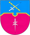
Zarychanka
| Zarychanka | ||
| Аричанка | ||

|
|
|
| Basic data | ||
|---|---|---|
| Oblast : | Dnepropetrovsk Oblast | |
| Rajon : | Zarychanka district | |
| Height : | 73 m | |
| Area : | 10.85 km² | |
| Residents : | 7,515 (2016) | |
| Population density : | 693 inhabitants per km² | |
| Postcodes : | 51000 | |
| Area code : | +380 5690 | |
| Geographic location : | 48 ° 57 ' N , 34 ° 29' E | |
| KOATUU : | 1225655100 | |
| Administrative structure : | 1 urban-type settlement , 22 villages | |
| Address: | вул. 14-ї Гвардійської дивізії 10 51000 смт. Аричанка |
|
| Website : | http://carichanka.at.ua/ | |
| Statistical information | ||
|
|
||
Zarychanka ( Ukrainian Царичанка ; Russian Царичанка Zarichanka ) is an urban-type settlement in the Ukrainian Oblast of Dnipropetrovsk with about 7500 inhabitants (2016).
The settlement of Zarychanka in the north of the oblast was founded in the 17th century and has been an urban-type settlement since 1957. Between 1784 and 1797 the city was called Alexopol . Zarychanka is located about 65 kilometers northwest of Dnipro on the banks of the Oril . The Zarychanka settlement community ( Царичанська селищна громада ), which covers an area of 453.5 km², includes the following villages:
- Babaikiwka ( Бабайківка ),
- Drahivka ( Драгівка )
- Dubowe ( Дубове )
- Hnativka ( Гнатівка )
- Ivano-Jarysiwka ( Івано-Яризівка )
- Jurivka ( Юр'ївка )
- Kalyniwka ( Калинівка )
- Kuschtschiwka ( Кущівка )
- Lyskivka ( Лисківка )
- Mykhailivka ( Михайлівка )
- Nenadivka ( Ненадівка )
- Novostroiiwka ( Новостроївка )
- Preobrashenka ( Преображенка )
- Prjadivka ( Прядівка )
- Pylypivka ( Пилипівка )
- Saorillja ( Заорілля )
- Seljaniwka ( Селянівка )
- Semenivka ( Семенівка )
- Tarasivka ( Тарасівка )
- Chervona Orilka ( Червона Орілька )
- Turowe ( Турове ),
- Werbowe ( Вербове )
population
| 1959 | 1970 | 1979 | 1989 | 2001 | 2016 |
|---|---|---|---|---|---|
| 5,655 | 6,190 | 7,403 | 8,584 | 7,933 | 7,515 |
Source:
Rajon
The Zarychanka district, administered from Zarychanka, is located in the north of the Dnipropetrovsk Oblast and borders on the Poltava Oblast in the west . It has an area of 903 km² and a population of 27,671 (2012). The population density is 31 inhabitants per km².
Individual evidence
- ↑ a b Demography of Ukrainian cities on pop-stat.mashke.org
- ↑ history Zarytschanka in the history of the towns and villages of the Ukrainian SSR ; accessed on November 22, 2017 (Ukrainian)


