
Oostduinkerke: Difference between revisions
m Reverted 1 edit by 65.129.155.10 (talk) to last revision by Wwikix. (TW) |
Thanabones (talk | contribs) Added links to websites, added some text, and added a category |
||
| (30 intermediate revisions by 21 users not shown) | |||
| Line 1: | Line 1: | ||
{{ |
{{More citations needed|date=March 2010}} |
||
{{Infobox settlement |
{{Infobox settlement |
||
| name = Oostduinkerke |
| name = Oostduinkerke |
||
| Line 14: | Line 14: | ||
| subdivision_type = Country |
| subdivision_type = Country |
||
| subdivision_name = [[Belgium]] |
| subdivision_name = [[Belgium]] |
||
| subdivision_type1 = [[Province]] |
| subdivision_type1 = [[Provinces of Belgium|Province]] |
||
| subdivision_name1 = {{Belgian province WVLA}} |
| subdivision_name1 = {{Belgian province WVLA}} |
||
| subdivision_type2 = [[Municipality]] |
| subdivision_type2 = [[Municipalities of Belgium|Municipality]] |
||
| subdivision_name2 = [[Koksijde]] |
| subdivision_name2 = [[Koksijde]] |
||
| coordinates = {{coord|51|07|13|N|2|40|43|E|type:city_region:BE|display=inline}} |
|||
| latd = 51 | latm = 07 | lats = 13 | latNS = N |
|||
| longd = 2 | longm = 40 | longs = 43 | longEW = E |
|||
| coordinates_type = type:city_region:BE |
|||
| elevation_m = |
| elevation_m = |
||
| area_total_km2 = |
| area_total_km2 = |
||
| Line 35: | Line 33: | ||
}} |
}} |
||
'''Oostduinkerke''' is a place in the [[Belgium|Belgian]] province of [[West Flanders]], where it is located on the southern west coast of Belgium |
'''Oostduinkerke''' ({{IPA-nl|ˌoːstˈdœy̯ŋkɛrkə}}; {{lang-fr|Ostdunkerque}} {{IPA-fr|ɔstdœ̃kɛʁk||}}; {{lang-vls|Ôostduunkerke}}) is a place in the [[Belgium|Belgian]] province of [[West Flanders]], where it is located on the southern west coast of Belgium. |
||
Once a municipality of its own, Oostduinkerke now is a sub-municipality in the municipality of [[Koksijde]]. |
Once a municipality of its own, Oostduinkerke now is a sub-municipality in the municipality of [[Koksijde]]. |
||
The name "Oostduinkerke" translates as 'East Dunkirk'. The town originally shared its name with the [[ |
The name "Oostduinkerke" translates as 'East Dunkirk'. The town originally shared its name with the city of [[Dunkirk]] in current-day [[France]]; therefore, in the 13th century, 'Oost-' was added to its name to avoid confusion with its namesake further to the west. |
||
Oostduinkerke lies amidst a [[dune]] area (approximately 2.4 |
Oostduinkerke lies amidst a [[dune]] area (approximately 2.4 km<sup>2</sup>; 1 sq. mi.), which is now a protected nature reserve. |
||
Oostduinkerke's sandy beach stretches from 250 to 700 metres (270 to 800 yards) at ebb-tide and extends over 30 km (20 miles), via De Panne to the beach of [[Dunkirk]] (France), which explains why Oostduinkerke is popular with sand yachters and parakarters.{{citation needed|date=February 2022}} |
|||
==Shrimp fishing on horseback== |
==Shrimp fishing on horseback== |
||
<!-- linked from redirect [[Shrimp fishing on horseback in Oostduinkerke]] --> |
<!-- linked from redirect [[Shrimp fishing on horseback in Oostduinkerke]] --> |
||
[[File:Shrimpers on horseback.jpg|thumb|Oostduinkerke is the only place in the world where horseback shrimping is |
[[File:Shrimpers on horseback.jpg|thumb|Oostduinkerke is the only place in the world where horseback shrimping is practised.]] |
||
{{Expand section|date=December 2015}} |
{{Expand section|date=December 2015}} |
||
Oostduinkerke is known for its [[shrimp]]ers on horseback, a considerable tourist attraction. |
Oostduinkerke is known for its [[shrimp]]ers on horseback, a considerable tourist attraction. The practice was once common across the coastal areas of the [[North Sea]], but today it is only present in Oostduinkerke, where 17 fishers remain active as of 2021.<ref name="Dansby 2021">{{cite web | last=Dansby | first=Angela | title=Europe’s 500-year-old seafood tradition | website=BBC Travel | date=24 February 2021 | url=https://www.bbc.com/travel/article/20210224-europes-500-year-old-seafood-tradition | access-date=9 February 2022}}</ref> |
||
==Sights== |
==Sights== |
||
Oostduinkerke has several museums. The National Fishery Museum gives a historical survey of [[Flanders|Flemish]] [[fishery]] and shows among other things scale models of fishing boats from 800 AD up to the present, and an original fisherman's cottage. Other museums are: 'The Key and Lock Museum' (a unique historical survey of 3,000 years of keys and locks), a regional museum 't Krekelhof (a huge collection of craft objects and curiosities from the 19th century), and Florishof (old crafts and folkloristic objects). |
Oostduinkerke has several museums. The National Fishery Museum gives a historical survey of [[Flanders|Flemish]] [[fishery]] and shows among other things scale models of fishing boats from 800 AD up to the present, and an original fisherman's cottage. Other museums are: 'The Key and Lock Museum' (a unique historical survey of 3,000 years of keys and locks), a regional museum 't Krekelhof (The cricket court in [[Dutch language|Dutch]]) (a huge collection of craft objects and curiosities from the 19th century), and Florishof (old crafts and [[Folklore|folkloristic]] objects). |
||
Oostduinkerke is also home to Koksijde Golf ter Hille, a par-72 golf course. |
Oostduinkerke is also home to Koksijde Golf ter Hille, a par-72 golf course. |
||
| Line 63: | Line 61: | ||
File:Sand-Yachting-0016-7.web.JPG|Sand-Yachting on Oostduinkerke beach |
File:Sand-Yachting-0016-7.web.JPG|Sand-Yachting on Oostduinkerke beach |
||
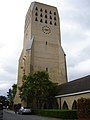
File:Oostduinkerke - Sint-Niklaaskerk 2.jpg|Sint-Niklaaskerk in Oostduinkerke |
File:Oostduinkerke - Sint-Niklaaskerk 2.jpg|Sint-Niklaaskerk in Oostduinkerke |
||
Cloned Paardenvisser by William Sweetlove (DSCF9833).jpg|Cloned Paardenvisser statue |
|||
Shrimp fishing Brabançon draft horse in Oostduinkerke (DSCF9699).jpg|[[Belgian Draught|Brabançon draft horse]] on the beach |
|||
</gallery> |
</gallery> |
||
==References== |
|||
{{Reflist}} |
|||
== External links == |
== External links == |
||
{{ |
{{commons category|Oostduinkerke}} |
||
*[http://www.visserijmuseum.be/ National Fishery Museum] |
*[https://web.archive.org/web/20040919064938/http://www.visserijmuseum.be/ National Fishery Museum] |
||
*[http://www.dekust.org/EN/visitor/resorts/ Map of the Flemish coast] |
*[http://www.dekust.org/EN/visitor/resorts/ Map of the Flemish coast] |
||
*[https://www.navigomuseum.be/en Website of the national fishing museum] |
|||
*[https://oostduinkerke.com/en/ Official website] |
|||
| ⚫ | |||
{{Authority control}} |
|||
{{coord|51|07|N|2|41|E|region:BE_type:city|display=title}} |
{{coord|51|07|N|2|41|E|region:BE_type:city|display=title}} |
||
| ⚫ | |||
[[Category:Populated places in West Flanders]] |
[[Category:Populated places in West Flanders]] |
||
[[Category:Populated places in Belgium]] |
|||
[[Category:Koksijde]] |
[[Category:Koksijde]] |
||
[[et:Wulpen]] |
[[et:Wulpen]] |
||
[[Category:Municipalities of West Flanders]] |
|||
Latest revision as of 20:00, 25 November 2023
This article needs additional citations for verification. (March 2010) |
Oostduinkerke | |
|---|---|
 Former townhall Oostduinkerke | |
 | |
| Coordinates: 51°07′13″N 2°40′43″E / 51.12028°N 2.67861°E | |
| Country | Belgium |
| Province | |
| Municipality | Koksijde |
| Population | |
| • Total | 8.534 |
| Source: NIS | |
| Postal code | 8670 |
Oostduinkerke (Dutch pronunciation: [ˌoːstˈdœy̯ŋkɛrkə]; French: Ostdunkerque [ɔstdœ̃kɛʁk]; West Flemish: Ôostduunkerke) is a place in the Belgian province of West Flanders, where it is located on the southern west coast of Belgium.
Once a municipality of its own, Oostduinkerke now is a sub-municipality in the municipality of Koksijde.
The name "Oostduinkerke" translates as 'East Dunkirk'. The town originally shared its name with the city of Dunkirk in current-day France; therefore, in the 13th century, 'Oost-' was added to its name to avoid confusion with its namesake further to the west.
Oostduinkerke lies amidst a dune area (approximately 2.4 km2; 1 sq. mi.), which is now a protected nature reserve.
Oostduinkerke's sandy beach stretches from 250 to 700 metres (270 to 800 yards) at ebb-tide and extends over 30 km (20 miles), via De Panne to the beach of Dunkirk (France), which explains why Oostduinkerke is popular with sand yachters and parakarters.[citation needed]
Shrimp fishing on horseback[edit]

This section needs expansion. You can help by adding to it. (December 2015) |
Oostduinkerke is known for its shrimpers on horseback, a considerable tourist attraction. The practice was once common across the coastal areas of the North Sea, but today it is only present in Oostduinkerke, where 17 fishers remain active as of 2021.[1]
Sights[edit]
Oostduinkerke has several museums. The National Fishery Museum gives a historical survey of Flemish fishery and shows among other things scale models of fishing boats from 800 AD up to the present, and an original fisherman's cottage. Other museums are: 'The Key and Lock Museum' (a unique historical survey of 3,000 years of keys and locks), a regional museum 't Krekelhof (The cricket court in Dutch) (a huge collection of craft objects and curiosities from the 19th century), and Florishof (old crafts and folkloristic objects).
Oostduinkerke is also home to Koksijde Golf ter Hille, a par-72 golf course.
The British Military Cemetery (1940–1945) bears witness to British sacrifices in the Battle of Dunkirk.
Images[edit]
-
 Oostduinkerke seaside apartments
 -
 Sand-Yachting on Oostduinkerke beach
 -
 Sint-Niklaaskerk in Oostduinkerke
 -
 Cloned Paardenvisser statue
 -
 Brabançon draft horse on the beach


.jpg)
.jpg)
References[edit]
- ^ Dansby, Angela (24 February 2021). "Europe's 500-year-old seafood tradition". BBC Travel. Retrieved 9 February 2022.
External links[edit]
- National Fishery Museum
- Map of the Flemish coast
- Website of the national fishing museum
- Official website
| Authority control databases: National |
|---|