Rose-Belle: Difference between revisions
Content deleted Content added
JJMC89 bot (talk | contribs) Migrate {{Infobox settlement}} coordinates parameters to {{Coord}}, see Wikipedia:Coordinates in infoboxes |
No edit summary |
||
| (7 intermediate revisions by 4 users not shown) | |||
| Line 1: | Line 1: | ||
{{Cleanup bare URLs|date=August 2022}} |
|||
{{Use dmy dates|date=October 2013}} |
{{Use dmy dates|date=October 2013}} |
||
{{Infobox settlement |
{{Infobox settlement |
||
| Line 168: | Line 169: | ||
<!-- population ----------------> |
<!-- population ----------------> |
||
| population_footnotes =<ref name="stats2012">{{cite journal|url=http://statsmauritius.gov.mu/English/Publications/Documents/Regular%20Reports/annual%20digest/annualdig12.pdf|publisher=Government of Mauritius|title=ANNUAL DIGEST OF STATISTICS 2012|page=22|author=Ministry of Finance & Economic Development|version=31 December|year=2012|accessdate=20 October 2013}}</ref> |
| population_footnotes =<ref name="stats2012">{{cite journal|url=http://statsmauritius.gov.mu/English/Publications/Documents/Regular%20Reports/annual%20digest/annualdig12.pdf|publisher=Government of Mauritius|title=ANNUAL DIGEST OF STATISTICS 2012|page=22|author=Ministry of Finance & Economic Development|version=31 December|year=2012|accessdate=20 October 2013}}</ref> |
||
| population_total = 12,799<ref>{{Cite web|title=Population of Rose Belle 2021 {{!}} Rose Belle population - statistics|url=https://population-hub.com/en/mu/population-of-rose-belle-11641.html|access-date=2021-03-14|website=Population HUB|language=en}}</ref> |
|||
| population_total = 12,619 |
|||
| population_as_of = |
| population_as_of = 2021 |
||
| population_rank = |
| population_rank = |
||
| population_density_km2 = <!-- for automatic calculation of any density field, use: auto --> |
| population_density_km2 = <!-- for automatic calculation of any density field, use: auto --> |
||
| Line 249: | Line 250: | ||
}} |
}} |
||
'''Rose-Belle''' is a |
'''Rose-Belle''' is a small town in southeastern [[Mauritius]]. |
||
== Location == |
|||
It is located in the [[Grand Port]] [[Districts of Mauritius|district]], ten kilometers west of the district's well known town of [[Mahébourg]]. The population of the town in 2021 was 12,799. Of the 20 cities in Mauritius, Rose Belle ranks 15th in terms of population. |
|||
==References== |
==References== |
||
Revision as of 10:29, 25 January 2024
Rose-Belle | |
|---|---|
Town | |
| Coordinates: 20°24′9″S 57°36′22″E / 20.40250°S 57.60611°E | |
| Country | |
| Districts | Grand Port |
| Government | |
| • Type | Municipality |
| Elevation | 270 m (890 ft) |
| Population (2021)[3] | |
| • Total | 12,799[1] |
| Time zone | UTC+4 (MUT) |
| ISO 3166 code | MU-CU |
| Climate | Af |
| Website | Municipal Council |
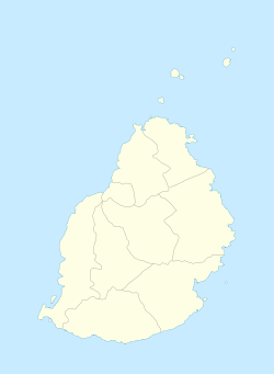
Rose-Belle is a small town in southeastern Mauritius.
Location
It is located in the Grand Port district, ten kilometers west of the district's well known town of Mahébourg. The population of the town in 2021 was 12,799. Of the 20 cities in Mauritius, Rose Belle ranks 15th in terms of population.
References
- ^ "Population of Rose Belle 2021 | Rose Belle population - statistics". Population HUB. Retrieved 14 March 2021.
- ^ http://localgovernment.gov.mu/English/Local%20Authorities/Pages/Municipal-and-District-Councils-in-Mauritius.aspx
- ^ Ministry of Finance & Economic Development (2012). "ANNUAL DIGEST OF STATISTICS 2012" (PDF). 31 December. Government of Mauritius: 22. Retrieved 20 October 2013.
{{cite journal}}: Cite journal requires|journal=(help)

