
Grand Port
Coordinates: 20 ° 25 ′ S , 57 ° 38 ′ E
| Grand Port District | |
|---|---|
.jpg) Grand Port (2011) |
|
| Basic data | |
| District capital: | Mahébourg |
| Area : | 260.3 km² |
| Residents : | 112997 (2015) |
| Population density : | 430 inhabitants / km² |
| ISO 3166-2 : | MU-GP |
| Time zone : | UTC + 4 |
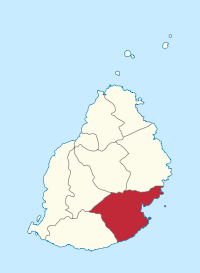
| Location in Mauritius | |
  |
|
Grand Port is a district of Mauritius that encompasses much of the south-eastern area of the island. Its district capital is Mahébourg , the former capital of Mauritius and the main city of the district. The island's airport is operated in Plaine Magnien , a town in the Grand Port district.
history
Grand Port is named after the settlement of the old Grand Port, which was the first Dutch landing site and the island's first port. Built by the Dutch and later taken over by the French, the city is a relic of the island's colonial past.
In 1810 the French navy defeated a British fleet here in the naval battle of Grand Port .
Communities
Mauritius is divided into villages ("Village Council Areas") (VCA) for administrative purposes. The following table lists the VCA that are (at least partially) located in the Grand Port district. The boundaries of the districts are not congruent with those of the municipalities. Municipalities are therefore sometimes assigned to two or three districts. There are 23 municipalities (VCA) in the Grand Port district.
| No. | Place name | Demarcation |
|---|---|---|
| 1501 | Bambous Virieux VCA | |
| 1502 | Bananes VCA | |
| 1503 | Grand Bel Air VCA | |
| 1504 | Bois des Amourettes VCA | |
| 1505 | Cluny VCA | |
| 1506 | Grand Sable VCA | |
| 1507 | L'Escalier VCA | West in the Savanne district |
| 1508 | Mahébourg VCA | |
| 1509 | Mare Chicose VCA | |
| 1510 | Mare d'Albert VCA | |
| 1511 | Mare Tabac VCA | |
| 1512 | New Grove VCA | |
| 1513 | Nouvelle France VCA | |
| 1514 | Old Grand Port VCA | |
| 1515 | Plaine Magnien VCA | |
| 1516 | Rivière des Créoles VCA | |
| 1517 | Rivière du Poste VCA | West in the Savanne district |
| 1518 | Rose Belle VCA | |
| 1519 | St. Hubert VCA | |
| 1520 | Trois Boutiques (Union Vale) VCA | |
| 1521 | Union Park VCA | |
| 1522 | Beau Vallon VCA | |
| 1523 | Petit Bel Air VCA |
topography
The northern part of the district is hilly with wooded valleys and rivers. The eastern part gradually rises to the main plateau and has a cool, temperate climate suitable for tea plantations. The southern part is a flat plain on the territory of which the international airport is located.
tourism
Grand Port has many hotels and resorts where tourists can have a comfortable stay. The most famous beach in the district is Blue Bay , one of the finest swimming spots on the island, surrounded by a semicircle of Filao trees. Located on the southeast coast, not far from Mahébourg, Blue Bay has a white sandy beach and a deep, clear, light blue sea. There are also opportunities for yachting and windsurfing. In many places, the district's colonial past cannot be denied.
Individual evidence
- ↑ Ministry of Finance & Economic Development: ANNUAL DIGEST OF STATISTICS 2015 (PDF; 6.18 MB) Government of Mauritius. S. August 19, 2016. Accessed December 23, 2016.
- ↑ Statistics Mauritius: Housing and population census 2011 , Volume II: Demographic and fertility characteristics , pp. 137-141, statsmauritius.govmu.org (PDF)
Web links
Districts:
Black River |
Flacq |
Grand Port |
Moka |
Pamplemousses |
Plaines Wilhems |
Port Louis (District) |
Rivière du Rempart |
savannah
Cities:
Beau Bassin-Rose Hill |
Curepipe |
Port Louis (city) |
Quatre Bornes |
Vacoas-Phoenix
Dependent islands:
Agalega |
Cargados Carajos |
Rodrigues
Bambous Virieux | Bananes | Beau Vallon | Bois des Amourettes | Cluny | Grand Bel Air | Grand Sable | L'Escalier (East) | Mahébourg | Mare Chicose | Mare d'Albert | Mare Tabac | New Grove | Nouvelle France | Old Grand Port | Petit Bel Air | Plaine Magnias | Rivière des Créoles | Rivière Du Poste (East) | Rose Belle | St. Hubert | Trois Boutiques (Union Vale) | Union Park