Quatre Bornes
| Quatre Bornes | ||
|---|---|---|
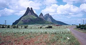
 Trois Mamelles mountain group near Quatre Bornes |
||
| Basic data | ||
| District: | Plaines Wilhems | |
| Coordinates: | 20 ° 16 ′ S , 57 ° 28 ′ E | |
| Height: | NA above d. M. | |
| Founding year: | N / A | |
| Surface: | N / A | |
| Residents: | 80.961 | |
| Time zone: | UTC +4 | |
| Telephone code: | N / A | |
| Website: | www.qb.mu | |
| Geographical location in Mauritius | ||
|
|
||
With 80,961 inhabitants (as of 2005), Quatre Bornes is the fifth largest city on the island of Mauritius and is located on a plateau in the center of the island in the Plaines Wilhems district .
Name and story
The name Quatre Bornes (four landmarks) refers to four historical landmarks that marked the districts of Palma , Bassin , Trianon and Beau Séjour and first appeared on a map from 1880. Another reading describes the stones as border points between Plaine Wilhems , Moka and Rivière Noire . Another version says that in 1761 two landowners, a Mabille and a Desveaux had disputes over land and therefore led a lawsuit, the Cas des Quatre Bornes (Fall of the Four Landmarks). But there are other ways to interpret the name.
The French period in the history of the place begins in 1721 with settlers from Prussia named Wilhem Leicknig, who later after the District Plaines Wilhems was named. In 1740, the French cartographer Guyomar defined the boundaries of today's district and described the area as a forest area that was slowly being settled . The plateau on which Quatre Bornes lies was named after a Barthelemy Fanfou de St Pierre . In 1752 the area was surveyed by a Monsieur Boudard and in 1764 Joseph François de Charpentier Cossigny, an engineer with the French East India Company , named his area of interest Palma . In 1770, the writer Jacques-Henri Bernardin de Saint-Pierre mentioned the Trois Mamelles (The Three Breasts) mountain range in his novel Paul et Virginie . In 1790 there was the first mayor in Quatre Bornes.
In 1810 British rule began with the appointment of a magistrate for Quatre Bornes. In 1850 the Church of St. Jean (Johanneskirche) was completed. The place received a train station in 1864 with the construction of the railway line. This started a rapid economic development. The place first appeared on a map in 1870 and officially received the status of a village in 1890. In 1896 it became a city; A monastery was founded in 1904 and a market hall was built in 1941. In 1953 a city library was established and the city continued to grow with the incorporation of surrounding villages. After 1980, after 12 years of independence from Great Britain, an economic upswing was recorded again, which is reflected in investment. The main branches of the economy are trade and industry.
Personalities
- Paul Bérenger (* 1945), politician
- Alain Harel (born 1950), bishop
- Yeldi Louison (* 1991), badminton player
- Aatish Lubah (born 1995), badminton player
- Prithvirajsing Roopun (* 1959), politician
