
Flacq
Coordinates: 20 ° 14 ′ S , 57 ° 43 ′ E
| Flacq district | |
|---|---|
 Waterfall of the Grand River South East |
|
| Basic data | |
| District capital: | Center de Flacq |
| Area : | 297.9 km² |
| Residents : | 138460 (2015) |
| Population density : | 460 people / km² |
| ISO 3166-2 : | MU-FL |
| Time zone : | UTC + 4 |
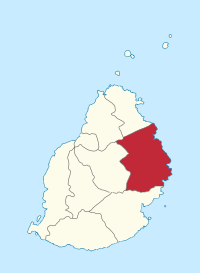
| Location in Mauritius | |
  |
|
Flacq is a district on the island state of Mauritius and is located in the east of the island. With 298 km² it is the largest district of Mauritius. Its district capital is Center de Flacq . Flacq also includes the popular bathing island Île aux Cerfs , which can only be reached by boat from Trou d'Eau Douce .
etymology
Under Governor Dirk Jansz Smient , the Dutch colonizers of Mahébourg advanced north. The area there, today's district, they called Noortwyk Vlakte , the northern plain. With the French takeover of the island, Vlakte became “Flacq”.
Communities
Mauritius is divided into villages ("Village Council Areas") (VCA) for administrative purposes. The following table names the VCA which (at least partially) are located in the Flacq district. The boundaries of the districts are not congruent with those of the municipalities. Municipalities are therefore sometimes assigned to two or three districts. There are 29 municipalities (VCA) in the Flacq district.
| No. | Place name | Demarcation |
|---|---|---|
| 1401 | Bel Air Riv. Sèche VCA | |
| 1402 | Bon Accueil VCA | |
| 1403 | Camp de Masque VCA | |
| 1404 | Camp de Masque Pavé VCA | |
| 1405 | Camp Ithier VCA | |
| 1406 | Center de Flacq VCA | |
| 1407 | Clémencia VCA | |
| 1408 | Écroignard VCA | |
| 1409 | Grand River South-East VCA | |
| 1410 | Laventure VCA | |
| 1411 | Mare La Chaux VCA | |
| 1412 | Médine Camp de Masque VCA (East) | West in the Moka district |
| 1413 | Montagne Blanche VCA (East) | West in the Moka district |
| 1414 | Olivia VCA | |
| 1415 | Poste de Flacq VCA | |
| 1416 | Quatre Cocos VCA | |
| 1417 | Quatre Soeurs VCA | |
| 1418 | Plaines des Roches VCA (South) | Nord in the Rivière du Rempart district |
| 1419 | St. Julien (Haut de Flacq) VCA (East) | West in the Moka district |
| 1420 | St. Julien D'Hotman VCA (East) | West in the Moka district |
| 1421 | Sébastopol VCA | |
| 1422 | Trou d'eau douce VCA | |
| 1423 | Amaury VCA (South) | Nord in the Rivière du Rempart district |
| 1424 | Brisée Verdière VCA (South) | Nord in the Rivière du Rempart district |
| 1425 | Dubreuil VCA (East) | West in the Moka district |
| 1426 | Lalmatie VCA (East) | West in the Moka district |
| 1427 | Queen Victoria VCA | |
| 1428 | Villebague VCA (middle) | East in the Rivière du Rempart district and West in the Pamplemousses district |
| 1430 | Roches Noires VCA (South) | Nord in the Rivière du Rempart district |
Web links
Individual evidence
- ↑ Ministry of Finance & Economic Development: ANNUAL DIGEST OF STATISTICS 2015 (PDF; 6.18 MB) Government of Mauritius. S. August 19, 2016. Accessed December 23, 2016.
- ↑ Laurence Nairac: Trou d'Eau Douce, 1980
- ↑ Statistics Mauritius: Housing and population census 2011 , Volume II: Demographic and fertility characteristics , pp. 137-141, statsmauritius.govmu.org (PDF)
Districts:
Black River |
Flacq |
Grand Port |
Moka |
Pamplemousses |
Plaines Wilhems |
Port Louis (District) |
Rivière du Rempart |
savannah
Cities:
Beau Bassin-Rose Hill |
Curepipe |
Port Louis (city) |
Quatre Bornes |
Vacoas-Phoenix
Dependent islands:
Agalega |
Cargados Carajos |
Rodrigues
Amaury (South) | Bel Air Riv. Sèche | Bon Accueil | Brisée Verdière | Camp de Masque Pavé | Camp de Masque | Camp Ithier | Center de Flacq | Clémencia | Dubreuil (East) | Écroignard | Grand River South-East | Lalmatia | Laventure | Mare La Chaux | Médine Camp de Masque (East) | Montagne Blanche (East) | Olivia | Plaines des Roches (South) | Poste de Flacq | Quatre Cocos | Quatre Soeurs | Queen Victoria | Roches Noires | Sébastopol | St. Julien (Haut de Flacq) (East) | St. Julien D'Hotman (East) | Trou d'eau douce | Villebague (middle)