
Pamplemousses (district)
Coordinates: 20 ° 7 ′ S , 57 ° 35 ′ E
| Pamplemousses district | |
|---|---|
 Pamplemousses District Court |
|
| Basic data | |
| District capital: | Triolet |
| Area : | 178.7 km² |
| Residents : | 139966 (2015) |
| Population density : | 780 inhabitants / km² |
| ISO 3166-2 : | MU-PA |
| Time zone : | UTC + 4 |
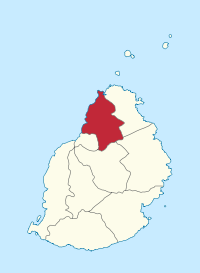
| Location in Mauritius | |
  |
|
Pamplemousses is a district on the island state of Mauritius and is located in the north of the island. Its district capital is Triolet . Districts in Mauritius are mainly statistical districts and judicial districts (see: Court organization in Mauritius ). There is a District Court at the district level. This is for the Pamplemousses district in the village of Pamplemousses .

Communities
Mauritius is divided into Village Council Areas (VCA) for administrative purposes. The following table names the VCA which (at least partially) are located in the Pamplemousses district. The boundaries of the districts are not congruent with those of the municipalities. Municipalities are therefore sometimes assigned to two or three districts. There are 22 municipalities (VCA) in the Pamplemousses district.
| No. | Place name | Demarcation |
|---|---|---|
| 1201 | Arsenal VCA | |
| 1202 | Calebasses VCA | |
| 1203 | Congomah VCA | |
| 1204 | Crève Coeur VCA | |
| 1205 | D'Épinay VCA | |
| 1206 | Fond du Sac VCA | |
| 1207 | Grand Baie VCA (West) | East in the Rivière du Rempart district |
| 1208 | Long Mountain VCA | |
| 1209 | Morcellement St. André VCA | |
| 1210 | Pamplemousses VCA | |
| 1211 | Piton VCA (West) | East in the Rivière du Rempart district |
| 1212 | Plaine des Papayes VCA | |
| 1213 | Pointe aux Piments VCA | |
| 1214 | Terre Rouge VCA | |
| 1215 | Triolet VCA | |
| 1216 | Villebague VCA (North-West) | East in the Rivière du Rempart district and South in the Flacq district |
| 1217 | Baie du Tombeau VCA | |
| 1218 | Le Hochet VCA | |
| 1219 | Mapou VCA (South) | Nord district in the Rivière du Rempart |
| 1220 | Notre Dame VCA | |
| 1221 | Amitié VCA (West) | East in the Rivière du Rempart district |
| 1222 | Belle Vue Maurel VCA (North) | South in the Rivière du Rempart district |
Individual evidence
- ↑ Ministry of Finance & Economic Development: ANNUAL DIGEST OF STATISTICS 2015 (PDF; 6.18 MB) Government of Mauritius. S. August 19, 2016. Accessed December 23, 2016.
- ↑ Statistics Mauritius: Housing and population census 2011 , Volume II: Demographic and fertility characteristics , pp. 137-141, statsmauritius.govmu.org (PDF)
Web links
Districts:
Black River |
Flacq |
Grand Port |
Moka |
Pamplemousses |
Plaines Wilhems |
Port Louis (District) |
Rivière du Rempart |
savannah
Cities:
Beau Bassin-Rose Hill |
Curepipe |
Port Louis (city) |
Quatre Bornes |
Vacoas-Phoenix
Dependent islands:
Agalega |
Cargados Carajos |
Rodrigues
Amitié (West) | Arsenal | Baie du Tombeau | Belle Vue Maurel (North) | Calebasses | Congomah | Crève Coeur | D'Épinay | Fond du Sac | Grand Baie (West) | Le Hochet | Long Mountain | Mapou (South) | Morcellement St. André | Notre Dame | Pamplemousses | Piton (West) | Plaine des Papayes | Pointe aux Piments | Terre Rouge | Triolet | Villebague (north-west)