
Savanna (district)
Coordinates: 20 ° 28 ′ S , 57 ° 30 ′ E
| Savanne District | |
|---|---|
 Baie du Cap (2009) |
|
| Basic data | |
| District capital: | Souillac |
| Area : | 244.8 km² |
| Residents : | 63585 (2015) |
| Population density : | 280 inhabitants / km² |
| ISO 3166-2 : | MU-SA |
| Time zone : | UTC + 4 |
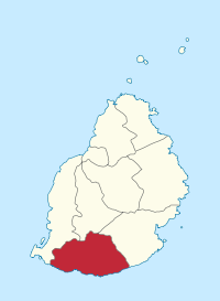
| Location in Mauritius | |
  |
|
Savanne is a district on the island state of Mauritius and is located in the south of the island. Its district capital is Souillac.
Communities
Mauritius is divided into villages ("Village Council Areas") (VCA) for administrative purposes. The following table lists the VCA which are (at least partially) in the Black River District. The boundaries of the districts are not congruent with those of the municipalities. Municipalities are therefore sometimes assigned to two or three districts. There are 16 parishes (VCA) in the Black River District.
| No. | Place name | Demarcation |
|---|---|---|
| 1601 | Baie du Cap VCA | |
| 1602 | Bois Chéri VCA | |
| 1603 | Camp Diable VCA | |
| 1604 | Chemin Grenier VCA | |
| 1605 | Grand Bois VCA | |
| 1606 | Rivière des Anguilles VCA | |
| 1607 | Rivière du Poste VCA (West) | East in the Grand Port District |
| 1608 | Souillac VCA | |
| 1609 | Surinam VCA | |
| 1610 | Bel Ombre VCA | |
| 1611 | Bénarès VCA | |
| 1612 | Britannia VCA | |
| 1613 | Chamouny VCA | |
| 1614 | L'Escalier VCA (West) | East in the Grand Port District |
| 1615 | St. Aubin VCA | |
| 1616 | Chamarel VCA (East) | West in the Black River District |
Individual evidence
- ↑ Ministry of Finance & Economic Development: ANNUAL DIGEST OF STATISTICS 2015 (PDF; 6.18 MB) Government of Mauritius. S. August 19, 2016. Accessed December 23, 2016.
- ↑ Statistics Mauritius: Housing and population census 2011 , Volume II: Demographic and fertility characteristics , pp. 137-141, statsmauritius.govmu.org (PDF)
Web links
Districts:
Black River |
Flacq |
Grand Port |
Moka |
Pamplemousses |
Plaines Wilhems |
Port Louis (District) |
Rivière du Rempart |
savannah
Cities:
Beau Bassin-Rose Hill |
Curepipe |
Port Louis (city) |
Quatre Bornes |
Vacoas-Phoenix
Dependent islands:
Agalega |
Cargados Carajos |
Rodrigues
Baie du Cap | Bel Ombre | Bois Chéri | Britannia | Bénarès | Camp Diable | Chamarel (East) | Chamouny | Chemin Grenier | Grand Bois | L'Escalier (West) | Rivière des Anguilles | Rivière du Poste (West) | Souillac | St. Aubin | Surinam