Baie du Tombeau
Coordinates: 20 ° 7 ′ S , 57 ° 30 ′ E
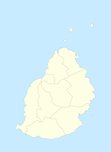
Baie du Tombeau is a place ("Village") in the north of Mauritius . It is part of the Pamplemousses district and administratively belongs to the Village Council Area (VCA) Baie du Tombeau. At the 2011 census, the place had 14,687 inhabitants. The place is divided into the districts Lagon-ville, Elizabeth Ville and Le Goulet. It is located at the mouth of the Tombeau River . The capital Port Louis is located directly to the south .
history
According to legend, Pieter Both drowned on March 6, 1615 at the Baie du Tombeau after a shipwreck. The name should be derived from this ("Tombe" is French for grave, "Eau" for water, so Tombeau would be a shortened form of water grave ). According to another story, English sailors used the coast to refresh their provisions. They called the stretch of coast Brownsbaye, it was Baie du Tombeau by shifting sounds. The name Baie du Tombeau appears for the first time on a map by the Abbé de la Caille from 1753.
On July 4, 1748, the British admiral Edward Boscawen appeared in front of Baie du Tombeau and tried to conquer the French colony in a surprise attack. It failed because of the French coastal fortifications.
As part of the Mauritius campaign , the British succeeded in conquering the island in 1810. General John Abercrombie took Baie du Tombeau on December 1, 1810.
The area of today's Baie du Tombeau consisted of a few plantations at the beginning of English rule. After slavery was abolished, free slaves settled in Baie du Tombeau as fishermen in the 1830s.
The place remained a sleepy nest until the Second World War. Strong growth began in the 1960s. The place developed into a suburb of Port Louis, an industrial area on the highway was established. In 2006 there were more than ten factories in town. After the Bon Pasteur chapel became too small, the Church of St. Malo was built and consecrated in 1968. In 1988 the Clinic du Nord was opened.
The Hindu temple Nav Roop Durga Mandir is located on the eastern edge of the village.
literature
- Benjamin Moutou: Pamplemousses - Riviére du Rempart - Quatre siécles d'histoire, 2006, ISBN 978-99903-992-9-5 , pp. 275-279
Individual evidence
- ↑ Statistics Mauritius: Housing and population census 2011 , Volume II: Demographic and fertility characteristics , p. 71, statsmauritius.govmu.org (PDF)
