
Tanying: Difference between revisions
Tutwakhamoe (talk | contribs) mNo edit summary |
IznoRepeat (talk | contribs) m Category:CS1 maint: others Chinese texts; gen fixes |
||
| (6 intermediate revisions by 4 users not shown) | |||
| Line 2: | Line 2: | ||
| name = Tanying Area |
| name = Tanying Area |
||
| native_name = 檀营地区 |
| native_name = 檀营地区 |
||
| settlement_type = [[Area (Beijing)|Area]] & [[Ethnic townships, towns, and sums|Ethnic |
| settlement_type = [[Area (Beijing)|Area]] & [[Ethnic townships, towns, and sums|Ethnic Township]] |
||
| image_skyline = Shahe, Miyun (20150106155637).JPG |
| image_skyline = Shahe, Miyun (20150106155637).JPG |
||
| subdivision_type = [[List of sovereign states|Country]] |
| subdivision_type = [[List of sovereign states|Country]] |
||
| Line 28: | Line 28: | ||
| map_caption = Location of Tanning Area within [[Miyun District]] |
| map_caption = Location of Tanning Area within [[Miyun District]] |
||
| mapsize = |
| mapsize = |
||
| other_name = Tanying Manchu and Mongol Ethnic Township<br />檀营满族蒙古族乡 |
| other_name = Tanying Manchu and Mongol Ethnic Township<br />{{native name|zh|檀营满族蒙古族乡}}<Br>{{native name|mn|{{MongolUnicode|lang=mn|ᠲᠠᠨ ᠶᠢᠩ ᠮᠠᠨᠵᠤ ᠮᠣᠩᠭᠣᠯ ᠰᠢᠶᠠᠩ|style=max-height:2em; word-wrap:normal}}}}<Br>{{native name|mnc|{{MongolUnicode|lang=mnc|ᡨᠠᠨ ᠶᡳᠩ ᠮᠠᠨᠵᡠ ᠮᠣᠩᡤᠣ ᡠᡴᠰᡠᡵᠠᡳ ᡥᡳᠶᠠᠩ|style=max-height:2em; word-wrap:normal}}}} |
||
}} |
}} |
||
'''Tanying Area''' ({{Lang-zh||s=檀营地区|t=檀營地區|p=Tányíng Dìqū}}) is an [[Area (Beijing)|area]] and an [[Ethnic townships, towns, and sums|ethnic township]] located in the [[Miyun District]] of [[Beijing]], [[China]].<ref>{{Cite web|url=http://www.cfguide.com/town/Tanying_303030505.htm|title= |
'''Tanying Area''' ({{Lang-zh||s=檀营地区|t=檀營地區|p=Tányíng Dìqū}}) is an [[Area (Beijing)|area]] and an [[Ethnic townships, towns, and sums|ethnic township]] located in the [[Miyun District]] of [[Beijing]], [[China]].<ref>{{Cite web|url=http://www.cfguide.com/town/Tanying_303030505.htm|title= |
||
Tanying Area, Miyung, Beijing, China|website=www.aldpage.com|access-date=2018-04-11}}</ref> Located on the south of Ye Mountain (冶山), it shares border with [[Mujiayu|Mujiayu Town]] in its north and east, [[Gulou Subdistrict, Beijing|Gulou Subdistrict]] in its southwest, and [[Miyun Town]] in its northwest. In 2020, the area had 15,466 inhabitants under its administration.<ref>{{Cite web |title=北京市密云区第七次全国人口普查公报 |url= |
Tanying Area, Miyung, Beijing, China|website=www.aldpage.com|access-date=2018-04-11}}</ref> Located on the south of Ye Mountain (冶山), it shares border with [[Mujiayu|Mujiayu Town]] in its north and east, [[Gulou Subdistrict, Beijing|Gulou Subdistrict]] in its southwest, and [[Miyun Town]] in its northwest. In 2020, the area had 15,466 inhabitants under its administration.<ref>{{Cite web |title=北京市密云区第七次全国人口普查公报 |url=http://www.bjmy.gov.cn/art/2021/6/11/art_10759_360417.html |access-date=2022-10-31 |website=www.bjmy.gov.cn}}</ref> |
||
The name Tanying ({{Zh|s=檀营|l=Tan Barrack}}) originates in 1777, when the region, which was called Tan Department (檀州) at the time, was used as a garrison for stationing [[Eight Banners]] troops.<ref name=":0">{{Cite book | |
The name Tanying ({{Zh|s=檀营|l=Tan Barrack}}) originates in 1777, when the region, which was called Tan Department (檀州) at the time, was used as a garrison for stationing [[Eight Banners]] troops.<ref name=":0">{{Cite book |script-title=zh:中华人民共和国政区大典, 北京市卷 |date=2013 |publisher=中国社会出版社 |editor=李立国 |editor2=李万钧 |editor3=吴世民 |isbn=978-7-5087-4058-4 |location=Beijing |oclc=910451741}}</ref> |
||
== History == |
== History == |
||
| Line 51: | Line 53: | ||
|- |
|- |
||
|1965 - 1987 |
|1965 - 1987 |
||
|Administered by |
|Administered by Mujiayu People's Commune |
||
|- |
|- |
||
|1987 - 2005 |
|1987 - 2005 |
||
| Line 59: | Line 61: | ||
| rowspan="2" |Tanying Area (Manchu and Mongol Ethnic Township) |
| rowspan="2" |Tanying Area (Manchu and Mongol Ethnic Township) |
||
|- |
|- |
||
|2015–present |
|||
|2015 - present |
|||
|Miyun District, Beijing |
|Miyun District, Beijing |
||
|} |
|} |
||
| Line 84: | Line 86: | ||
File:Miyunbei Railway Station 20160413 112339.jpg|Rail tracks within Miyunbei Railway Station, 2016 |
File:Miyunbei Railway Station 20160413 112339.jpg|Rail tracks within Miyunbei Railway Station, 2016 |
||
</gallery> |
</gallery> |
||
== See also == |
|||
| ⚫ | |||
==References== |
==References== |
||
{{reflist}} |
{{reflist}} |
||
{{Subdivisions of Miyun District, Beijing}} |
|||
| ⚫ | |||
{{authority control}} |
|||
[[Category:Miyun District]] |
[[Category:Miyun District]] |
||
[[Category:Ethnic townships of the People's Republic of China]] |
[[Category:Ethnic townships of the People's Republic of China]] |
||
| ⚫ | |||
{{Beijing-geo-stub}} |
{{Beijing-geo-stub}} |
||
| ⚫ | |||
Latest revision as of 16:42, 22 April 2024
Tanying Area
檀营地区 | |
|---|---|
.JPG) Xinbei Road within the area, 2015 | |
.png) Location of Tanning Area within Miyun District | |
 Tanying Area  Tanying Area | |
| Coordinates: 40°23′22″N 116°51′47″E / 40.38944°N 116.86306°E | |
| Country | China |
| Municipality | Beijing |
| District | Miyun |
| Village-level Divisions | 3 communities |
| Area | |
| • Total | 2.9 km2 (1.1 sq mi) |
| Elevation | 82 m (269 ft) |
| Population (2020) | |
| • Total | 15,466 |
| • Density | 5,300/km2 (14,000/sq mi) |
| Time zone | UTC+8 (China Standard) |
| Postal code | 101511 |
| Area code | 010 |
Tanying Area (simplified Chinese: 檀营地区; traditional Chinese: 檀營地區; pinyin: Tányíng Dìqū) is an area and an ethnic township located in the Miyun District of Beijing, China.[1] Located on the south of Ye Mountain (冶山), it shares border with Mujiayu Town in its north and east, Gulou Subdistrict in its southwest, and Miyun Town in its northwest. In 2020, the area had 15,466 inhabitants under its administration.[2]
The name Tanying (Chinese: 檀营; lit. 'Tan Barrack') originates in 1777, when the region, which was called Tan Department (檀州) at the time, was used as a garrison for stationing Eight Banners troops.[3]
History[edit]
| Year | Status | Under |
|---|---|---|
| 1953 - 1958 | Tanying Township | Miyun County, Hebei |
| 1958 - 1965 | Administered by Chengguan People's Commune | Miyun County, Beijing |
| 1965 - 1987 | Administered by Mujiayu People's Commune | |
| 1987 - 2005 | Tanying Manchu and Mongol Ethnic Township | |
| 2005 - 2015 | Tanying Area (Manchu and Mongol Ethnic Township) | |
| 2015–present | Miyun District, Beijing |
Administrative divisions[edit]
In 2021, Tanying Area is formed from 3 residential communities, and they are organized in the following table:[4]
| Subdivision Names | Name Transliterations |
|---|---|
| 檀营 | Tanying |
| 第一 | Diyi |
| 第二 | Di'er |
Gallery[edit]
-
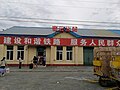 Entrance of Miyunbei Railway Station on the west of the area, 2016
 -
 Rail tracks within Miyunbei Railway Station, 2016


See also[edit]
References[edit]
- ^ "Tanying Area, Miyung, Beijing, China". www.aldpage.com. Retrieved 2018-04-11.
- ^ "北京市密云区第七次全国人口普查公报". www.bjmy.gov.cn. Retrieved 2022-10-31.
- ^ a b 李立国; 李万钧; 吴世民, eds. (2013). 中华人民共和国政区大典, 北京市卷. Beijing: 中国社会出版社. ISBN 978-7-5087-4058-4. OCLC 910451741.
- ^ "2021年统计用区划代码和城乡划分代码". www.stats.gov.cn. Retrieved 2022-10-29.
This Beijing location article is a stub. You can help Wikipedia by expanding it. |