
Butler, Oklahoma: Difference between revisions
m Bot: Migrating 1 langlinks to WP:Wikidata - d:q2187508 |
Red Director (talk | contribs) |
||
| (41 intermediate revisions by 22 users not shown) | |||
| Line 1: | Line 1: | ||
{{For|the unincorporated community in Delaware County|Butler, Delaware County, Oklahoma}} |
|||
{{Use mdy dates|date=May 2024}} |
|||
{{Infobox settlement |
{{Infobox settlement |
||
|official_name = Butler, Oklahoma |
|official_name = Butler, Oklahoma |
||
|settlement_type = [[Town]] |
|settlement_type = [[Town]] |
||
|nickname = |
|nickname = |
||
|motto = |
|motto = |
||
<!-- Images --> |
<!-- Images --> |
||
|image_skyline = |
|image_skyline = |
||
|imagesize = |
|imagesize = |
||
|image_caption = |
|image_caption = |
||
|image_flag = |
|image_flag = |
||
|image_seal = |
|image_seal = |
||
| Line 16: | Line 18: | ||
|mapsize = 250px |
|mapsize = 250px |
||
|map_caption = Location of Butler, Oklahoma |
|map_caption = Location of Butler, Oklahoma |
||
|image_map1 = |
|image_map1 = |
||
|mapsize1 = |
|mapsize1 = |
||
|map_caption1 = |
|map_caption1 = |
||
<!-- Location --> |
<!-- Location --> |
||
|subdivision_type = [[List of sovereign states|Country]] |
|||
|coordinates_region = US-OK |
|||
| |
|subdivision_name = United States |
||
| |
|subdivision_type1 = [[U.S. state|State]] |
||
|subdivision_type1 = [[Political divisions of the United States|State]] |
|||
|subdivision_name1 = [[Oklahoma]] |
|subdivision_name1 = [[Oklahoma]] |
||
|subdivision_type2 = [[List of counties in Oklahoma|County]] |
|subdivision_type2 = [[List of counties in Oklahoma|County]] |
||
| Line 30: | Line 31: | ||
<!-- Government --> |
<!-- Government --> |
||
|government_footnotes = |
|government_footnotes = |
||
|government_type = |
|government_type = |
||
|leader_title = |
|leader_title = |
||
|leader_name = |
|leader_name = |
||
|leader_title1 = |
|leader_title1 = |
||
|leader_name1 = |
|leader_name1 = |
||
|established_title = |
|established_title = |
||
|established_date = |
|established_date = |
||
<!-- Area --> |
<!-- Area --> |
||
|unit_pref |
|unit_pref = Imperial |
||
|area_footnotes = <ref name="TigerWebMapServer">{{cite web|title=ArcGIS REST Services Directory|url=https://tigerweb.geo.census.gov/arcgis/rest/services/TIGERweb/Places_CouSub_ConCity_SubMCD/MapServer|publisher=United States Census Bureau|accessdate=September 20, 2022}}</ref> |
|||
|area_footnotes = |
|||
|area_magnitude = |
|area_magnitude = |
||
|area_total_km2 = 1. |
|area_total_km2 = 1.10 |
||
|area_land_km2 = 1. |
|area_land_km2 = 1.10 |
||
|area_water_km2 = 0. |
|area_water_km2 = 0.00 |
||
|area_total_sq_mi = 0. |
|area_total_sq_mi = 0.43 |
||
|area_land_sq_mi = 0. |
|area_land_sq_mi = 0.43 |
||
|area_water_sq_mi = 0. |
|area_water_sq_mi = 0.00 |
||
<!-- Population --> |
<!-- Population --> |
||
|population_as_of = [[United States Census |
|population_as_of = [[2020 United States Census|2020]] |
||
|population_footnotes = |
|population_footnotes = |
||
|population_total = |
|population_total = 208 |
||
|population_density_km2 = |
|population_density_km2 = 188.64 |
||
|population_density_sq_mi = |
|population_density_sq_mi = 488.26 |
||
<!-- General information --> |
<!-- General information --> |
||
| Line 62: | Line 63: | ||
|timezone_DST = CDT |
|timezone_DST = CDT |
||
|utc_offset_DST = -5 |
|utc_offset_DST = -5 |
||
|elevation_footnotes = |
|elevation_footnotes = <ref name=gnis/> |
||
| |
|elevation_ft = 1768 |
||
|coordinates = {{coord|35|38|11|N|99|11|11|W|region:US-OK|display=inline,title}} |
|||
|elevation_ft = 1772 |
|||
|coordinates_display = display=inline,title |
|||
|latd = 35 |latm = 38 |lats = 14 |latNS = N |
|||
|longd = 99 |longm = 11 |longs = 9 |longEW = W |
|||
<!-- Area/postal codes & others --> |
|||
|postal_code_type = [[ZIP code]] |
|postal_code_type = [[ZIP code]] |
||
|postal_code = 73625 |
|postal_code = 73625 |
||
|area_code = [[Area code 580|580]] |
|area_code = [[Area code 580|580]] |
||
|blank_name = [[Federal Information Processing Standard|FIPS code]] |
|blank_name = [[Federal Information Processing Standard|FIPS code]] |
||
|blank_info = 40-10450{{ |
|blank_info = 40-10450<ref name="GR2">{{cite web |url=https://www.census.gov |publisher=[[United States Census Bureau]] |accessdate=January 31, 2008 |title=U.S. Census website }}</ref> |
||
|blank1_name = [[Geographic Names Information System|GNIS]] feature ID |
|blank1_name = [[Geographic Names Information System|GNIS]] feature ID |
||
|blank1_info = |
|blank1_info = 2411749<ref name=gnis>{{GNIS|2411749}}</ref> |
||
|website = |
|website = |
||
|footnotes = |
|footnotes = |
||
|pop_est_as_of = |
|||
|pop_est_footnotes = |
|||
|population_est = |
|||
}} |
}} |
||
'''Butler''' is a town in [[Custer County, Oklahoma|Custer County]], [[Oklahoma]], United States. The population was 208 at the time of the [[2020 United States census|2020 census]],<ref>{{cite web|url= https://www.census.gov/search-results.html?searchType=web&cssp=SERP&q=Butler%20town,%20Oklahoma|title= Butler (town), Oklahoma |publisher=US Census Bureau|accessdate=October 16, 2023}}</ref> down from 287 at the [[2010 United States Census|2010 census]].<ref name="Census 2010">{{cite web| url=http://factfinder.census.gov/bkmk/table/1.0/en/DEC/10_SF1/G001/1600000US4010450| title=Geographic Identifiers: 2010 Demographic Profile Data (G001): Butler town, Oklahoma| publisher=U.S. Census Bureau, American Factfinder| accessdate=March 9, 2015| archive-url=https://archive.today/20150309235710/http://factfinder.census.gov/bkmk/table/1.0/en/DEC/10_SF1/G001/1600000US4010450| archive-date=March 9, 2015| url-status=dead}}</ref> |
|||
'''Butler''' is a town in [[Custer County, Oklahoma|Custer County]], [[Oklahoma]], [[United States]]. The population was 287 at the [[United States Census, 2010|2010 census]]. |
|||
==Geography== |
==Geography== |
||
Butler is located in western Custer County at the intersection of state highways [[Oklahoma State Highway 33|33]] and [[Oklahoma State Highway 44|44]]. Highway 33 leads west {{Convert|11|mi}} to [[Hammon, Oklahoma|Hammon]] and east {{convert|12|mi}} to [[U.S. Route 183#Oklahoma|U.S. Route 183]], which in turn leads {{convert|8.5|mi}} south to [[Clinton, Oklahoma|Clinton]], the Custer County seat. Highway 44 leads south from Butler {{convert|14|mi}} to [[Foss, Oklahoma|Foss]] and [[Interstate 40 in Oklahoma|Interstate 40]]. |
|||
| ⚫ | |||
| ⚫ | |||
===Climate=== |
===Climate=== |
||
{{Weather box |
{{Weather box |
||
|location = Butler, Oklahoma |
|location = Butler, Oklahoma |
||
|single line = |
|single line = Y |
||
|Jan high F = 47.8 |
|Jan high F = 47.8 |
||
|Feb high F = 53.1 |
|Feb high F = 53.1 |
||
| Line 102: | Line 103: | ||
|Nov high F = 60.2 |
|Nov high F = 60.2 |
||
|Dec high F = 49.9 |
|Dec high F = 49.9 |
||
|year high F |
|year high F= |
||
|Jan low F = 19.1 |
|Jan low F = 19.1 |
||
|Feb low F = 24.4 |
|Feb low F = 24.4 |
||
| Line 115: | Line 116: | ||
|Nov low F = 32.6 |
|Nov low F = 32.6 |
||
|Dec low F = 22.4 |
|Dec low F = 22.4 |
||
|year low F |
|year low F= |
||
|Jan precipitation inch = 0.7 |
|Jan precipitation inch = 0.7 |
||
|Feb precipitation inch = 1.1 |
|Feb precipitation inch = 1.1 |
||
|Mar precipitation inch = 1.9 |
|Mar precipitation inch = 1.9 |
||
|Apr precipitation inch = 2 |
|Apr precipitation inch = 2.0 |
||
|May precipitation inch = 4.2 |
|May precipitation inch = 4.2 |
||
|Jun precipitation inch = 3.8 |
|Jun precipitation inch = 3.8 |
||
|Jul precipitation inch = 2 |
|Jul precipitation inch = 2.0 |
||
|Aug precipitation inch = 3 |
|Aug precipitation inch = 3.0 |
||
|Sep precipitation inch = 3.1 |
|Sep precipitation inch = 3.1 |
||
|Oct precipitation inch = 2 |
|Oct precipitation inch = 2.0 |
||
|Nov precipitation inch = 1.6 |
|Nov precipitation inch = 1.6 |
||
|Dec precipitation inch = 0.8 |
|Dec precipitation inch = 0.8 |
||
|year precipitation inch |
|year precipitation inch= |
||
|source 1 = Weatherbase.com <ref>{{cite web |
|source 1 = Weatherbase.com <ref>{{cite web |
||
| url =http://www.weatherbase.com/weather/weatherall.php3?s=178343&refer= |
| url =http://www.weatherbase.com/weather/weatherall.php3?s=178343&refer= |
||
| title = Historical Weather for Butler, Oklahoma, United States}}</ref> |
| title = Historical Weather for Butler, Oklahoma, United States}}</ref> |
||
|date=August 2010 |
|date=August 2010 |
||
}} |
|||
}}<noinclude> |
|||
{{Template reference list}} |
|||
</noinclude> |
|||
==Demographics== |
==Demographics== |
||
{{US Census population |
|||
{{USCensusPop|1909=150 (est)|1910=|1920=332|1930=473|1940=428|1950=351|1960=351|1970=315|1980=388|1990=341|2000=345|2010=287}} |
|||
|1920= 332 |
|||
|1930= 473 |
|||
|1940= 428 |
|||
|1950= 351 |
|||
|1960= 351 |
|||
|1970= 315 |
|||
|1980= 388 |
|||
|1990= 341 |
|||
|2000= 345 |
|||
|2010= 287 |
|||
|2020= 208 |
|||
|footnote=U.S. Decennial Census<ref name="DecennialCensus">{{cite web |url=https://www.census.gov/programs-surveys/decennial-census.html|title=Census of Population and Housing|publisher=Census.gov|accessdate=June 4, 2015}}</ref> |
|||
}} |
|||
As of the [[census]] |
As of the [[census]]<ref name="GR2" /> of 2000, there were 345 people, 138 households, and 104 families residing in the town. The population density was {{convert|815.0|PD/sqmi|PD/km2|sp=us|adj=off}}. There were 160 housing units at an average density of {{convert|378.0|/sqmi|/km2|sp=us|adj=off}}. The racial makeup of the town was 89.28% [[White (U.S. Census)|White]], 0.87% [[Native American (U.S. Census)|Native American]], 0.29% [[Asian (U.S. Census)|Asian]], 4.93% from [[Race (United States Census)|other races]], and 4.64% from two or more races. [[Hispanic (U.S. Census)|Hispanic]] or [[Latino (U.S. Census)|Latino]] of any race were 11.88% of the population. |
||
There were 138 households out of which 28.3% had children under the age of 18 living with them, 59.4% were [[Marriage|married couples]] living together, 13.0% had a female householder with no husband present, and 24.6% were non-families. 21.7% of all households were made up of individuals and 11.6% had someone living alone who was 65 years of age or older. The average household size was 2.50 and the average family size was 2.88. |
There were 138 households, out of which 28.3% had children under the age of 18 living with them, 59.4% were [[Marriage|married couples]] living together, 13.0% had a female householder with no husband present, and 24.6% were non-families. 21.7% of all households were made up of individuals, and 11.6% had someone living alone who was 65 years of age or older. The average household size was 2.50 and the average family size was 2.88. |
||
In the town the population was spread out with 24.1% under the age of 18, 7.2% from 18 to 24, 25.2% from 25 to 44, 27.0% from 45 to 64, and 16.5% who were 65 years of age or older. The median age was 40 years. For every 100 females there were 84.5 males. For every 100 females age 18 and over, there were 94.1 males. |
In the town, the population was spread out, with 24.1% under the age of 18, 7.2% from 18 to 24, 25.2% from 25 to 44, 27.0% from 45 to 64, and 16.5% who were 65 years of age or older. The median age was 40 years. For every 100 females, there were 84.5 males. For every 100 females age 18 and over, there were 94.1 males. |
||
The median income for a household in the town was $29,375, and the median income for a family was $32,083. Males had a median income of $25,500 versus $24,583 for females. The [[per capita income]] for the town was $13,917. About 18.4% of families and 29.8% of the population were below the [[poverty line]], including 51.5% of those under age 18 and 7.0% of those age 65 or over. |
The median income for a household in the town was $29,375, and the median income for a family was $32,083. Males had a median income of $25,500 versus $24,583 for females. The [[per capita income]] for the town was $13,917. About 18.4% of families and 29.8% of the population were below the [[poverty line]], including 51.5% of those under age 18 and 7.0% of those age 65 or over. |
||
| Line 153: | Line 164: | ||
==External links== |
==External links== |
||
* [http://digital.library.okstate.edu/encyclopedia/entries/B/BU018.html Encyclopedia of Oklahoma History and Culture - Butler] |
* [https://web.archive.org/web/20090105083052/http://digital.library.okstate.edu/encyclopedia/entries/B/BU018.html Encyclopedia of Oklahoma History and Culture - Butler] |
||
{{Custer County, Oklahoma}} |
{{Custer County, Oklahoma}} |
||
{{authority control}} |
|||
| ⚫ | |||
| ⚫ | |||
[[Category:Towns in Oklahoma]] |
[[Category:Towns in Oklahoma]] |
||
Latest revision as of 20:19, 7 May 2024
Butler, Oklahoma | |
|---|---|
 Location of Butler, Oklahoma | |
| Coordinates: 35°38′11″N 99°11′11″W / 35.63639°N 99.18639°W | |
| Country | United States |
| State | Oklahoma |
| County | Custer |
| Area | |
| • Total | 0.43 sq mi (1.10 km2) |
| • Land | 0.43 sq mi (1.10 km2) |
| • Water | 0.00 sq mi (0.00 km2) |
| Elevation | 1,768 ft (539 m) |
| Population (2020) | |
| • Total | 208 |
| • Density | 488.26/sq mi (188.64/km2) |
| Time zone | UTC-6 (Central (CST)) |
| • Summer (DST) | UTC-5 (CDT) |
| ZIP code | 73625 |
| Area code | 580 |
| FIPS code | 40-10450[3] |
| GNIS feature ID | 2411749[2] |
Butler is a town in Custer County, Oklahoma, United States. The population was 208 at the time of the 2020 census,[4] down from 287 at the 2010 census.[5]
Geography[edit]
Butler is located in western Custer County at the intersection of state highways 33 and 44. Highway 33 leads west 11 miles (18 km) to Hammon and east 12 miles (19 km) to U.S. Route 183, which in turn leads 8.5 miles (13.7 km) south to Clinton, the Custer County seat. Highway 44 leads south from Butler 14 miles (23 km) to Foss and Interstate 40.
According to the United States Census Bureau, Butler has a total area of 1.0 square mile (2.6 km2), all land.[5] Foss Reservoir is 5 miles (8 km) south of Butler.
Climate[edit]
| Climate data for Butler, Oklahoma | |||||||||||||
|---|---|---|---|---|---|---|---|---|---|---|---|---|---|
| Month | Jan | Feb | Mar | Apr | May | Jun | Jul | Aug | Sep | Oct | Nov | Dec | Year |
| Mean daily maximum °F (°C) | 47.8 (8.8) |
53.1 (11.7) |
62.2 (16.8) |
72.9 (22.7) |
80.5 (26.9) |
89.4 (31.9) |
95.6 (35.3) |
93.3 (34.1) |
84.6 (29.2) |
74.4 (23.6) |
60.2 (15.7) |
49.9 (9.9) |
72.0 (22.2) |
| Mean daily minimum °F (°C) | 19.1 (−7.2) |
24.4 (−4.2) |
32.6 (0.3) |
44.1 (6.7) |
53.3 (11.8) |
63.5 (17.5) |
68.4 (20.2) |
66.5 (19.2) |
57.9 (14.4) |
44.6 (7.0) |
32.6 (0.3) |
22.4 (−5.3) |
44.1 (6.7) |
| Average precipitation inches (mm) | 0.7 (18) |
1.1 (28) |
1.9 (48) |
2.0 (51) |
4.2 (110) |
3.8 (97) |
2.0 (51) |
3.0 (76) |
3.1 (79) |
2.0 (51) |
1.6 (41) |
0.8 (20) |
26.2 (670) |
| Source: Weatherbase.com [6] | |||||||||||||
Demographics[edit]
| Census | Pop. | Note | %± |
|---|---|---|---|
| 1920 | 332 | — | |
| 1930 | 473 | 42.5% | |
| 1940 | 428 | −9.5% | |
| 1950 | 351 | −18.0% | |
| 1960 | 351 | 0.0% | |
| 1970 | 315 | −10.3% | |
| 1980 | 388 | 23.2% | |
| 1990 | 341 | −12.1% | |
| 2000 | 345 | 1.2% | |
| 2010 | 287 | −16.8% | |
| 2020 | 208 | −27.5% | |
| U.S. Decennial Census[7] | |||
As of the census[3] of 2000, there were 345 people, 138 households, and 104 families residing in the town. The population density was 815.0 inhabitants per square mile (314.7/km2). There were 160 housing units at an average density of 378.0 per square mile (145.9/km2). The racial makeup of the town was 89.28% White, 0.87% Native American, 0.29% Asian, 4.93% from other races, and 4.64% from two or more races. Hispanic or Latino of any race were 11.88% of the population.
There were 138 households, out of which 28.3% had children under the age of 18 living with them, 59.4% were married couples living together, 13.0% had a female householder with no husband present, and 24.6% were non-families. 21.7% of all households were made up of individuals, and 11.6% had someone living alone who was 65 years of age or older. The average household size was 2.50 and the average family size was 2.88.
In the town, the population was spread out, with 24.1% under the age of 18, 7.2% from 18 to 24, 25.2% from 25 to 44, 27.0% from 45 to 64, and 16.5% who were 65 years of age or older. The median age was 40 years. For every 100 females, there were 84.5 males. For every 100 females age 18 and over, there were 94.1 males.
The median income for a household in the town was $29,375, and the median income for a family was $32,083. Males had a median income of $25,500 versus $24,583 for females. The per capita income for the town was $13,917. About 18.4% of families and 29.8% of the population were below the poverty line, including 51.5% of those under age 18 and 7.0% of those age 65 or over.
References[edit]
- ^ "ArcGIS REST Services Directory". United States Census Bureau. Retrieved September 20, 2022.
- ^ a b U.S. Geological Survey Geographic Names Information System: Butler, Oklahoma
- ^ a b "U.S. Census website". United States Census Bureau. Retrieved January 31, 2008.
- ^ "Butler (town), Oklahoma". US Census Bureau. Retrieved October 16, 2023.
- ^ a b "Geographic Identifiers: 2010 Demographic Profile Data (G001): Butler town, Oklahoma". U.S. Census Bureau, American Factfinder. Archived from the original on March 9, 2015. Retrieved March 9, 2015.
- ^ "Historical Weather for Butler, Oklahoma, United States".
- ^ "Census of Population and Housing". Census.gov. Retrieved June 4, 2015.
External links[edit]
Municipalities and communities of Custer County, Oklahoma, United States | ||
|---|---|---|
| Cities | 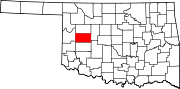 | |
| Towns | ||
| Unincorporated communities | ||
| Ghost town | ||
| Footnotes | ‡This populated place also has portions in an adjacent county or counties | |