
Loch Veyatie: Difference between revisions
Scope creep (talk | contribs) national scenic area |
Tag Tags: Mobile edit Mobile web edit |
||
| Line 54: | Line 54: | ||
| reference = |
| reference = |
||
}} |
}} |
||
'''Loch Veyatie''' ( |
'''Loch Veyatie''' ({{lang-gd|Loch Mheathadaidh}}) is a large freshwater [[loch]] in north-west [[Scotland]].<ref>{{cite web|title=Bathymetrical Survey of the Fresh-Water Lochs of Scotland, 1897–1909|url=http://maps.nls.uk/bathymetric/chart/2096|website=Maps|publisher=The national library of Scotland|accessdate=25 November 2017}}</ref><ref name="bathy">{{cite book|title=Lochs of the Kirkaig Basin - Loch Veyatie|date=1897–1909|publisher=Bathymetrical Survey of the Fresh-Water Lochs of Scotland|location=National Library of Scotland Maps|page=163|url=https://maps.nls.uk/bathymetric/text/37340|accessdate=25 November 2017}}</ref><ref name="britlakes">{{cite web |title=Loch Veyatie|url=https://eip.ceh.ac.uk/apps/lakes/detail.html#wbid=10719 |website=Centre for Ecology and Hydrology |publisher=Scotland and Northern Ireland Forum for Environmental Research (SNIFFER) |accessdate=20 January 2022}}</ref> It stretches for 6 km north-westwards from the [[Human settlement|settlement]] of [[Elphin, Highland|Elphin]], and lies between [[Suilven]] and [[Cùl Mòr]]. The loch is located in an area known as the ''Assynt-Coigach [[National scenic area (Scotland)|National Scenic Area]]'',<ref>{{cite web|url=https://sitelink.nature.scot/site/9119|title=Assynt-Coigach National Scenic Area|publisher=NatureScot|access-date=2 October 2020}}</ref> one of 40 such areas in Scotland.<ref>{{cite web|url=https://www.nature.scot/professional-advice/protected-areas-and-species/protected-areas/national-designations/national-scenic-areas|title=National Scenic Areas|publisher=NatureScot|access-date=2 November 2022}}</ref> |
||
==Parish boundary== |
==Parish boundary== |
||
Latest revision as of 00:49, 14 November 2023
| Loch Veyatie | |
|---|---|
 View towards Loch Veyatie With the Cam Loch beyond and Ben More Assynt under cloud in the distance. | |
 Loch Veyatie Location in Sutherland | |
| Location | NC17871375 |
| Coordinates | 58°04′32″N 5°05′20″W / 58.075529°N 5.088992°W |
| Type | freshwater loch |
| Primary outflows | Uidh Fheàrna |
| Max. length | 6.4 km (4.0 mi)[1] |
| Max. width | 0.8 km (0.50 mi)[1] |
| Surface area | 257 ha (640 acres)[2] |
| Average depth | 41 ft (12 m)[1] |
| Max. depth | 125.8 ft (38.3 m)[1] |
| Water volume | 1,132,526,812.12 cu ft (32,069,588.000 m3)[1] |
| Shore length1 | 22 km (14 mi) [2] |
| Surface elevation | 124 m (407 ft)[2] |
| Max. temperature | 56.9 °F (13.8 °C)[1] |
| Min. temperature | 56.9 °F (13.8 °C)[1] |
| Settlements | Elphin |
| 1 Shore length is not a well-defined measure. | |
Loch Veyatie (Scottish Gaelic: Loch Mheathadaidh) is a large freshwater loch in north-west Scotland.[3][1][2] It stretches for 6 km north-westwards from the settlement of Elphin, and lies between Suilven and Cùl Mòr. The loch is located in an area known as the Assynt-Coigach National Scenic Area,[4] one of 40 such areas in Scotland.[5]
Parish boundary[edit]
The boundary between Ross-shire and Sutherland (and therefore between the parishes of Lochbroom and Assynt) runs the length of the loch.
Angling[edit]
Well known for its trout (including ferox) and charr, it is a popular destination for anglers. Run-off from a salmon hatchery at the eastern end of the loch attracts large fish, including, unusually, charr, into its main feeder river, the Abhainn Mhòr. The reservoir Cam Loch is directly located 1 km to the northeast, and follows the same orientation.
Geography[edit]
Loch Veyatie is drained at its western end by Uidh Fheàrna, a channel of slow-moving water leading into Fionn Loch, which is itself drained by the River Kirkaig leading to the notable 20m Falls of Kirkaig before entering Loch Kirkaig.[6]
Frigate[edit]
The Loch-class frigate HMS Loch Veyatie was named after the loch.
Gallery[edit]
- Images of Veyatie and surrounding areas
-
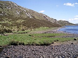
 Bay below Creagan Mòr, Loch Veyatie. This sheltered bay was most welcome by a group of anglers on a rather windy day. At the inner end of the bay is the small beach
 -
 Cul Mor from a boat on Loch Veyatie
 -
 Far eastern end of Uidh Fhearna looking eastback down the side of Loch Veyatie The 'shore' of the loch here was fairly flat before narrowing down towards Uidh Fhearna
 -
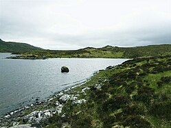
 Unnamed micro island on Loch Veyatie
 -
 Loch shallows
 -
 View of Loch Veyatie with Cul Mòr in the distance. Note the manmade dock.
 -
 Loch Veyatie, north shore. Less appealing than the beach a few hundred metres to the east.


References[edit]
- ^ a b c d e f g h Lochs of the Kirkaig Basin - Loch Veyatie. National Library of Scotland Maps: Bathymetrical Survey of the Fresh-Water Lochs of Scotland. 1897–1909. p. 163. Retrieved 25 November 2017.
- ^ a b c d "Loch Veyatie". Centre for Ecology and Hydrology. Scotland and Northern Ireland Forum for Environmental Research (SNIFFER). Retrieved 20 January 2022.
- ^ "Bathymetrical Survey of the Fresh-Water Lochs of Scotland, 1897–1909". Maps. The national library of Scotland. Retrieved 25 November 2017.
- ^ "Assynt-Coigach National Scenic Area". NatureScot. Retrieved 2 October 2020.
- ^ "National Scenic Areas". NatureScot. Retrieved 2 November 2022.
- ^ Microsoft; Nokia (25 November 2017). "Loch Veyatie" (Map). Bing Maps. Microsoft. Retrieved 25 November 2017.