
New York State Route 175: Difference between revisions
Mitchazenia (talk | contribs) fix double period |
Mitchazenia (talk | contribs) non breaking spaces |
||
| Line 32: | Line 32: | ||
*[[Syracuse, New York|Syracuse]] |
*[[Syracuse, New York|Syracuse]] |
||
|} |
|} |
||
Route 175 begins at an intersection with U.S. Route 20 in Skaneateles.<ref name="google">{{cite map|publisher=[[Google Maps]]|url=http://maps.google.com/maps?hl=en&q=from:+Lee+Mulroy+Rd/RT-175+%4042.945124,+-76.392544+to:+Unknown+road+%4042.982747,+-76.330725+to:W+Kennedy+St/RT-175+%4043.030675,+-76.147824&um=1&ie=UTF-8&sa=N&tab=wl|title=Overview Map of NY 175|accessdate=2007-12-07}}</ref> Route 175 heads east on Lee Mulroy Road, intersecting with Onondaga CR 259A at 1 |
Route 175 begins at an intersection with U.S. Route 20 in Skaneateles.<ref name="google">{{cite map|publisher=[[Google Maps]]|url=http://maps.google.com/maps?hl=en&q=from:+Lee+Mulroy+Rd/RT-175+%4042.945124,+-76.392544+to:+Unknown+road+%4042.982747,+-76.330725+to:W+Kennedy+St/RT-175+%4043.030675,+-76.147824&um=1&ie=UTF-8&sa=N&tab=wl|title=Overview Map of NY 175|accessdate=2007-12-07}}</ref> Route 175 heads east on Lee Mulroy Road, intersecting with Onondaga CR 259A at 1 mile. [[New York State Route 41]] parallels to the north as Route 175 turns to the north after the intersection with 259A. Route 175 turns to the south, intersecting with Onondaga CR 211 at 2.3 miles. Route 175 curves again to the north, becoming concurrent with [[New York State Route 174]] at 3.5 miles. Route 175 and Route 174 head north, entering [[Marcellus (town), New York|Marcellus]], where they split. Route 175 heads east towards [[Syracuse, New York|Syracuse]].<ref name="google"/> |
||
Route 175 becomes known as the West Seneca Turnpike and intersects with Onondaga CR 168 in Wellington Corner.<ref name="google"/> The next several miles become desolate, as the only intersections along the way are for Onondaga CRs. In the city of [[Onondaga, New York|Onondaga]], Route 175 intersects with Route 173, becoming concurrent. The concurrency is short as Route 175 turns and heads to the northeast at 13 miles. Route 175 leaves Onondaga and begins to enter Syracuse, where it intersects with the western terminus of [[New York State Route 80]] at 14.26 |
Route 175 becomes known as the West Seneca Turnpike and intersects with Onondaga CR 168 in Wellington Corner.<ref name="google"/> The next several miles become desolate, as the only intersections along the way are for Onondaga CRs. In the city of [[Onondaga, New York|Onondaga]], Route 175 intersects with Route 173, becoming concurrent. The concurrency is short as Route 175 turns and heads to the northeast at 13 miles. Route 175 leaves Onondaga and begins to enter Syracuse, where it intersects with the western terminus of [[New York State Route 80]] at 14.26 miles. Route 175 ravages its way through Syracuse, ending at an intersection with [[U.S. Route 11]].<ref name="google"/> |
||
== History == |
== History == |
||
Revision as of 00:32, 22 January 2008
New York State Route 175 | ||||
|---|---|---|---|---|
 | ||||
| Route information | ||||
| Maintained by NYSDOT | ||||
| Length | 15.46 mi[1] (24.88 km) | |||
| Location | ||||
| Country | United States | |||
| State | New York | |||
| Counties | Onondaga | |||
| Highway system | ||||
| ||||

New York State Route 175 is a west-east state highway located within Skaneateles. The route begins at U.S. Route 20 in Skaneateles and at U.S. Route 11 in Syracuse, a span of 15.46 miles (24.88 kilometres). The road has two concurrencies, ones with Routes 174 and 173. The stretch from Marcellus to the end of the 173 concurrency is part of the original Seneca Turnpike and New York State Route 20N. Route 175 is the third route consisting of the original Turnpike.
Route description

| Communities |
|---|
Route 175 begins at an intersection with U.S. Route 20 in Skaneateles.[2] Route 175 heads east on Lee Mulroy Road, intersecting with Onondaga CR 259A at 1 mile. New York State Route 41 parallels to the north as Route 175 turns to the north after the intersection with 259A. Route 175 turns to the south, intersecting with Onondaga CR 211 at 2.3 miles. Route 175 curves again to the north, becoming concurrent with New York State Route 174 at 3.5 miles. Route 175 and Route 174 head north, entering Marcellus, where they split. Route 175 heads east towards Syracuse.[2]
Route 175 becomes known as the West Seneca Turnpike and intersects with Onondaga CR 168 in Wellington Corner.[2] The next several miles become desolate, as the only intersections along the way are for Onondaga CRs. In the city of Onondaga, Route 175 intersects with Route 173, becoming concurrent. The concurrency is short as Route 175 turns and heads to the northeast at 13 miles. Route 175 leaves Onondaga and begins to enter Syracuse, where it intersects with the western terminus of New York State Route 80 at 14.26 miles. Route 175 ravages its way through Syracuse, ending at an intersection with U.S. Route 11.[2]
History
Route 175 is part of the Seneca Turnpike which is a turnpike stretching from Utica to Canandaigua.[3] The turnpike originated in 1800 with the Seneca Turnpike Corporation. At 157 miles, it was the longest route in the state. An alternate road was approved in 1806 farther north, and as the city of Syracuse grew, the alternate road gained more use. The Seneca Turnpike Company closed its doors in 1852. Route 175 doesn't follow the original route of the Turnpike anymore, but it follows the route of the New Seneca Turnpike (no relation to the old one).[4] Route 175 was assigned its number in 1930.[5] Route 175 from the 174 concurrency to the Route 173 fork was part of the original New York State Route 20N.[6] Route 20N was removed in the 1960s, however 175 remained afterward.[7]
Major intersections
| County | Location | mi[1] | km | Destinations | Notes |
|---|---|---|---|---|---|
| Onondaga | Town of Skaneateles | 0.00 | 0.00 | ||
| Town of Marcellus | 3.50 | 5.63 | Southern terminus of concurrency. | ||
| Village of Marcellus | 5.01 | 8.06 | Northern terminus of concurrency. | ||
| Onondaga Hill | 13.00 | 20.92 | NY 173/NY 175 concurrency for 100 yards. | ||
| Syracuse | 14.26 | 22.95 | Western terminus of NY 80. | ||
| 15.46 | 24.88 | ||||
| 1.000 mi = 1.609 km; 1.000 km = 0.621 mi | |||||
References
- ^ a b "Traffic Data Report - NY 121 to NY 213" (PDF). NYSDOT. 2007-07-16. Retrieved 2007-11-16.
{{cite web}}: Check date values in:|date=(help) - ^ a b c d Overview Map of NY 175 (Map). Google Maps. Retrieved 2007-12-07.
- ^ Rivette, Barbara S. "Genesee Road." Enclylopedia of New York State. Syracuse University Press, 2005.
- ^ * Baer, Christopher T. "Turnpikes." Enclylopedia of New York State. Syracuse University Press, 2005.
- ^ Leon A. Dickinson (1930-01-12). "New Signs for State Highways". New York Times. p. 136.
{{cite news}}: Check date values in:|date=(help) - ^ Automobile Legal Association (ALA) Automobile Green Book, 1938/39 edition, (W.A. Thibodeau, 1938).
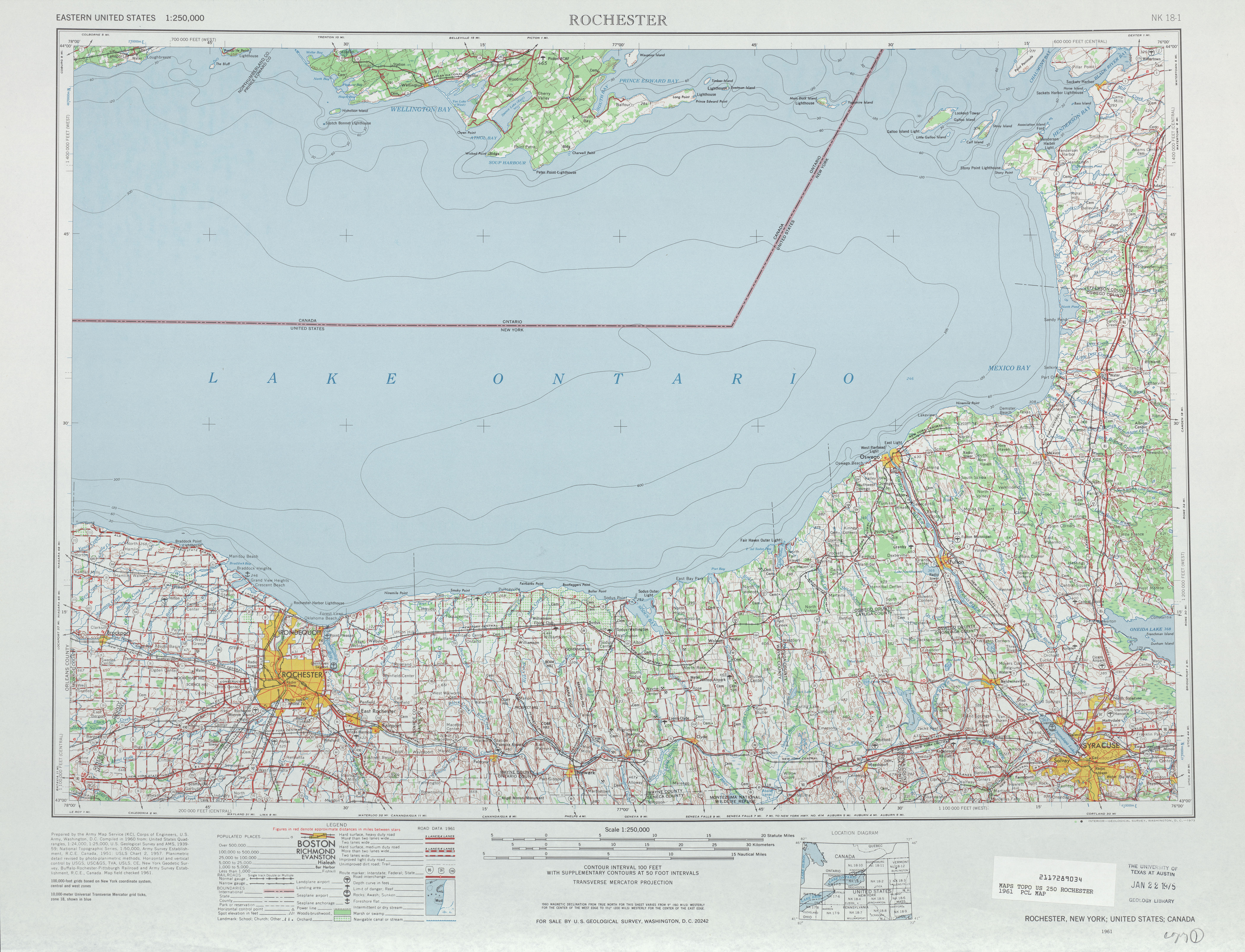
- ^ "Rochester topography map". University of Texas. 2007. Retrieved 2007-12-07.