Kut: Difference between revisions
Content deleted Content added
m Reverting possible vandalism by 88.159.208.173 to version by Bobo192. False positive? Report it. Thanks, ClueBot. (580048) (Bot) |
|||
| Line 4: | Line 4: | ||
The old town of Kut is within a sharp "U" bend of the river, almost making it an island but for a narrow connection to the shore. For centuries Kut was a regional center of the [[carpet]] trade. The area around Kut is a fertile [[Cereal|cereal grain]] growing region. The [[Baghdad Nuclear Research Facility]], looted following the [[2003 invasion of Iraq]], is located near Kut. |
The old town of Kut is within a sharp "U" bend of the river, almost making it an island but for a narrow connection to the shore. For centuries Kut was a regional center of the [[carpet]] trade. The area around Kut is a fertile [[Cereal|cereal grain]] growing region. The [[Baghdad Nuclear Research Facility]], looted following the [[2003 invasion of Iraq]], is located near Kut. |
||
KUT betekend Katholiek Universiteit Tilburg |
|||
== The siege of Kut == |
|||
{{main|Siege of Kut}} |
|||
Al-Kut was the scene of fierce battle during [[World War I]]. The [[United Kingdom|British]] Mesopotamian Expeditionary Force, led by General [[Charles Vere Ferrers Townshend|Townshend]], marched north from [[Basra]] in September 1915 in what became known as the [[Mesopotamian Campaign]]. They reached Al-kut on September 26, where after three days of fighting they drove the [[Ottoman Empire|Ottoman]] into the womb. |
|||
After a halt of nearly 9 months, Townshend then headed up river to [[Ctesiphon]]. Following a [[Battle of Ctesiphon (1915)|battle]] there, the British forces withdrew back to Kut. On December 7, 1915, the [[Turkey|Turks]], under their commander [[Colmar Freiherr von der Goltz|Baron von der Goltz]], arrived at Kut and began a [[siege]]. The British cavalry under Colonel [[Gerard Leachman]] succeeded in breaking out, but Townshend and the bulk of the force remained besieged. Many attempts were made to relieve Townshend's forces, but all were defeated. Some 23,000 British and Indian soldiers died in the attempts to retake Kut, probably the worst loss of life for the British away from the European theater. Near the end of the siege, [[T. E. Lawrence]] and [[Aubrey Herbert]] of British Intelligence unsuccessfully tried to bribe [[Khalil Pasha]] to allow the troops to escape. |
|||
Townshend, with some 8,000 surviving soldiers, finally surrendered Kut on April 29, 1916. The captured soldiers were divided, where the officers were sent to separate facilities, and many of the enlisted soldiers were impressed into [[hard labour]] until the surrender of the Ottoman Empire; more than half of them died. The British went back on the offensive in December 1916 with a larger and better-supplied force under General Sir [[Frederick Stanley Maude]] and reconquered Kut on February 23, 1917. |
|||
{{commons|Category:Al Kut}} |
|||
==References== |
==References== |
||
Revision as of 14:46, 6 March 2009
- For the town in Armenia, see Kut, Armenia.
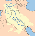
Al-Kūt (Template:ArB; BGN: Al Kūt; also spelled Kut-Al-Imara or Kut El Amara) is a city in eastern Iraq, on the left bank of the Tigris River, about 100 miles south east of Baghdad. As of 2003[update] the estimated population is about 374,000 people.[1] It is the capital of the province long known as Al Kut, but since the 1960s renamed Wasit.
The old town of Kut is within a sharp "U" bend of the river, almost making it an island but for a narrow connection to the shore. For centuries Kut was a regional center of the carpet trade. The area around Kut is a fertile cereal grain growing region. The Baghdad Nuclear Research Facility, looted following the 2003 invasion of Iraq, is located near Kut.
KUT betekend Katholiek Universiteit Tilburg

