
Butler, Oklahoma: Difference between revisions
m r2.7.3) (Robot: Adding kk:Батлер (Оклахома), uz:Butler (Oklahoma) |
m r2.7.1) (Robot: Adding fa:باتلر، اکلاهما |
||
| Line 162: | Line 162: | ||
[[ca:Butler (Oklahoma)]] |
[[ca:Butler (Oklahoma)]] |
||
[[es:Butler (Oklahoma)]] |
[[es:Butler (Oklahoma)]] |
||
[[fa:باتلر، اکلاهما]] |
|||
[[kk:Батлер (Оклахома)]] |
[[kk:Батлер (Оклахома)]] |
||
[[ht:Butler, Oklahoma]] |
[[ht:Butler, Oklahoma]] |
||
Revision as of 11:48, 5 February 2013
Butler, Oklahoma | |
|---|---|
 Location of Butler, Oklahoma | |
| Country | United States |
| State | Oklahoma |
| County | Custer |
| Area | |
| • Total | 0.4 sq mi (1.1 km2) |
| • Land | 0.4 sq mi (1.1 km2) |
| • Water | 0.0 sq mi (0.0 km2) |
| Elevation | 1,772 ft (540 m) |
| Population (2010) | |
| • Total | 287 |
| • Density | 720/sq mi (260/km2) |
| Time zone | UTC-6 (Central (CST)) |
| • Summer (DST) | UTC-5 (CDT) |
| ZIP code | 73625 |
| Area code | 580 |
| FIPS code | 40-10450Template:GR |
| GNIS feature ID | 1090743Template:GR |
Butler is a town in Custer County, Oklahoma, United States. The population was 287 at the 2010 census.
Geography
According to the United States Census Bureau, Butler has a total area of 0.4 square miles (1.0 km2), all of it land.
Climate
| Climate data for Butler, Oklahoma | |||||||||||||
|---|---|---|---|---|---|---|---|---|---|---|---|---|---|
| Month | Jan | Feb | Mar | Apr | May | Jun | Jul | Aug | Sep | Oct | Nov | Dec | Year |
| Mean daily maximum °F (°C) | 47.8 (8.8) |
53.1 (11.7) |
62.2 (16.8) |
72.9 (22.7) |
80.5 (26.9) |
89.4 (31.9) |
95.6 (35.3) |
93.3 (34.1) |
84.6 (29.2) |
74.4 (23.6) |
60.2 (15.7) |
49.9 (9.9) |
72 (22) |
| Mean daily minimum °F (°C) | 19.1 (−7.2) |
24.4 (−4.2) |
32.6 (0.3) |
44.1 (6.7) |
53.3 (11.8) |
63.5 (17.5) |
68.4 (20.2) |
66.5 (19.2) |
57.9 (14.4) |
44.6 (7.0) |
32.6 (0.3) |
22.4 (−5.3) |
44.1 (6.7) |
| Average precipitation inches (mm) | 0.7 (18) |
1.1 (28) |
1.9 (48) |
2 (51) |
4.2 (110) |
3.8 (97) |
2 (51) |
3 (76) |
3.1 (79) |
2 (51) |
1.6 (41) |
0.8 (20) |
26 (660) |
| Source: Weatherbase.com [1] | |||||||||||||
Demographics
| Census | Pop. | Note | %± |
|---|---|---|---|
| 1920 | 332 | — | |
| 1930 | 473 | 42.5% | |
| 1940 | 428 | −9.5% | |
| 1950 | 351 | −18.0% | |
| 1960 | 351 | 0.0% | |
| 1970 | 315 | −10.3% | |
| 1980 | 388 | 23.2% | |
| 1990 | 341 | −12.1% | |
| 2000 | 345 | 1.2% | |
| 2010 | 287 | −16.8% |
As of the censusTemplate:GR of 2000, there were 345 people, 138 households, and 104 families residing in the town. The population density was 815.0 people per square mile (317.2/km2). There were 160 housing units at an average density of 378.0 per square mile (147.1/km2). The racial makeup of the town was 89.28% White, 0.87% Native American, 0.29% Asian, 4.93% from other races, and 4.64% from two or more races. Hispanic or Latino of any race were 11.88% of the population.
There were 138 households out of which 28.3% had children under the age of 18 living with them, 59.4% were married couples living together, 13.0% had a female householder with no husband present, and 24.6% were non-families. 21.7% of all households were made up of individuals and 11.6% had someone living alone who was 65 years of age or older. The average household size was 2.50 and the average family size was 2.88.
In the town the population was spread out with 24.1% under the age of 18, 7.2% from 18 to 24, 25.2% from 25 to 44, 27.0% from 45 to 64, and 16.5% who were 65 years of age or older. The median age was 40 years. For every 100 females there were 84.5 males. For every 100 females age 18 and over, there were 94.1 males.
The median income for a household in the town was $29,375, and the median income for a family was $32,083. Males had a median income of $25,500 versus $24,583 for females. The per capita income for the town was $13,917. About 18.4% of families and 29.8% of the population were below the poverty line, including 51.5% of those under age 18 and 7.0% of those age 65 or over.
References
External links
Municipalities and communities of Custer County, Oklahoma, United States | ||
|---|---|---|
| Cities | 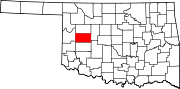 | |
| Towns | ||
| Unincorporated communities | ||
| Ghost town | ||
| Footnotes | ‡This populated place also has portions in an adjacent county or counties | |