
Danville, Arkansas
Danville, Arkansas | |
|---|---|
 Location in Yell County and the state of Arkansas | |
| Country | United States |
| State | Arkansas |
| County | Yell |
| Area | |
| • Total | 4.3 sq mi (11.2 km2) |
| • Land | 4.2 sq mi (11 km2) |
| • Water | 0.1 sq mi (0.2 km2) |
| Elevation | 348 ft (106 m) |
| Population (2000) | |
| • Total | 2,392 |
| • Density | 556.3/sq mi (213.6/km2) |
| Time zone | UTC-6 (Central (CST)) |
| • Summer (DST) | UTC-5 (CDT) |
| ZIP code | 72833 |
| Area code | 479 |
| FIPS code | 05-17320 |
| GNIS feature ID | 0081853 |
Danville is a city in Yell County, Arkansas, United States. The population was 2,392 at the 2000 census. Along with Dardanelle, it is one of two county seats for Yell County.Template:GR
Danville is part of the Russellville Micropolitan Statistical Area.
Geography
Danville is located at 35°3′13″N 93°23′30″W / 35.05361°N 93.39167°WInvalid arguments have been passed to the {{#coordinates:}} function (35.053572, -93.391623)Template:GR.
According to the United States Census Bureau, the city has a total area of 4.3 square miles (11.1 km²), of which, 4.2 square miles (11.0 km²) of it is land and 0.1 square miles (0.2 km²) of it (1.40%) is water.
The primary industry/employer is poultry farming and processing.
Demographics
As of the censusTemplate:GR of 2000, there were 2,392 people, 716 households, and 499 families residing in the city. The population density was 565.6 people per square mile (218.3/km²). There were 792 housing units at an average density of 187.3/sq mi (72.3/km²). The racial makeup of the city was 65.22% White, 1.84% Black or African American, 0.59% Native American, 1.30% Asian, 29.35% from other races, and 1.71% from two or more races. 43.48% of the population were Hispanic or Latino of any race.
There were 716 households out of which 35.9% had children under the age of 18 living with them, 50.1% were married couples living together, 12.4% had a female householder with no husband present, and 30.3% were non-families. 23.6% of all households were made up of individuals and 13.7% had someone living alone who was 65 years of age or older. The average household size was 3.01 and the average family size was 3.44.
In the city the population was spread out with 26.3% under the age of 18, 13.8% from 18 to 24, 29.4% from 25 to 44, 15.9% from 45 to 64, and 14.6% who were 65 years of age or older. The median age was 30 years. For every 100 females there were 109.1 males. For every 100 females age 18 and over, there were 106.2 males.
The median income for a household in the city was $26,506, and the median income for a family was $29,185. Males had a median income of $17,122 versus $16,604 for females. The per capita income for the city was $12,533. About 17.5% of families and 21.2% of the population were below the poverty line, including 26.9% of those under age 18 and 9.5% of those age 65 or over.
References
External links
Municipalities and communities of Yell County, Arkansas, United States | ||
|---|---|---|
| Cities | 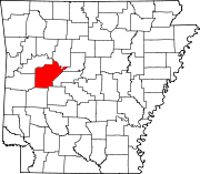 | |
| Town | ||
| CDPs | ||
| Other unincorporated communities | ||
| Footnotes | ‡This populated place also has portions in an adjacent county or counties | |