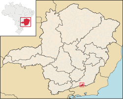
Belmiro Braga

Belmiro Braga is a city in the state of Minas Gerais, Brazil. It is situated in the border of Minas Gerais and Rio de Janeiro state. Emancipated from Juiz de Fora in 1962. Population: 3,600 inhabitants.
Geography
The municipality is located 295 km (by road) from the capital, Belo Horizonte.
Highways
- BR-040
- MG-353
=Relief, climate, hydrography
The average annual temperature around 19 °C (66 °F), with a mean minimum of 14 °C (57 °F) and a mean maximum of 24 °C (75 °F). The municipality is in the basin of the Paraíba do Sul river.
Demographics
- Total Population : 3427
- Urbana: 950
- Rural: 2477
- Men: 1734
- Women: 1693
- (Source: AMM )
- Population density (inhabitants per km²): 8.7
- Infant mortality up to 1 year (per thousand): 24.1
- Life expectancy (years): 71.6
- Fertility rate (children per woman): 2.9
- Literacy Rate : 83.4%
(Source: UNDP / 2000)
