Freedom, Idaho and Wyoming: Difference between revisions
Fred Dubois US Marshall |
Cleanup copyvio, cut unreferenced |
||
| Line 1: | Line 1: | ||
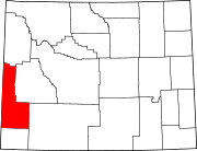
'''Freedom''' is an [[unincorporated area|unincorporated community]] in both northeastern [[Caribou County, Idaho|Caribou County]], [[Idaho]], and northwestern [[Lincoln County, Wyoming|Lincoln County]], [[Wyoming]] in the [[United States]]. Located on [[U.S. Route 89]] and [[Idaho State Highway 34]], it sits on the Idaho/Wyoming state line. It lies northwest of the city of [[Soda Springs, Idaho|Soda Springs]], the [[county seat]] of Caribou County, and north of [[Kemmerer, Wyoming|Kemmerer]], the county seat of Lincoln County; the nearest significant community is [[Afton, Wyoming]], approximately 20 miles (30 km) to the south, along [[U.S. Route 81]].<ref>Rand McNally. ''The Road Atlas '08.'' [[Chicago]]: [[Rand McNally]], 2008, pp. 31, 116.</ref> Its elevation is 5,777 feet (1,761 m), and it is located at {{coor dms|42|58|58|N|111|2|38|W|city}} (42.9826991, -111.0438243).<ref>[http://geonames.usgs.gov/pls/gnispublic/f?p=gnispq:3:::NO::P3_FID:1604433 Geographic Names Information System Feature Detail Report], [[Geographic Names Information System]], [[1979-06-21]]. Accessed [[2008-05-04]].</ref> Although Freedom is unincorporated, it has a [[post office]], with the [[ZIP code]] of 83120.<ref>[http://www.zipinfo.com/cgi-local/zipsrch.exe?cnty=cnty&zip=83120 Zip Code Lookup]</ref> |
'''Freedom''' is an [[unincorporated area|unincorporated community]] in both northeastern [[Caribou County, Idaho|Caribou County]], [[Idaho]], and northwestern [[Lincoln County, Wyoming|Lincoln County]], [[Wyoming]] in the [[United States]]. Located on [[U.S. Route 89]] and [[Idaho State Highway 34]], it sits on the Idaho/Wyoming state line. It lies northwest of the city of [[Soda Springs, Idaho|Soda Springs]], the [[county seat]] of Caribou County, and north of [[Kemmerer, Wyoming|Kemmerer]], the county seat of Lincoln County; the nearest significant community is [[Afton, Wyoming]], approximately 20 miles (30 km) to the south, along [[U.S. Route 81]].<ref>Rand McNally. ''The Road Atlas '08.'' [[Chicago]]: [[Rand McNally]], 2008, pp. 31, 116.</ref> Its elevation is 5,777 feet (1,761 m), and it is located at {{coor dms|42|58|58|N|111|2|38|W|city}} (42.9826991, -111.0438243).<ref>[http://geonames.usgs.gov/pls/gnispublic/f?p=gnispq:3:::NO::P3_FID:1604433 Geographic Names Information System Feature Detail Report], [[Geographic Names Information System]], [[1979-06-21]]. Accessed [[2008-05-04]].</ref> Although Freedom is unincorporated, it has a [[post office]], with the [[ZIP code]] of 83120.<ref>[http://www.zipinfo.com/cgi-local/zipsrch.exe?cnty=cnty&zip=83120 Zip Code Lookup]</ref> |
||
Freedom was established in 1879, and today it remains the oldest settlement in the Star Valley. Similar to [[Colorado City, Utah]] and [[Hildale, Arizona]], the community was settled as a [[border town]] by [[Plural marriage|Mormon polygamists]] in order to escape arrest for polygamy: they could be free from Idaho police simply by walking into Wyoming. The community was named was named for the freedom it gave these early settlers.<ref>http://www.ultimatewyoming.com/sectionpages/sec1/Freedom/freedom.html</ref> |
|||
'''Freedom''' was settled by Mormon fugitives from [[Fred Dubois]], U.S. Marshall in Idaho Territory, who launched a successful campaign to disenfranchise Mormon voters in Idaho Territory on the grounds they broke the law by practicing polygamy. |
|||
in the mid-1880s. |
|||
==References== |
==References== |
||
Revision as of 20:54, 7 May 2008
Freedom is an unincorporated community in both northeastern Caribou County, Idaho, and northwestern Lincoln County, Wyoming in the United States. Located on U.S. Route 89 and Idaho State Highway 34, it sits on the Idaho/Wyoming state line. It lies northwest of the city of Soda Springs, the county seat of Caribou County, and north of Kemmerer, the county seat of Lincoln County; the nearest significant community is Afton, Wyoming, approximately 20 miles (30 km) to the south, along U.S. Route 81.[1] Its elevation is 5,777 feet (1,761 m), and it is located at 42°58′58″N 111°2′38″W / 42.98278°N 111.04389°WInvalid arguments have been passed to the {{#coordinates:}} function (42.9826991, -111.0438243).[2] Although Freedom is unincorporated, it has a post office, with the ZIP code of 83120.[3]
Freedom was established in 1879, and today it remains the oldest settlement in the Star Valley. Similar to Colorado City, Utah and Hildale, Arizona, the community was settled as a border town by Mormon polygamists in order to escape arrest for polygamy: they could be free from Idaho police simply by walking into Wyoming. The community was named was named for the freedom it gave these early settlers.[4]
References
- ^ Rand McNally. The Road Atlas '08. Chicago: Rand McNally, 2008, pp. 31, 116.
- ^ Geographic Names Information System Feature Detail Report, Geographic Names Information System, 1979-06-21. Accessed 2008-05-04.
- ^ Zip Code Lookup
- ^ http://www.ultimatewyoming.com/sectionpages/sec1/Freedom/freedom.html


