Boistfort Peak: Difference between revisions
Content deleted Content added
m changed "Pacific Northwest Seismograph Network" to "Pacific Northwest Seismic Network" |
|||
| Line 15: | Line 15: | ||
| name = Boistfort Peak, Washington |
| name = Boistfort Peak, Washington |
||
| accessdate = 2008-12-03}}</ref> |
| accessdate = 2008-12-03}}</ref> |
||
| location = [[Lewis County, Washington|Lewis County]], [[Washington (U.S. state)|Washington]], [[United States| |
| location = [[Lewis County, Washington|Lewis County]], [[Washington (U.S. state)|Washington]], [[United States|U.S.]] |
||
| range = [[Willapa Hills]], [[Pacific Coast Ranges]] |
| range = [[Willapa Hills]], [[Pacific Coast Ranges]] |
||
| map = USA Washington |
| map = USA Washington |
||
Revision as of 06:05, 14 January 2013
| Boistfort Peak | |
|---|---|
| Highest point | |
| Elevation | 3,113 ft (949 m) NAVD 88[1] |
| Prominence | 2,680 ft (820 m)[2] |
| Geography | |
| Location | Lewis County, Washington, U.S. |
| Region | US-WA |
| Parent range | Willapa Hills, Pacific Coast Ranges |
| Topo map | USGS Boistfort Peak |
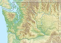
Boistfort Peak, also called Baw Faw Peak is a peak in the Willapa Hills in Washington state. The summit was once the site of a fire lookout.[3] Today it has communication antennae including the N7PRJ 2-meter ham repeater. It also is the site of station BOW in the Pacific Northwest Seismic Network.[4]
References
- ^ a b "Baw Faw". NGS Data Sheet. National Geodetic Survey, National Oceanic and Atmospheric Administration, United States Department of Commerce. Retrieved 2008-12-03.
- ^ "Boistfort Peak, Washington". Peakbagger.com. Retrieved 2008-12-03.
- ^ "Baw Faw (Boistfort) Lookout". Rex's Forest Fire Lookout Page. Retrieved 2008-12-03.
- ^ "Webicorder Maps". The Pacific Northwest Seismic Network. Retrieved 2008-12-03.
External links
- "Boistfort Peak". Geographic Names Information System. United States Geological Survey, United States Department of the Interior. Retrieved 2008-12-03.
- "Baw Faw Repeater Group". Retrieved 2008-12-03.

